Sonnier Bank
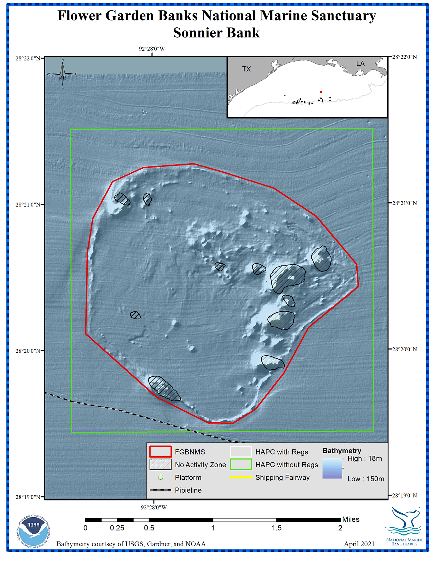
Bottom Depth Range: 62-210 feet (19-64 meters)
Distance from Land: 83 miles (134 km)
Area: 3.1 square miles (8.0 sq km)
Sonnier Bank (formerly known as Three Hickey Rocks and Candy Mountain) consists of eight separate peaks, two of which are within recreational diving depths. Like Stetson Bank, it is a mid-shelf bank made of uplifted siltstone and claystone.

This fragile substrate has been impacted by anchoring and hurricanes. In fact, Sonnier Bank sustained severe damage during the passage of Hurricanes Katrina and Rita in 2005. It has been suggested that the level of damage from the hurricanes was directly related to earlier weakening of the substrate by chronic anchoring from vessels visiting the bank for diving and fishing activities.
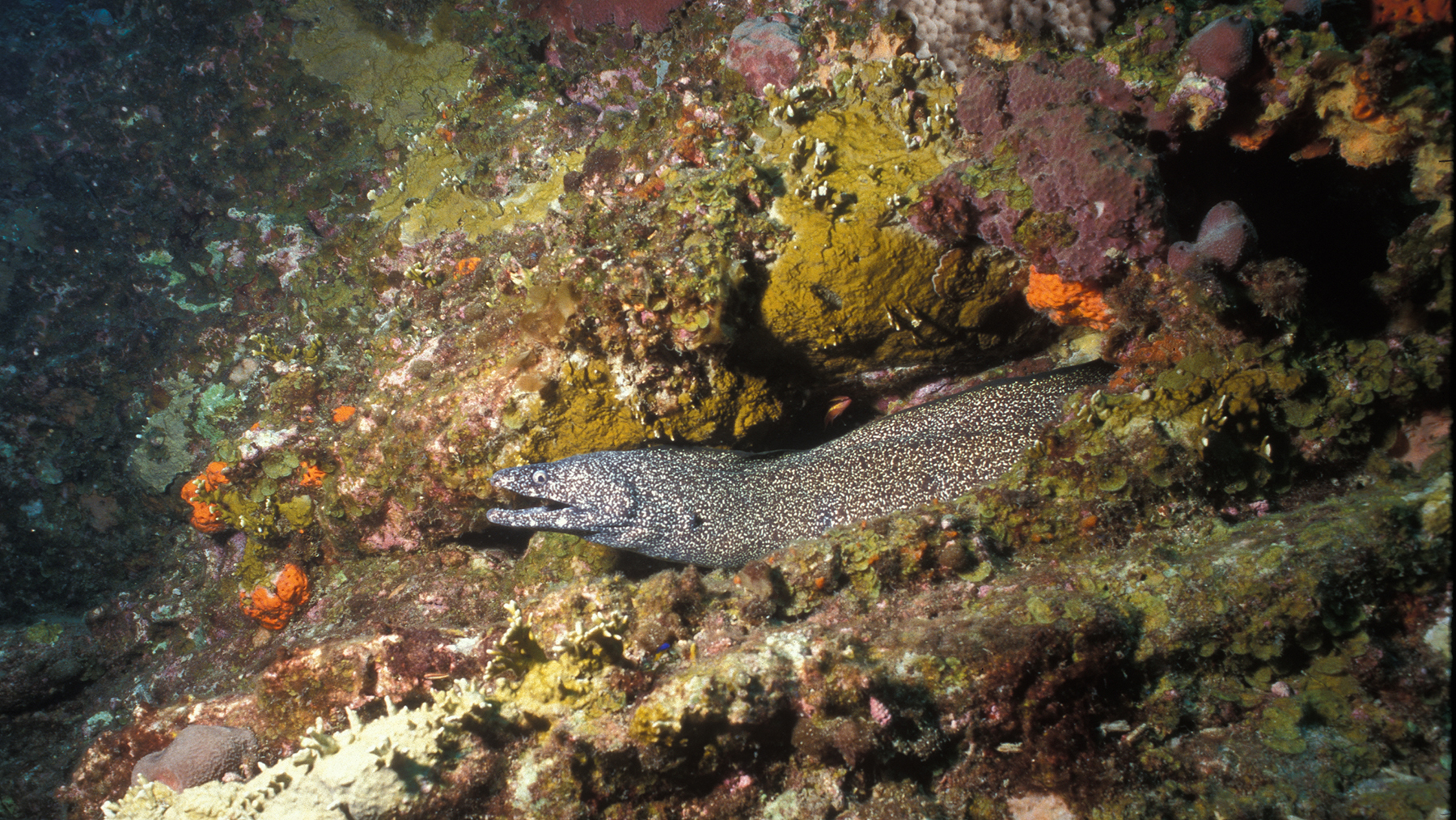
The reef crests of Sonnier Bank are characterized as coral communities featuring fire coral, sponges and algae, as well as the invasive species, Tubastraea coccinea. Deeper habitats contain extensive mesophotic communities.
Sonnier Bank is a Habitat Area of Particular Concern (HAPC). It is named for Farley Sonnier, an offshore wildlife photographer.
Video
The following video is a compilation of footage taken during ROV (remotely operated vehicle) and manned submersible explorations at Stetson Bank.
0:00 A bathymetric map of Sonnier Bank followed by a variety of footage in an area about 100-145 feet deep (30-44 meters):
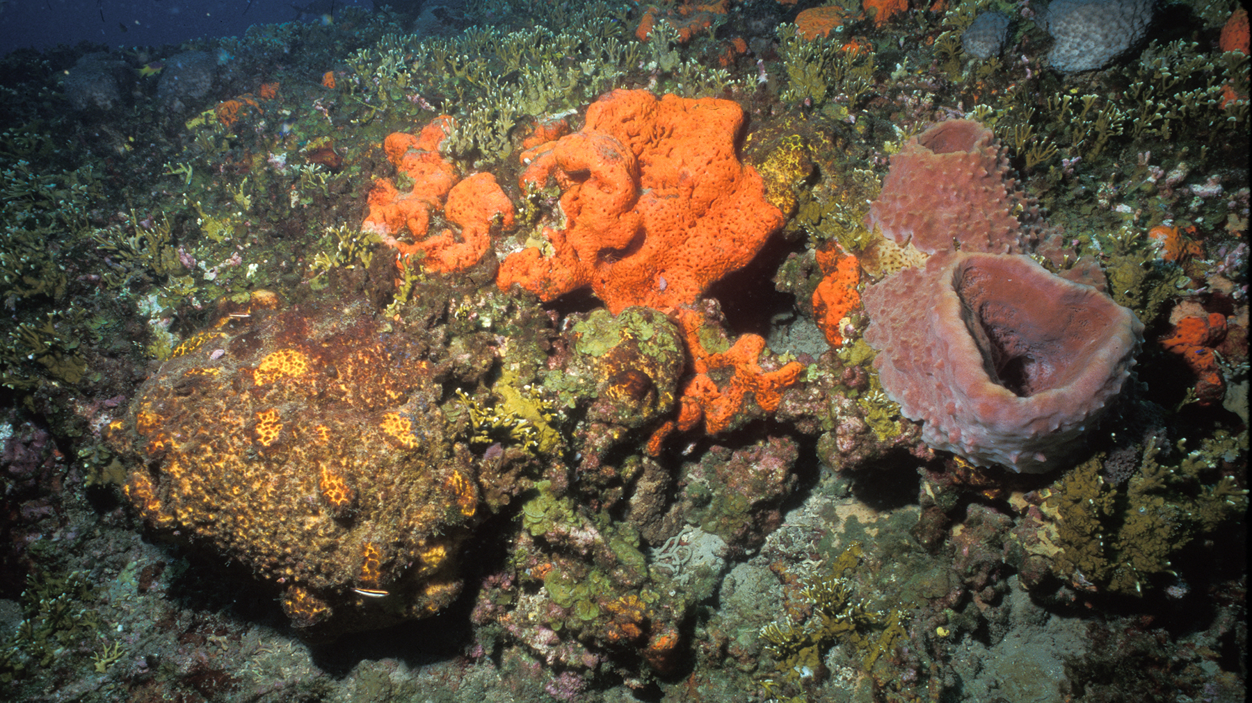
0:08 Large patch of fire coral surrounding an orange sponge, bicolor damselfish, soldierfish, sergeant major, rocky reef, sponges, spotted drum, brown chromis, longspine squirrelfish, queen angelfish, rock beauty, wrasses, parrotfish.
0:38 Shark cruising over the reef.
0:47 Four juvenile African pompano swimming with long trailing fins.
0:54 Abandoned fishing net on the sea floor.
1:02 Algal/sponge reef, ocean triggers, creolefish, rock beauty, spotfin hogfish, ling, snapper.
Video Length: 1:24
Credit: FGBNMS
Who Was V. Farley Sonnier?
Farley Sonnier (1942-1987) was a Louisiana lawyer and avid marine naturalist, who contributed his knowledge and photographs of offshore areas to several scientific studies in the 1970s and 1980s. Over 300 of his images are included in the often used reference book Fishes of the Gulf of Mexico, 2nd Edition, published in 1998.