A team of archaeologists, scientific divers and technicians assembled by NOAA joined forces September 10, 2012 to create a three-dimensional sonar map to document the storm-exposed remains of the USS HATTERAS, the only Union warship sunk in combat in the Gulf of Mexico during the Civil War.
Bow section of USS Hatteras. Photo: Jesse Cancelmo
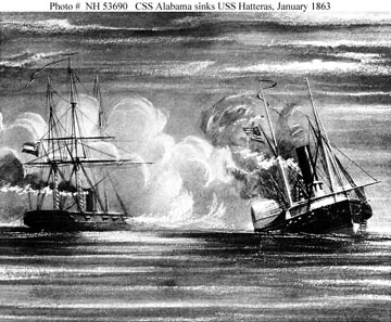
The HATTERAS, an iron-hulled steamship, was lost in a battle with the CSS ALABAMA on Jan. 11, 1863 about 20 miles out of Galveston. Today, the wreck of the HATTERAS is largely intact, resting 57 feet underwater in sand and silt. Recent hurricanes and storms have removed some of the sediment and sand that once encased the vessel, so within a short window of opportunity, the sanctuary's R/V MANTA and its divers assisted with a mission to map the wreck.
The use of 3D scanning technology provided an unparalleled view of the wreck, while also allowing scientists to document previously unexplored elements of the site. The results of this mission were shared by Jim Delgado during the 150th anniversary of the Battle of Galveston commemoration in January 2013.
The USS HATTERAS is located in federal waters, but the ship is administered by the Navy. The vessel is protected by the Sunken Military Craft Act as a war grave – two of the Hatteras crew went down with the ship, and their bodies were never recovered. They are presumed to lie inside the buried hull.
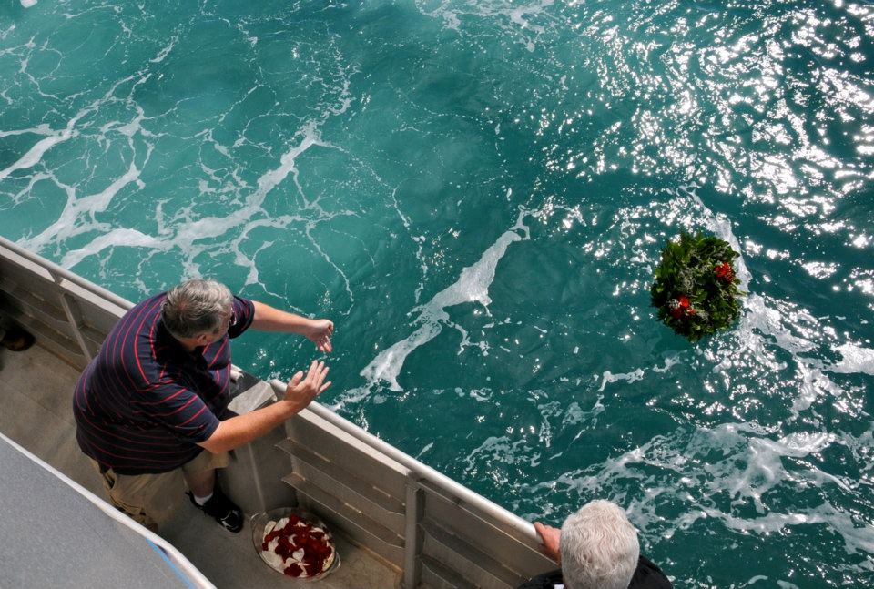
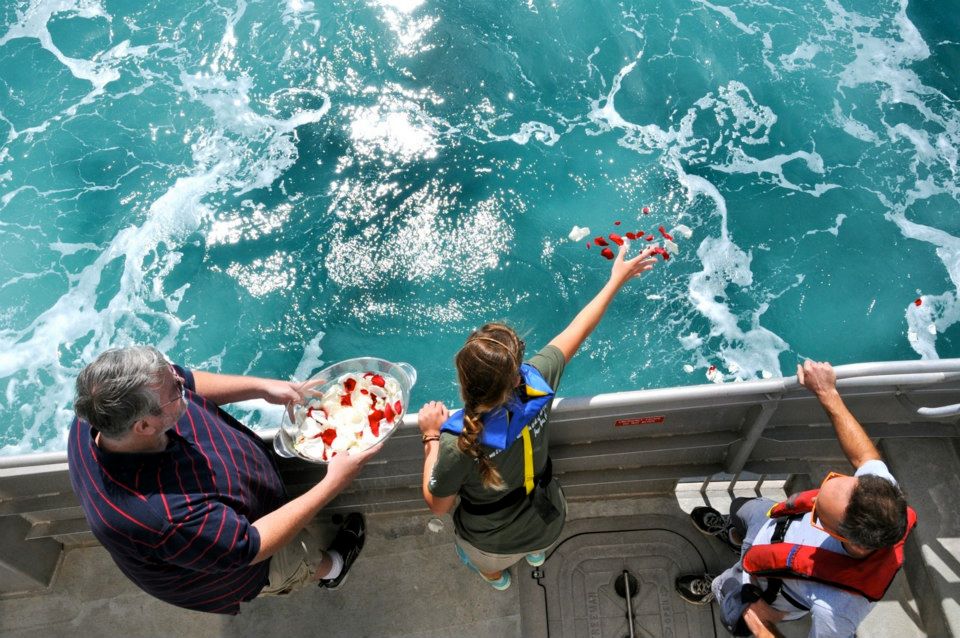
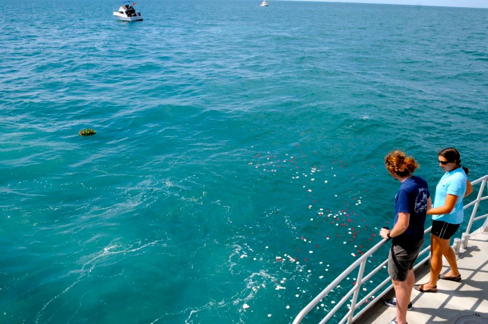
Before mapping activities began, Father Stephen Duncan, a priest and civil war history buff from Galveston Island, held a memorial service on the R/V MANTA for the two crew members who lost their lives in 1863. A wreath and rose petals were placed over the wreck site to honor the sailors.
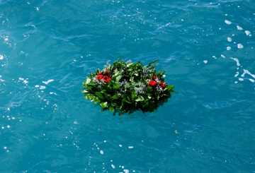
Memorial wreath floating above the wreck site.
Funding and support for the underwater archeology project was provided by the Edward E. and Marie L. Matthews Foundation, the OceanGate Foundation, and Teledyne BlueView. Participants included NOAA’s Maritime Heritage Program and FGBNMS, BOEM, BSEE, the TX Historical Commission, the US Naval History and Heritage Command, Tesla Offshore LLC, and private citizens including Houston underwater photographer Jesse Cancelmo.
Click on a picture below to see a larger, hi-resolution image. Please note the specific photo credit for each image.
|
|
|

Memorial Service
|

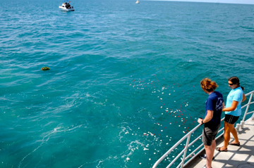
Project volunteer and local historian, Andrew Hall, releases a wreath on top of the wreck site to honor the two sailors that went down with the ship.
(Photo credit: FGBNMS)
|
Wreath floating above the wreck site of the USS HATTERAS.
(Photo credit: FGBNMS) |
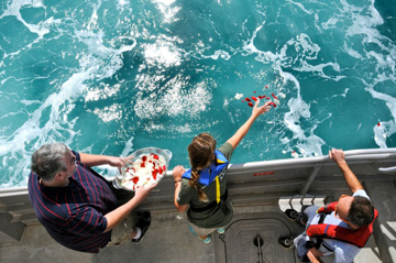
Rose petals are released during the memorial service.
(Photo credit: FGBNMS) |
Sanctuary team members watching rose petals float over the USS HATTERAS wreck site.
(Photo credit: FGBNMS) |
Mapping the Shipwreck
|
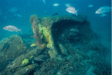
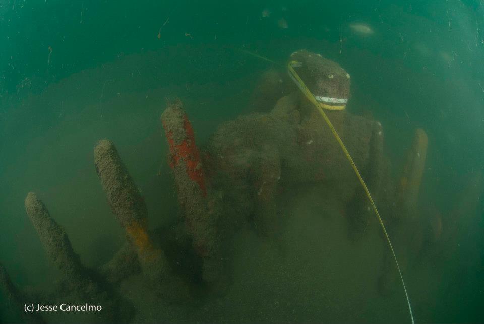
Image from the Hatteras wreck site. (Photo credit: Jesse Cancelmo) |
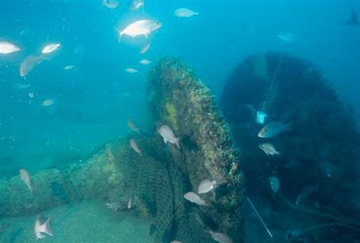
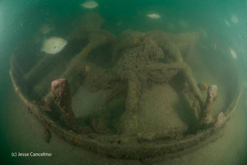
Part of a paddle wheel from the Hatteras wreck site. (Photo credit: Jesse Cancelmo) |

Stern post of the USS Hatteras. (Photo credit: Jesse Cancelmo) |
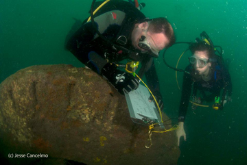
Tesla divers, Matt Keith and Amanda Evans, survey the starboard paddle wheel. (Photo credit: Jesse Cancelmo) |
|
|
Bow section of the USS Hatteras. This had not been documented before this mission. (Photo credit: Jesse Cancelmo)
|

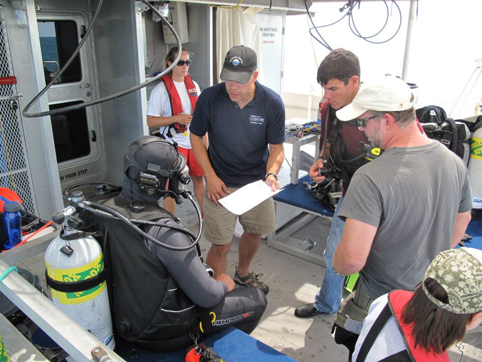
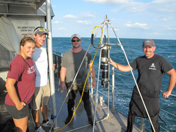
James Glaeser from Northwest Hydro, Inc. briefs divers as to where to place the BlueView system. (Photo credit: OceanGate Foundation) |
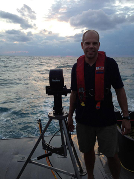
James Glaeser from Northwest Hydro, Inc., was the technician running the Teledyne BlueView sonar system. The final map products will be available and shared in the coming months. This system was cabled to the R/V MANTA, and placed on the seafloor around the wreck site by NOAA and BOEM/BSEE divers. (Photo credit: OceanGate Foundation) |

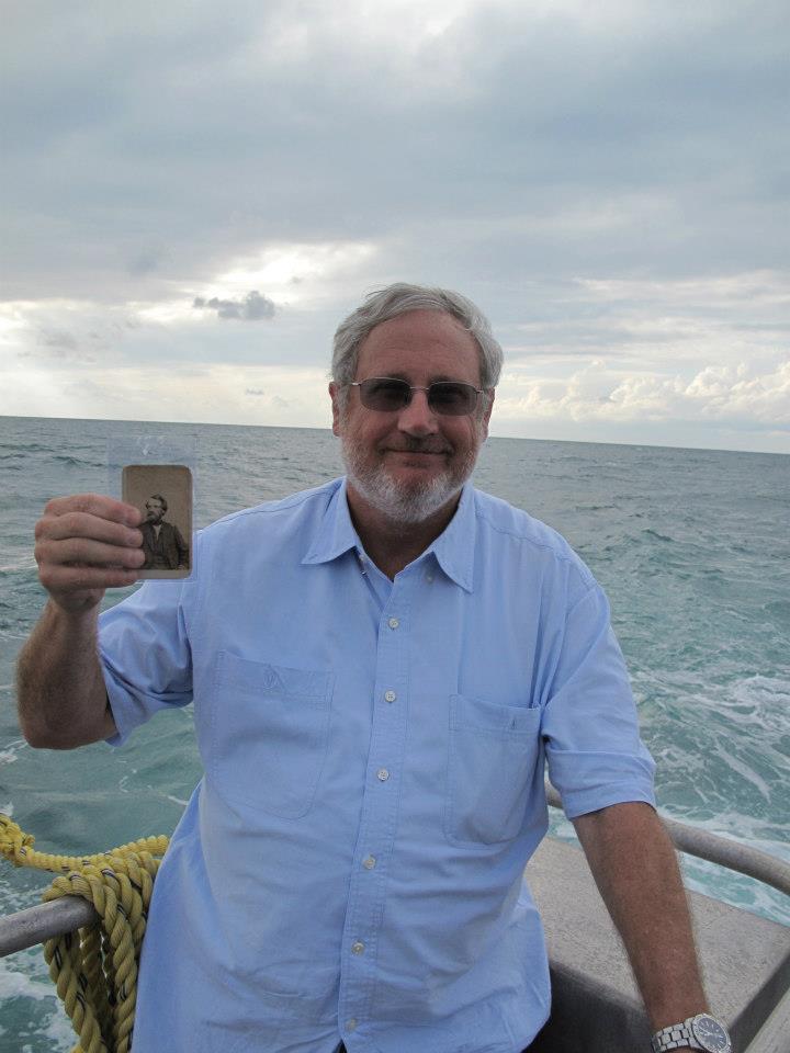
Galveston Historian Ed Cotham displays an historic photograph of the Master of the USS HATTERAS. (Photo credit: OceanGate Foundation) |
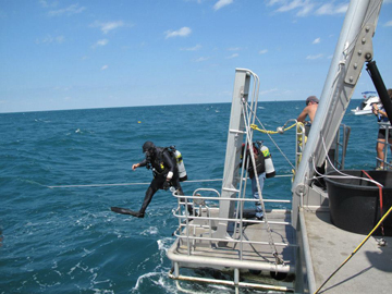
NOAA Divers step off the R/V MANTA to conduct a dive on the wreck of the USS HATTERAS. (Photo credit: OceanGate Foundation)
|
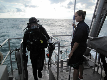
NOAA Diver Ryan Eckert returns to the R/V MANTA after a dive on the wreck of the USS HATTERAS. Ryan is wearing an OTS Guardian mask so that he can communicate topside. (Photo credit: OceanGate Foundation)
|
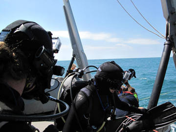
NOAA divers Ryan Eckert and Marissa Nuttall prepare to enter the water. They are both donning GoPro video systems on their heads. (Photo credit: OceanGate Foundation) |
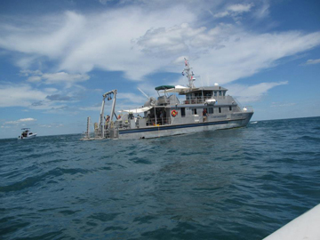
R/V MANTA on station during USS HATTERAS operations. (Photo credit: OceanGate Foundation) |
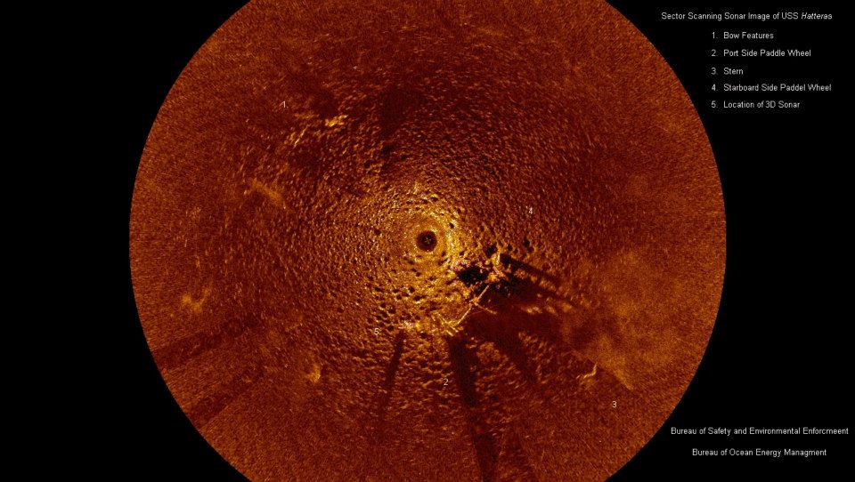
Texas A&M Students and BOEM/BSEE divers stand with the sector scanning sonar brought by BOEM/BSEE to image the wreck - although a much lower resolution than the BlueView sonar, it was a very useful tool to collect a broad perspective.
|
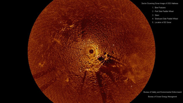
Image collected by BOEM/BSEE marine archaeologists, Chris Horrell and Doug Jones, using a sector scanning sonar deployed from the R/V MANTA. (Image credit: BOEM/BSEE)
|
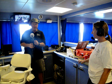
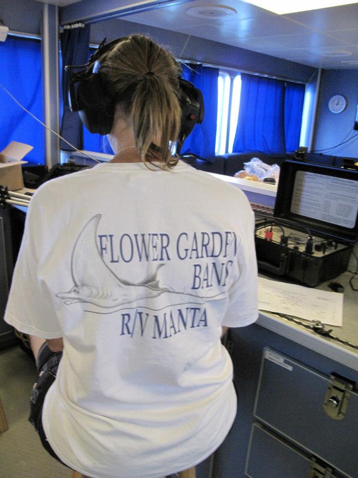
Craig Howard from Oceangate Foundation films the operations going on in the dry lab on board the R/V MANTA. FGBNMS Research Cooordinator Emma Hickerson is talking to the divers via underwater comms. (Photo credit: OceanGate Foundation) |
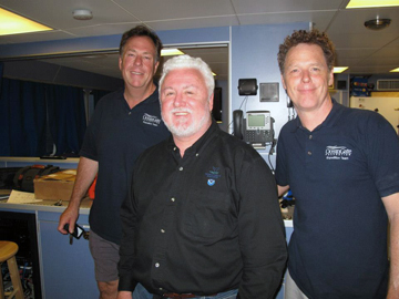
Dr. Jim Delgado, ONMS Director of Maritime Heritage with Oceangate Foundation representatives Craig Howard and David Todd. (Photo credit: OceanGate Foundation)
|
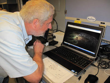
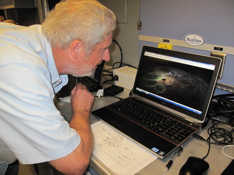
Historian Ed Cotham takes a closer look at the data being collected by the Teledyne BlueView sonar. (Photo credit: OceanGate Foundation)
|
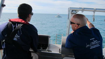
R/V MANTA Captains and NOAA divers,Darrell Walker and Michael Shetler at the stern station of the R/V MANTA overseeing operations. (Photo credit: OceanGate Foundation) |
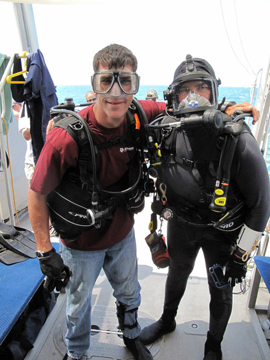
NOAA Divers John Embesi and Michael Shetler prepare to dive on the wreck of the USS HATTERAS. (Photo credit: OceanGate Foundation) |

FGBNMS Research Coordinator Emma Hickerson checks in with the divers using an OTS Guardian underwater communications system. (Photo credit: OceanGate Foundation) |
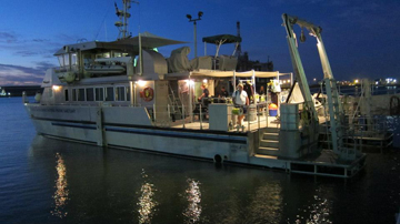
R/V Manta at the docks at twilight. (Photo credit: OceanGate Foundation) |
|
|
|
| |
In January 2013, the sanctuary partnered with folks from BOEM, BSEE, the TX Historical Commission, the US Naval History and Heritage Command, and Texas A&M Sea Camp to provide activities and information related to mapping the Hatteras shipwreck. These activities were held at the Texas Seaport Museum as part of the 150th anniversary commemoration of the Battle of Galveston.
Part of the display included artwork created by students in Galveston Independent School District.
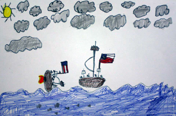
Sinking of Hatteras. Artwork: GISD student
|
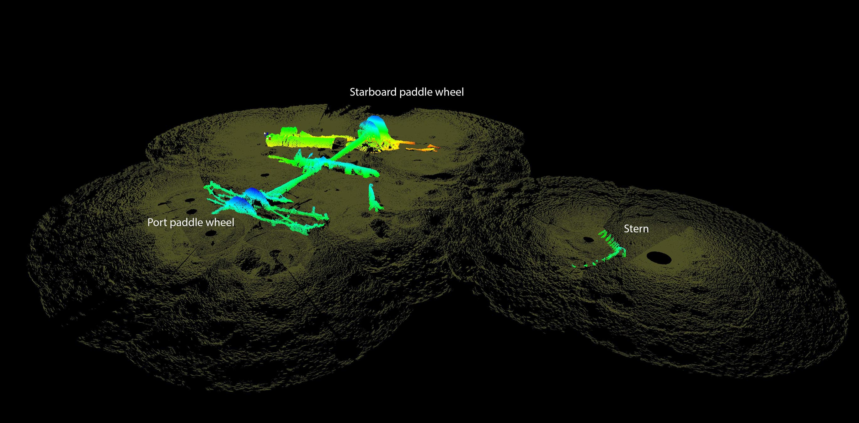
In conjunction with Battle of Galveston activities, NOAA's Office of National Marine Sanctuaries and its partners released the new 3D image of the HATTERAS wreck site. The image below is labeled to identify key parts of the vessel.

3D image generated by BlueView mapping data. Image: ONMS
|
|
|