SANCTUARY LOCATION

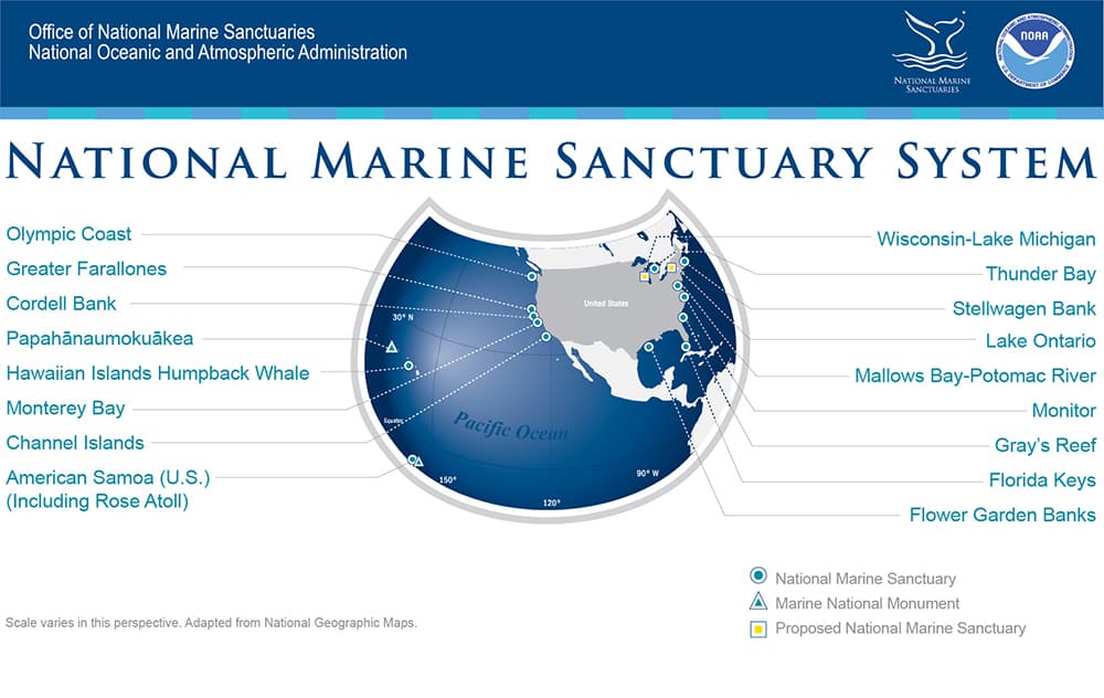
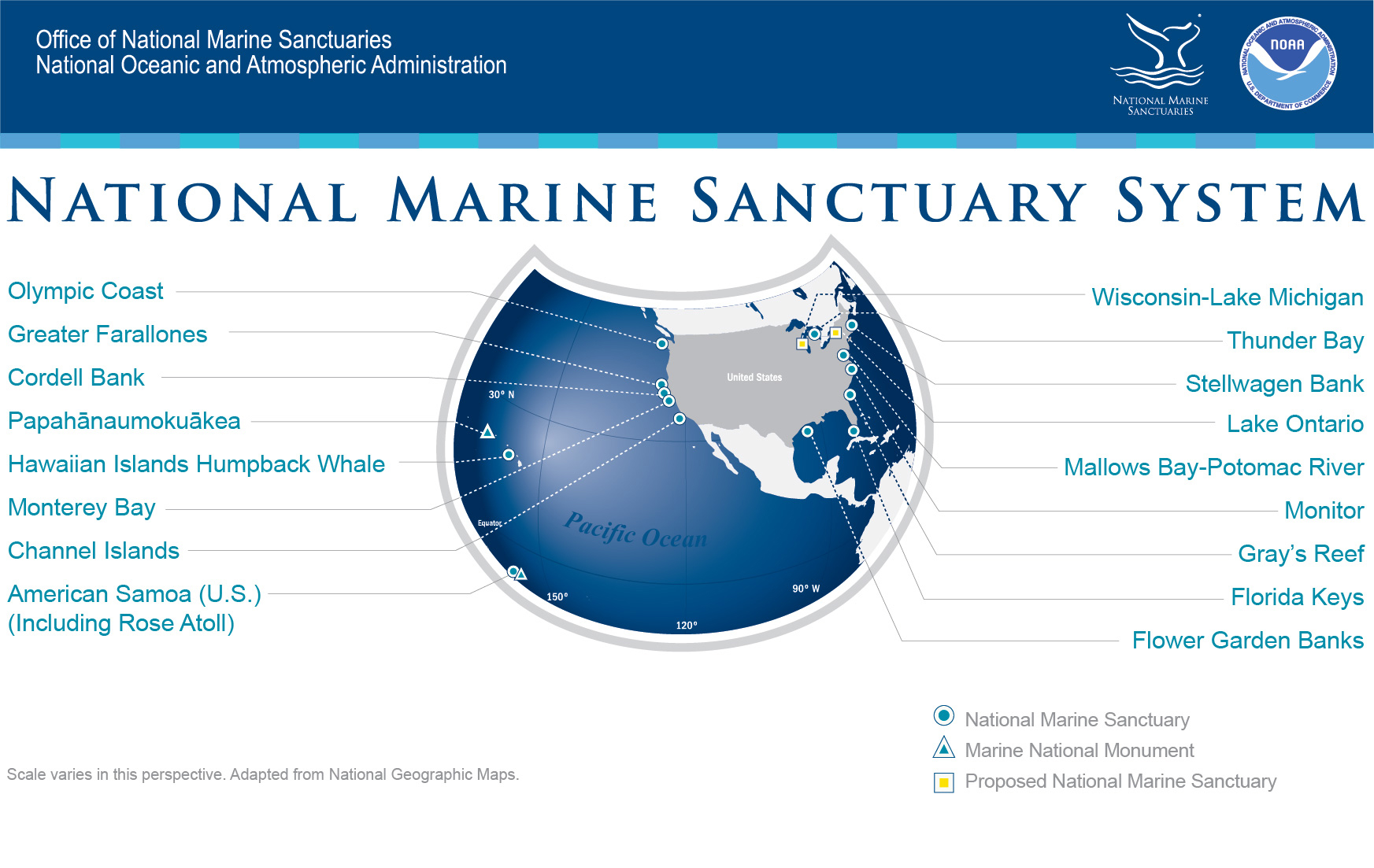
National Marine Sanctuaries System Map
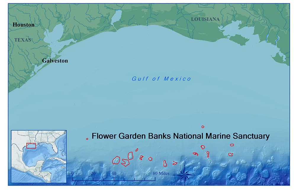
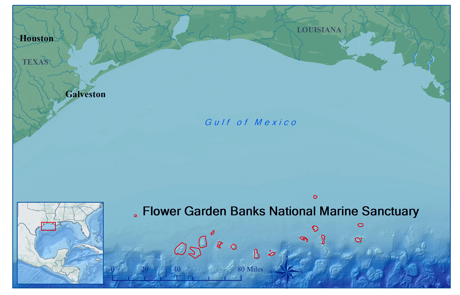
FGBNMS Atlas Map
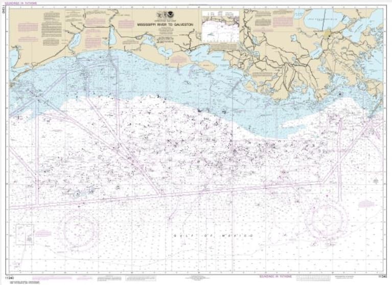
NOAA Nautical Chart 11340, which includes Flower Garden Banks National Marine Sanctuary
View NOAA Chart 11340 in NOAA's Online Chart Catalog
Download PDF of NOAA Chart 11340
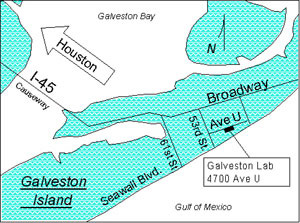
FGBNMS Office Location in Galveston, TX
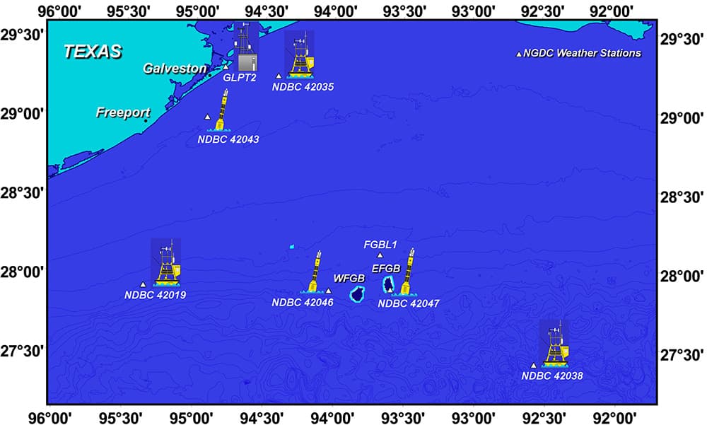
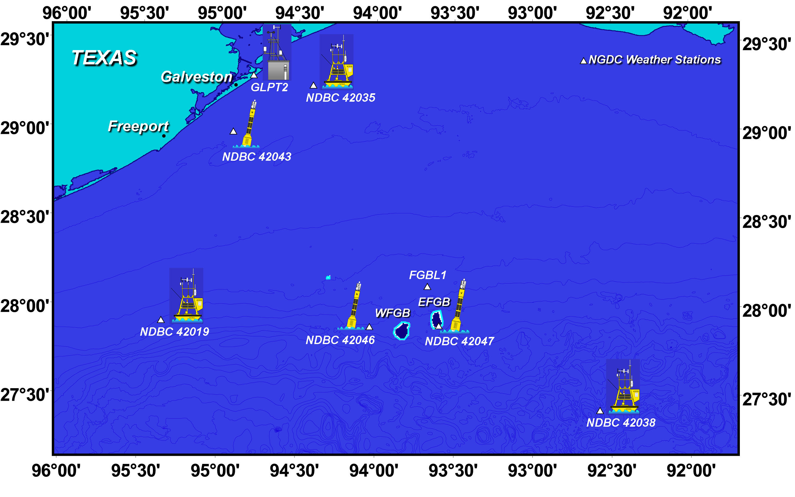
Weather and Data Buoys near FGBNMS (559kb jpg)
For more information on weather and data buoys near the sanctuary, please visit our Weather Buoy page.
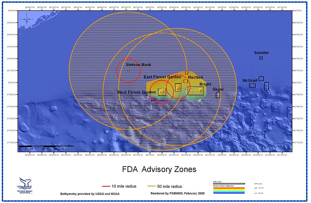
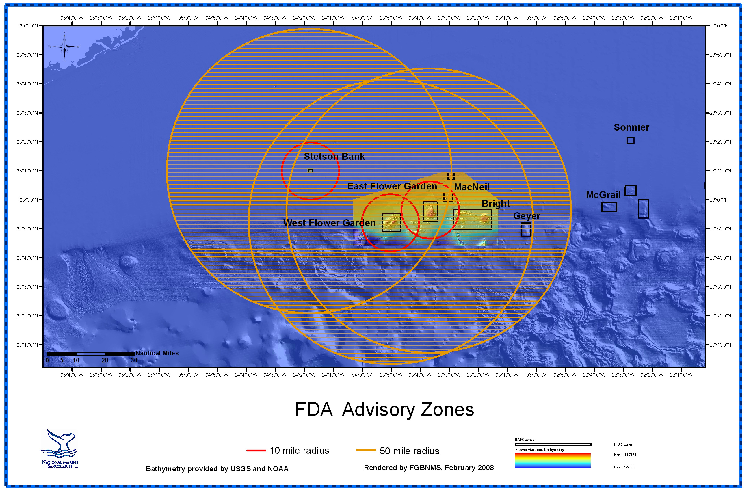
FDA Advisory Zones for Ciguatera Toxin in Fish
For additional information on the FDA Advisory regarding ciguatoxins in Gulf fish species, please visit our Ciguatera Information.
top of page
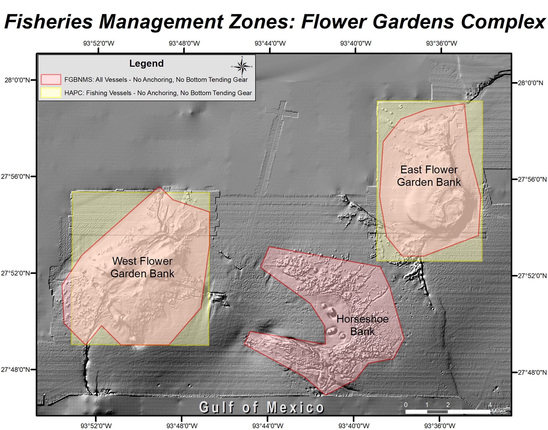
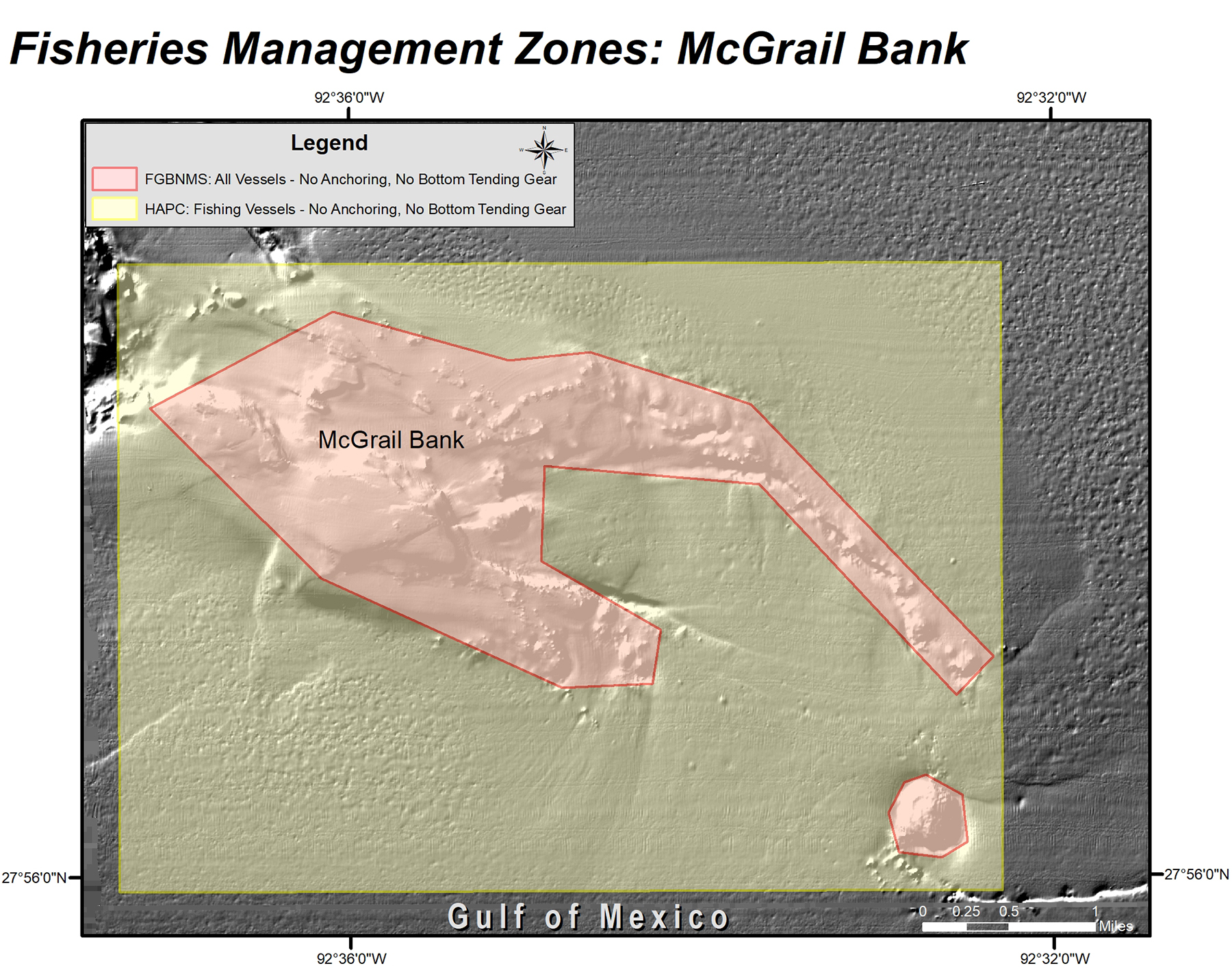
MANAGEMENT ZONES
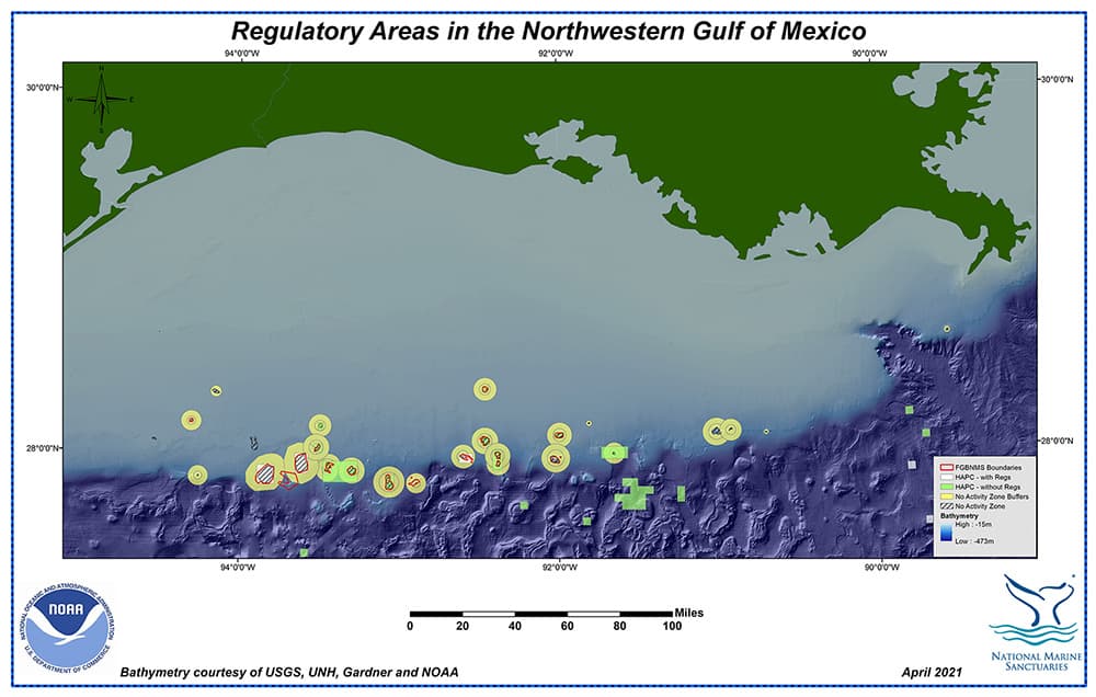
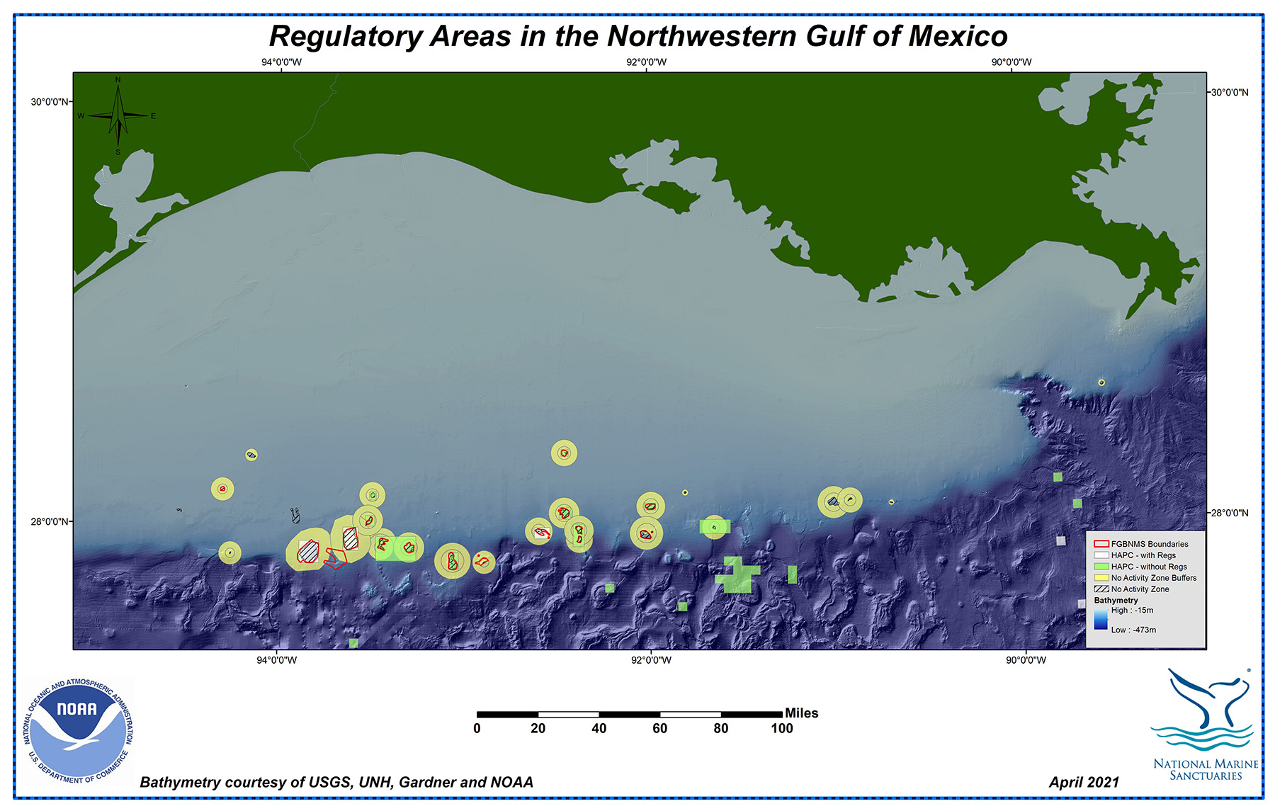
Regulatory areas in the northwestern Gulf of Mexico
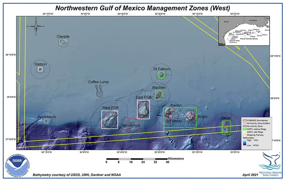
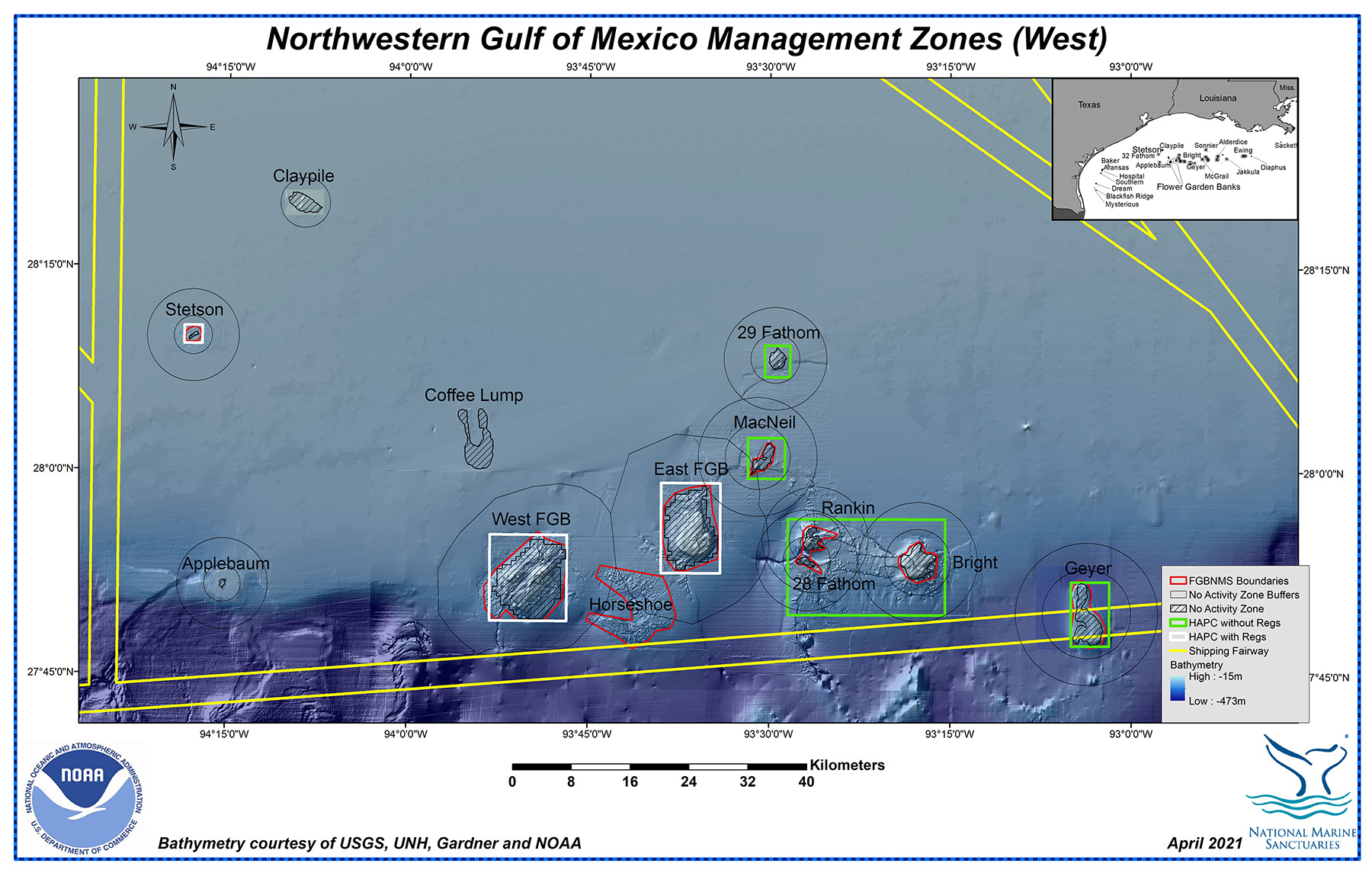
A closer look at the Management Zones in the western section of the northwestern Gulf of Mexico
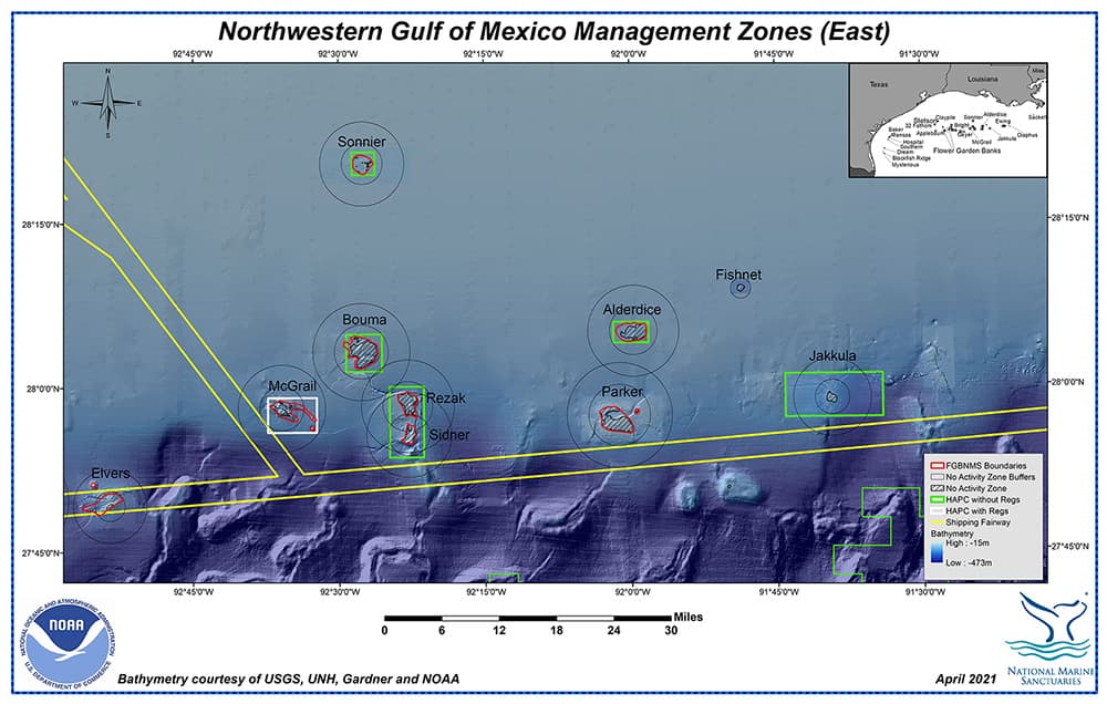
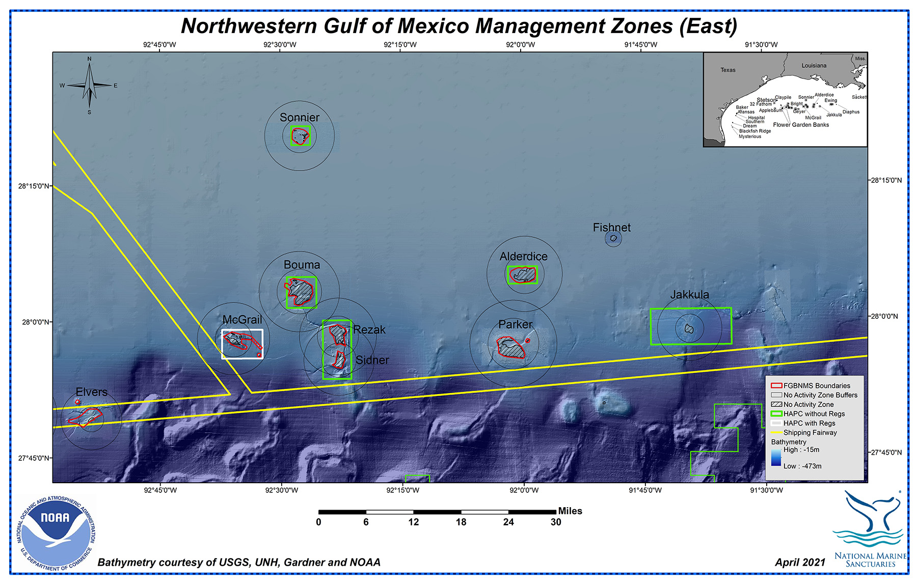
A closer look at the Management Zones in the eastern section of the northwestern Gulf of Mexico
For additional information on the management zones in the northwestern Gulf of Mexico, please visit our Management Zones page.
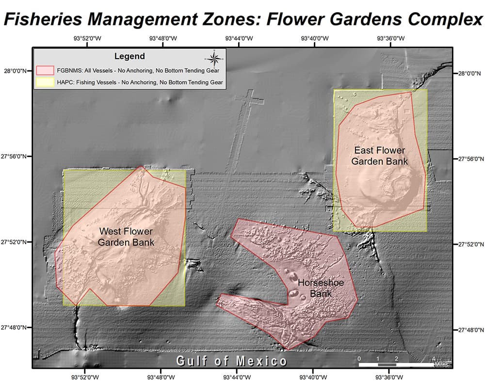
Fisheries Management zones around East and West Flower Garden Banks
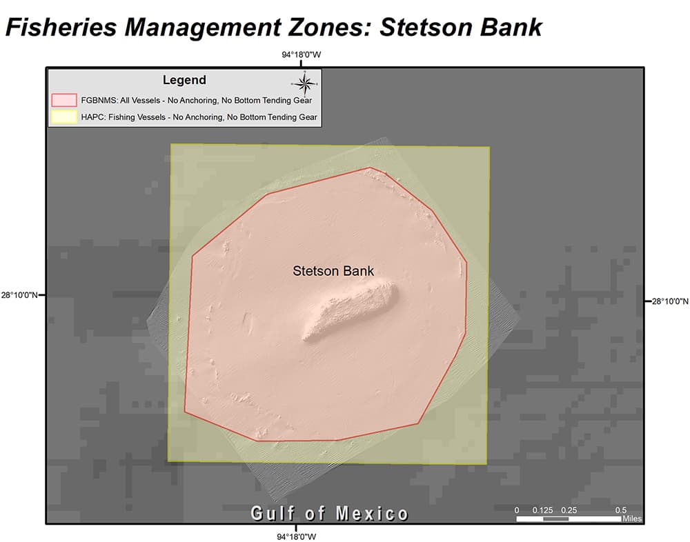
Fisheries Management zones around Stetson Bank
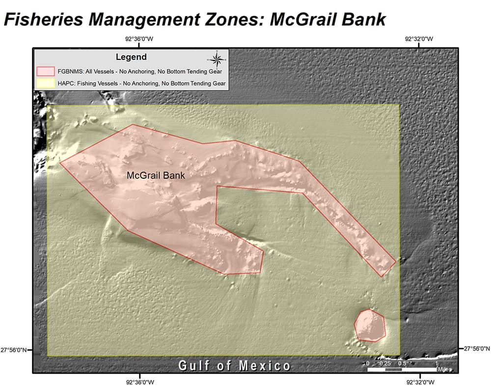
Fisheries Management zones around McGrail Bank
top of page
WATER FLOW
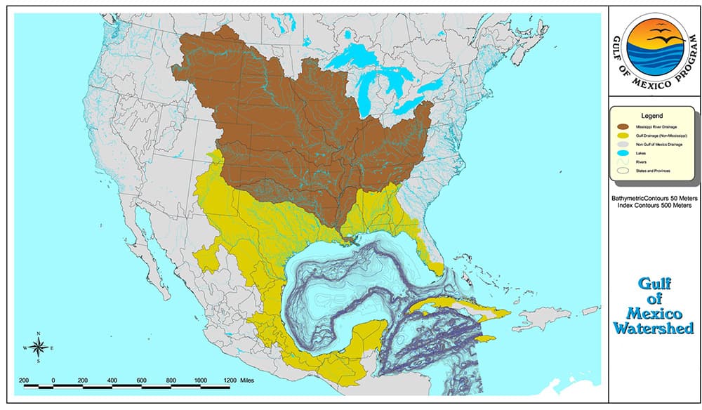
Gulf of Mexico Watershed
Image Credit: EPA
For more information about the Gulf of Mexico watershed, please visit our Natural Setting page.
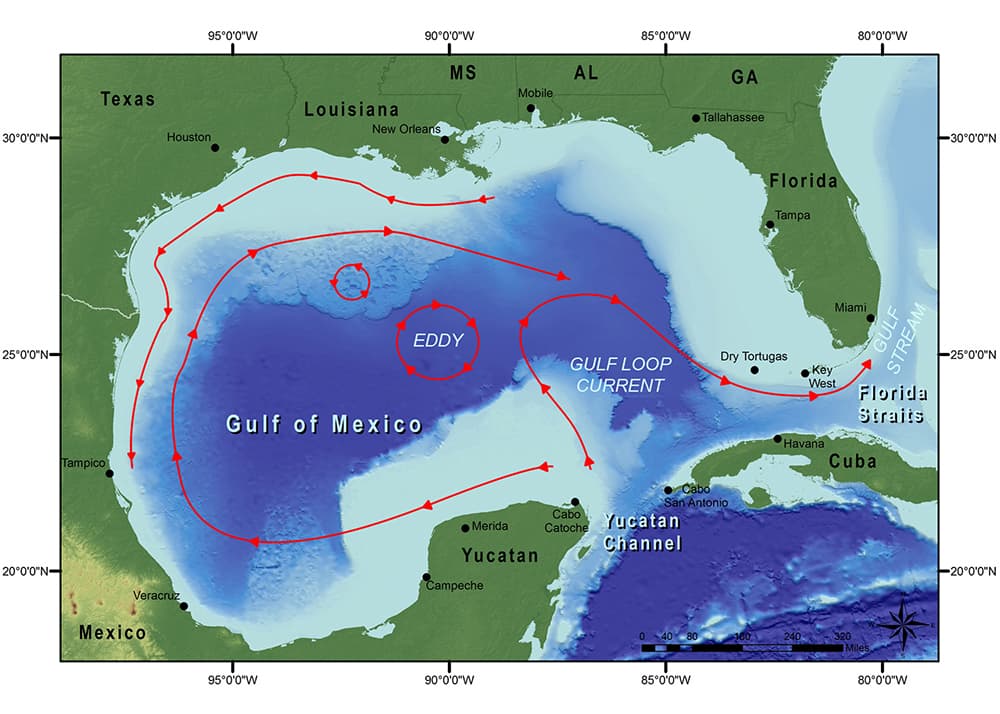
Basic current patterns in the Gulf of Mexico,
including the Loop Current
For more information about how current movement in the Gulf of Mexico affects Flower Garden Banks National Marine Sanctuary, please visit our Natural Setting web page.
top of page