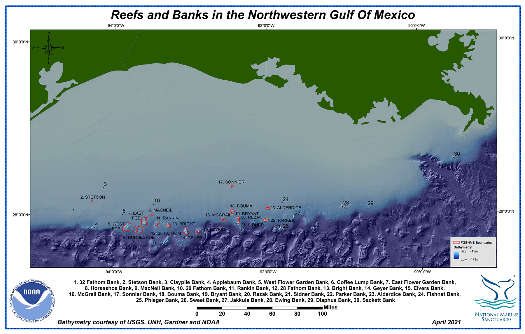
NORTHWESTERN GULF OF MEXICO

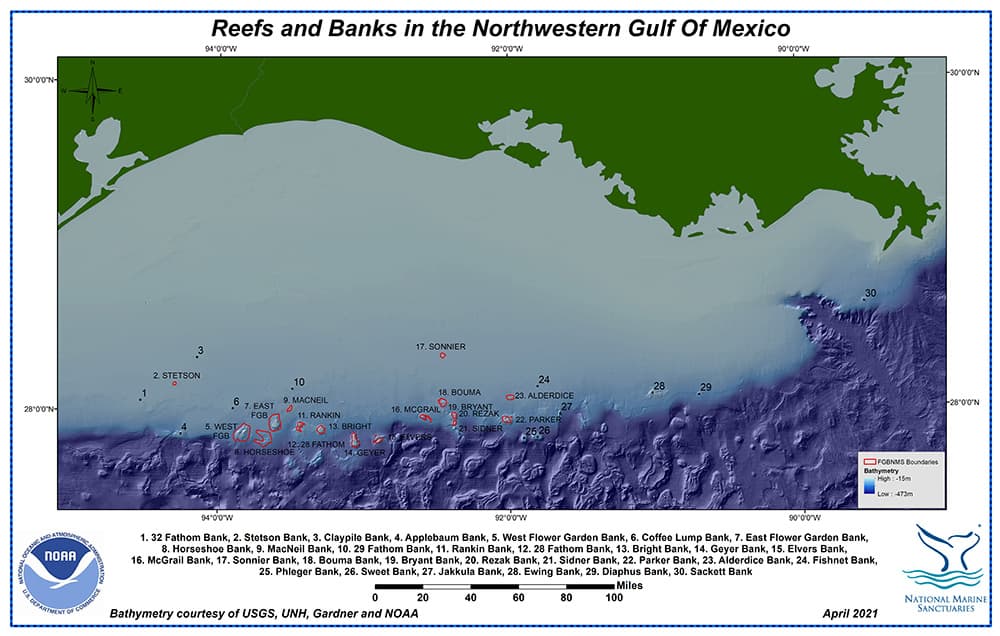
Reefs and banks of the northwestern Gulf of Mexico, off the coasts of Texas and Louisiana
Maps of individual sanctuary banks are shown in alphabetical order below.
ALDERDICE BANK
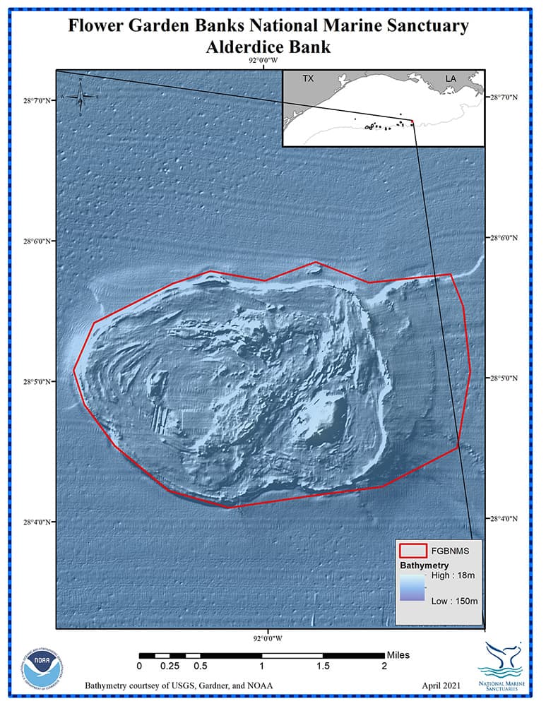
Alderdice Bank
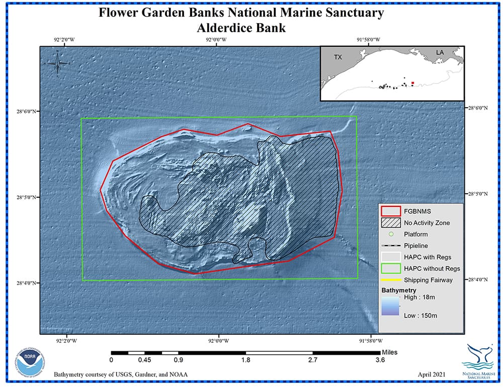
Management zones and infrastructure around Alderdice Bank
For more information about Alderdice Bank, click on this link.
top of page
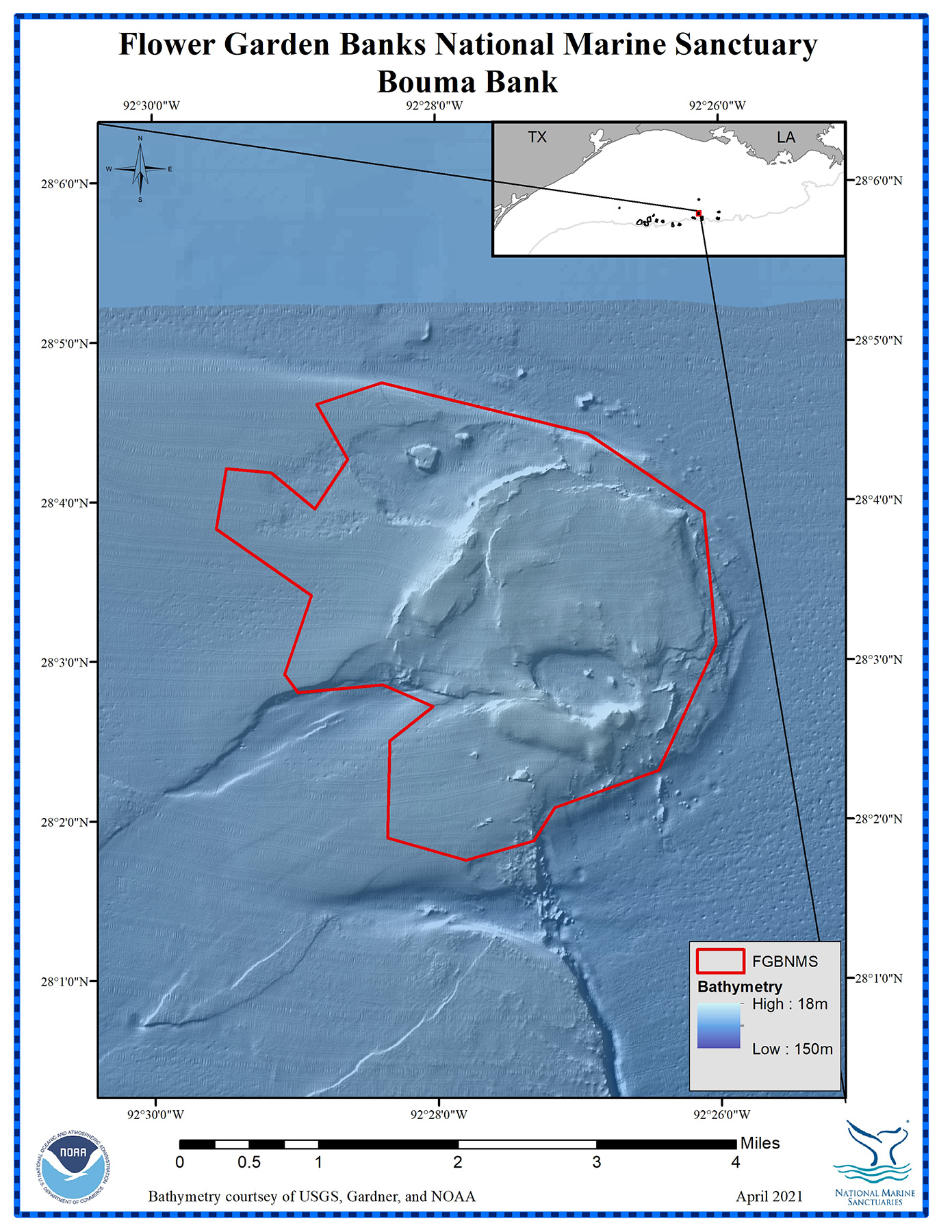
BOUMA BANK
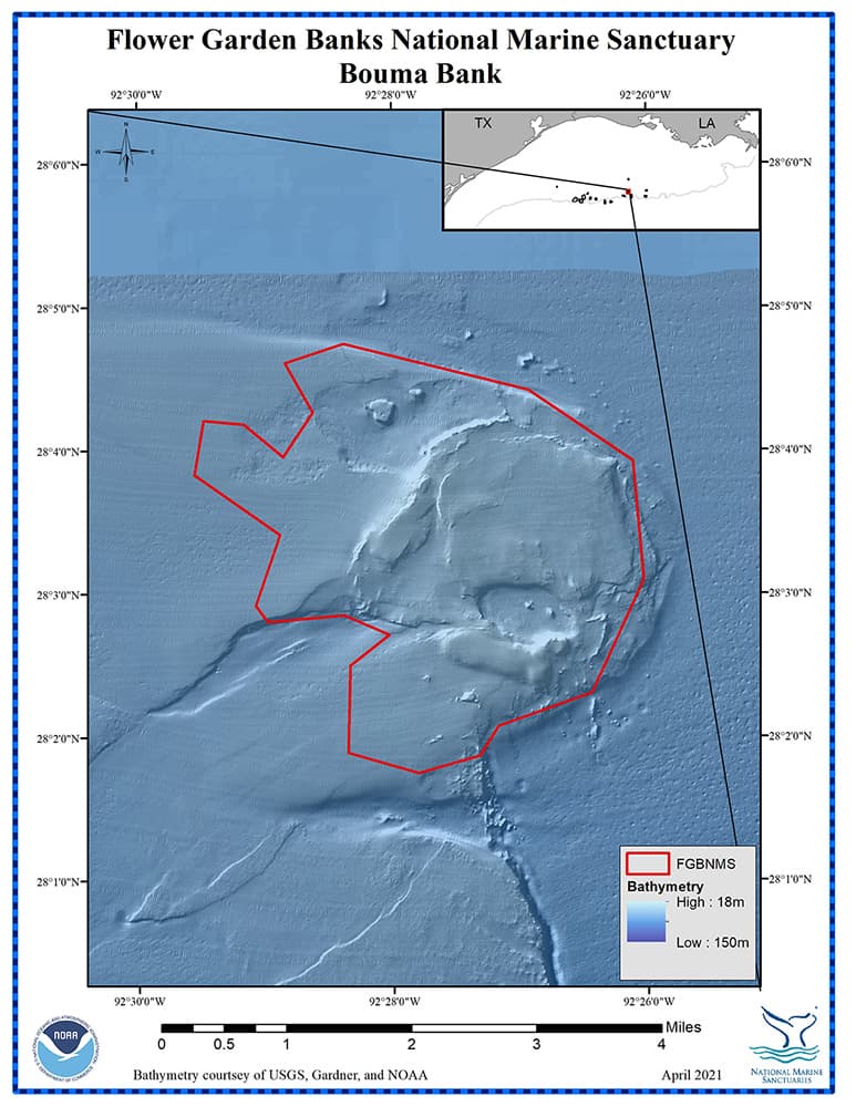
Bouma Bank
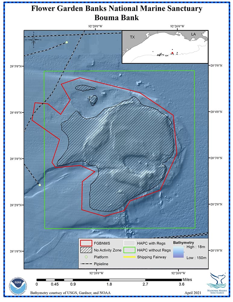
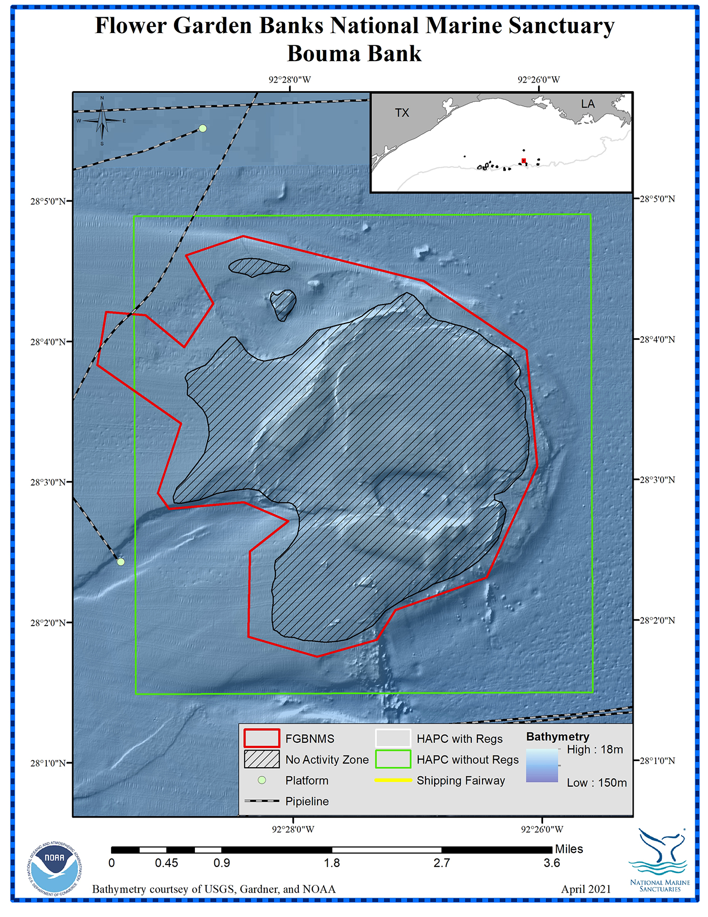
Management zones and infrastructure around Bouma Bank
For more information about Bouma Bank, click on this link.
top of page
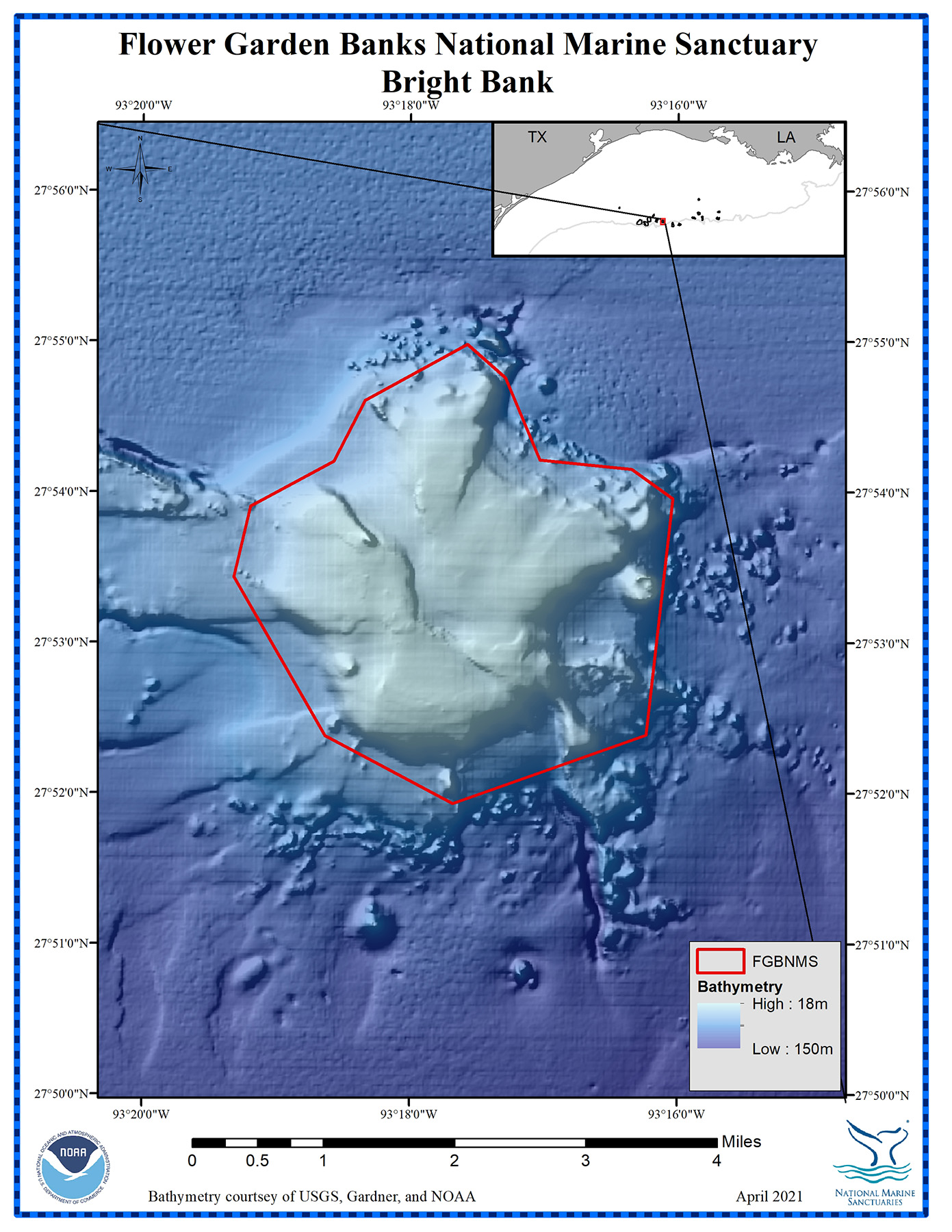
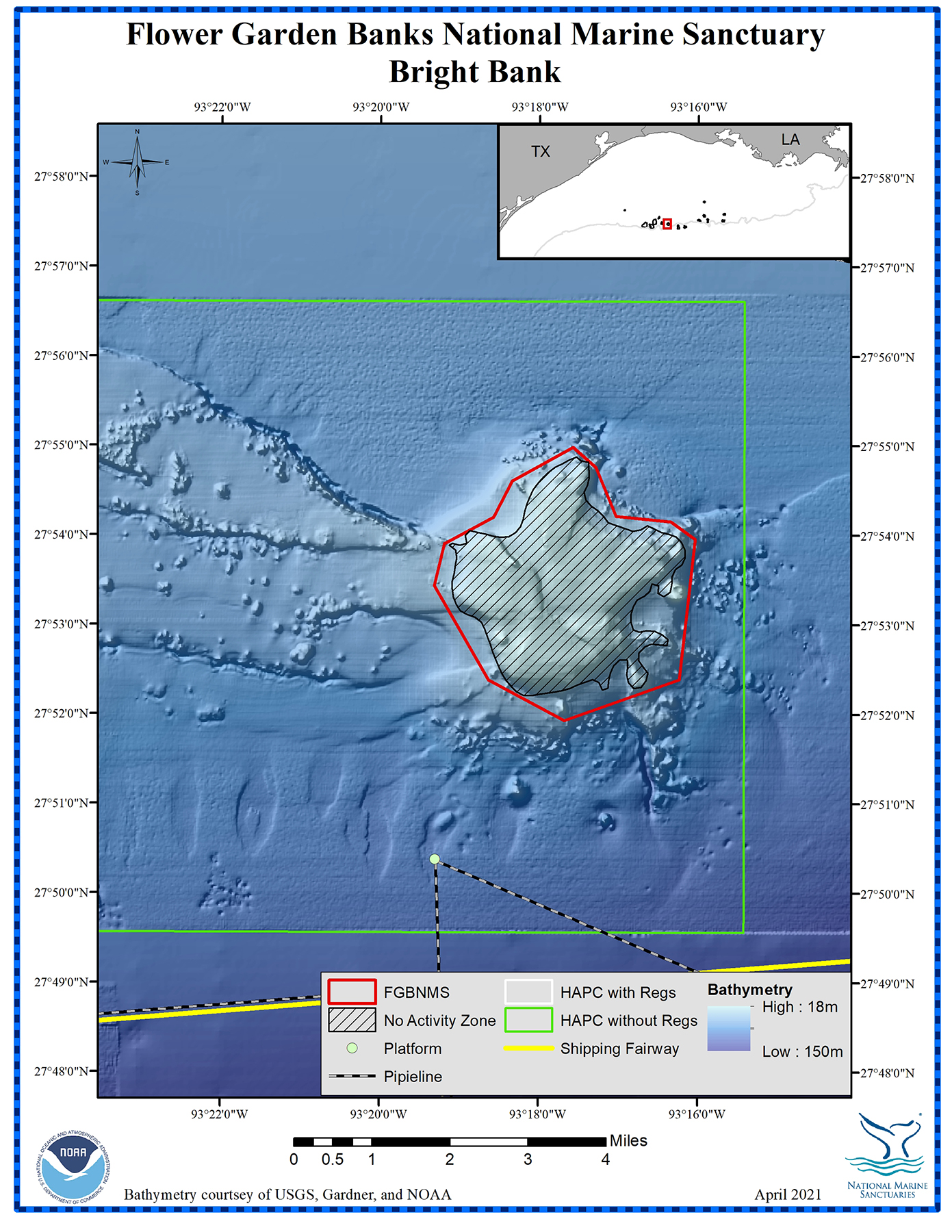
BRIGHT BANK

Bright Bank

Management zones and infrastructure around Bright Bank
For more information about Bright Bank, click on this link.
top of page
EAST FLOWER GARDEN BANK
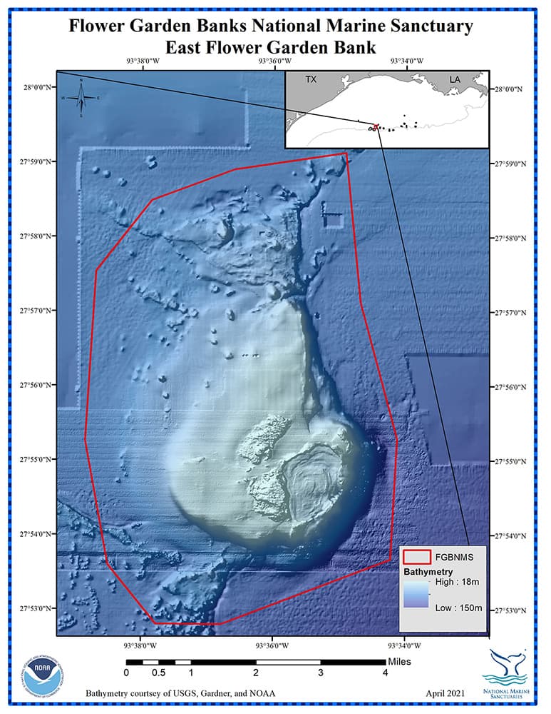
East Flower Garden Bank
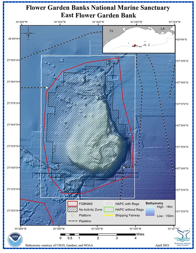
Management zones and infrastructure around East Flower Garden Bank
top of page
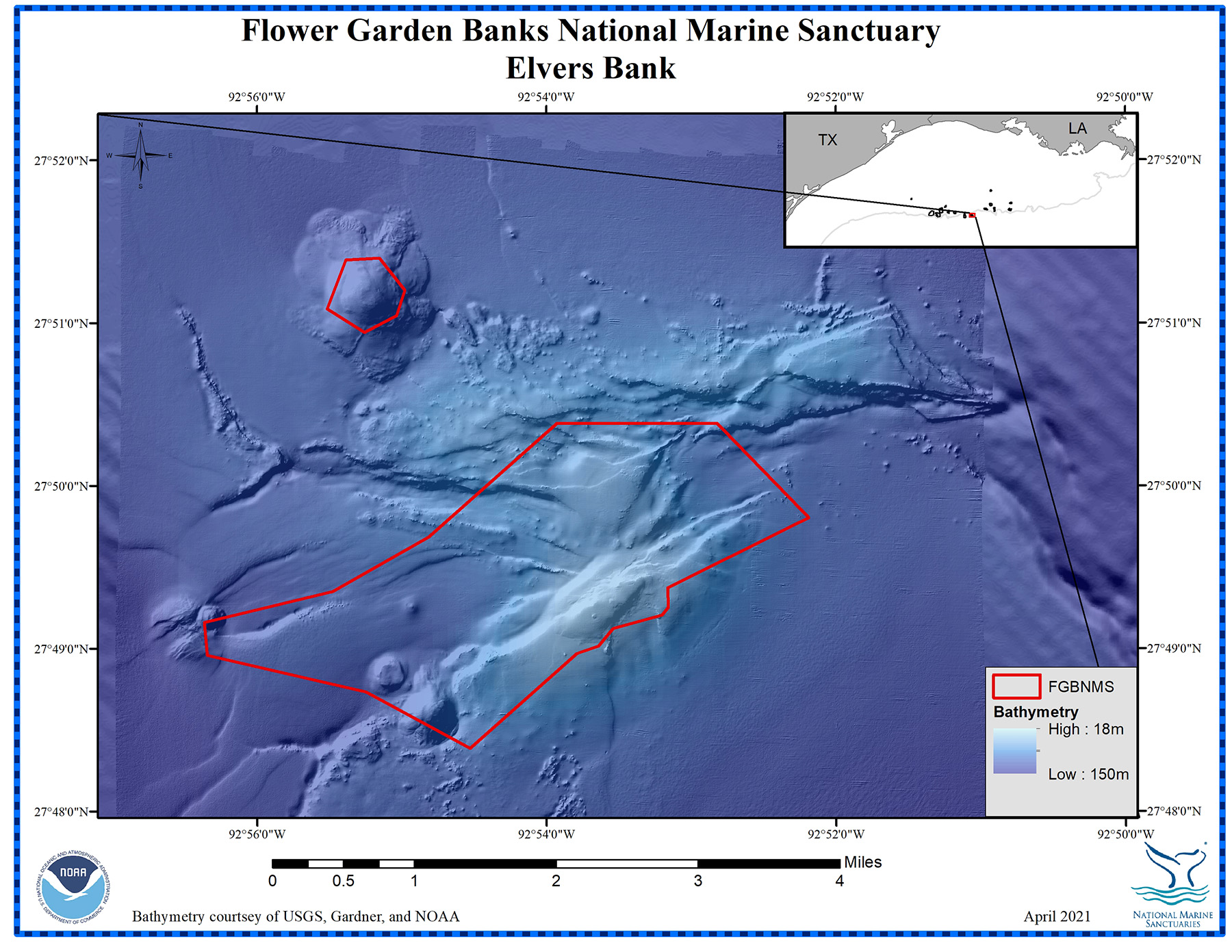
ELVERS BANK
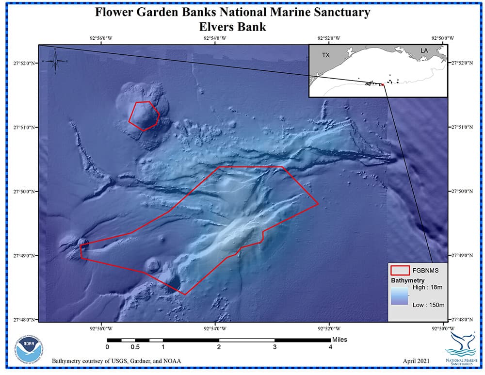
Elvers Bank has two boundary areas
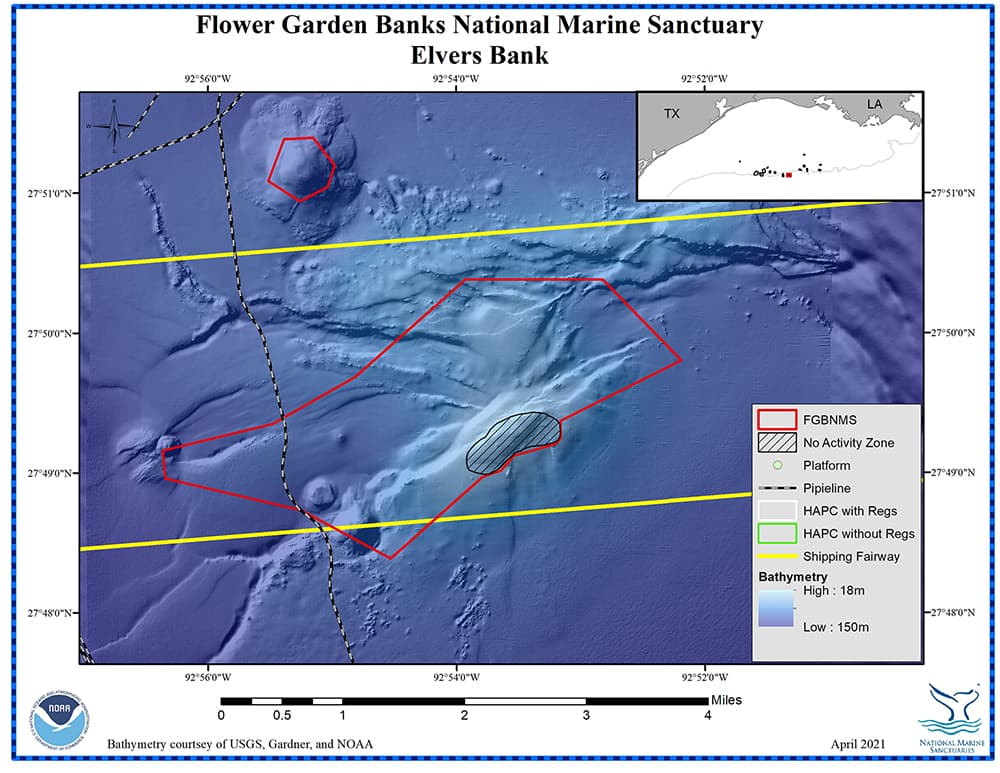
Management zones and infrastructure around Elvers Bank
For more information about Elvers Bank, click on this link.
top of page
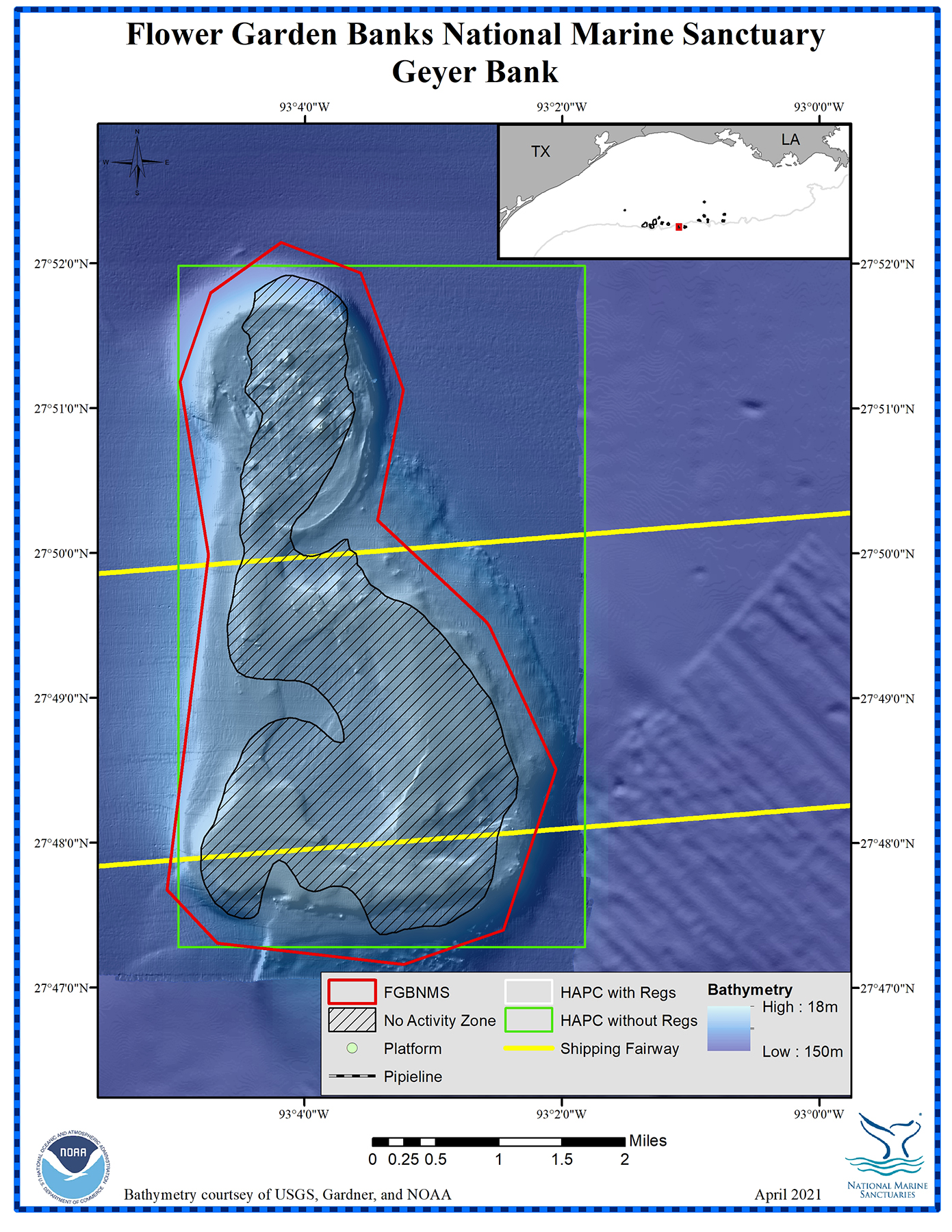
GEYER BANK
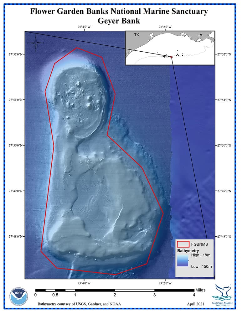
Geyer Bank
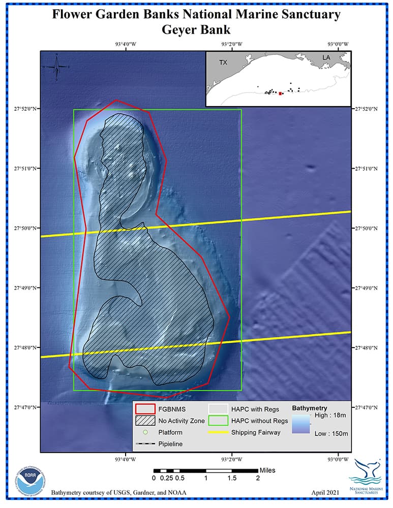
Management zones and infrastructure around Geyer Bank
For more information about Geyer Bank, click on this link.
top of page
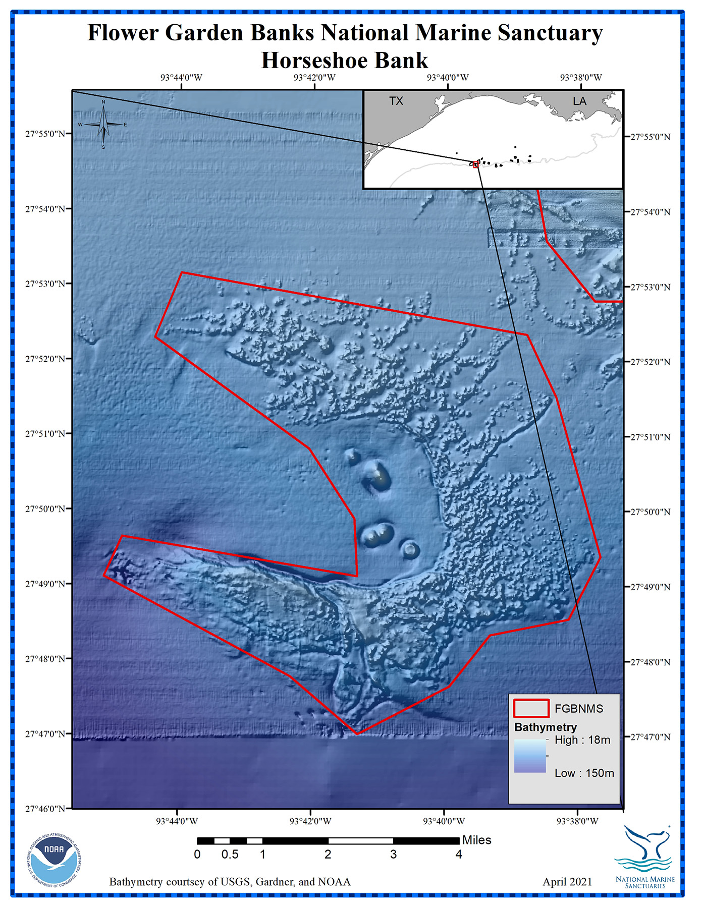
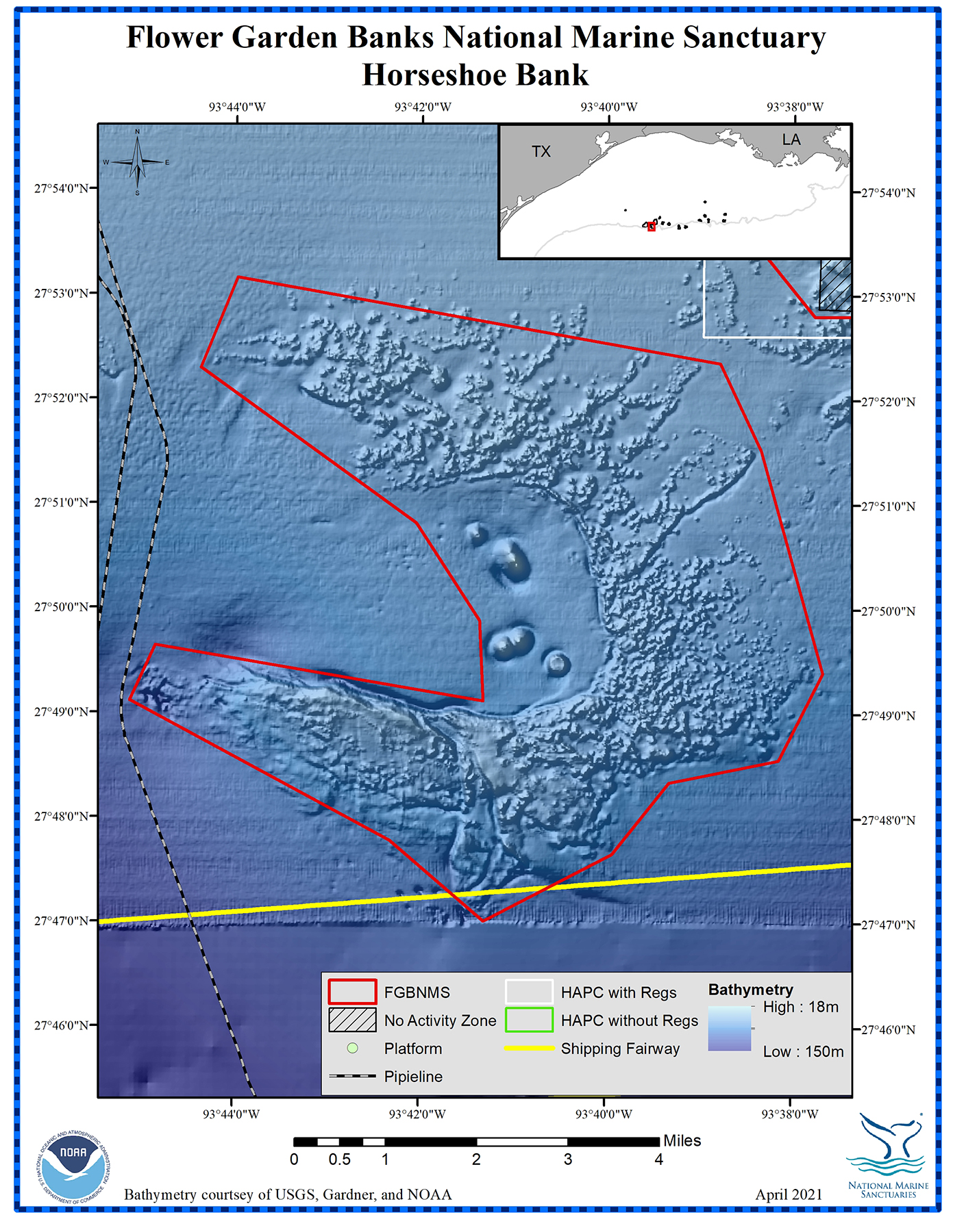
HORSESHOE BANK

Horseshoe Bank

Management zones and infrastructure around Horseshoe Bank
For more information about Horseshoe Bank, click on this link.
top of page
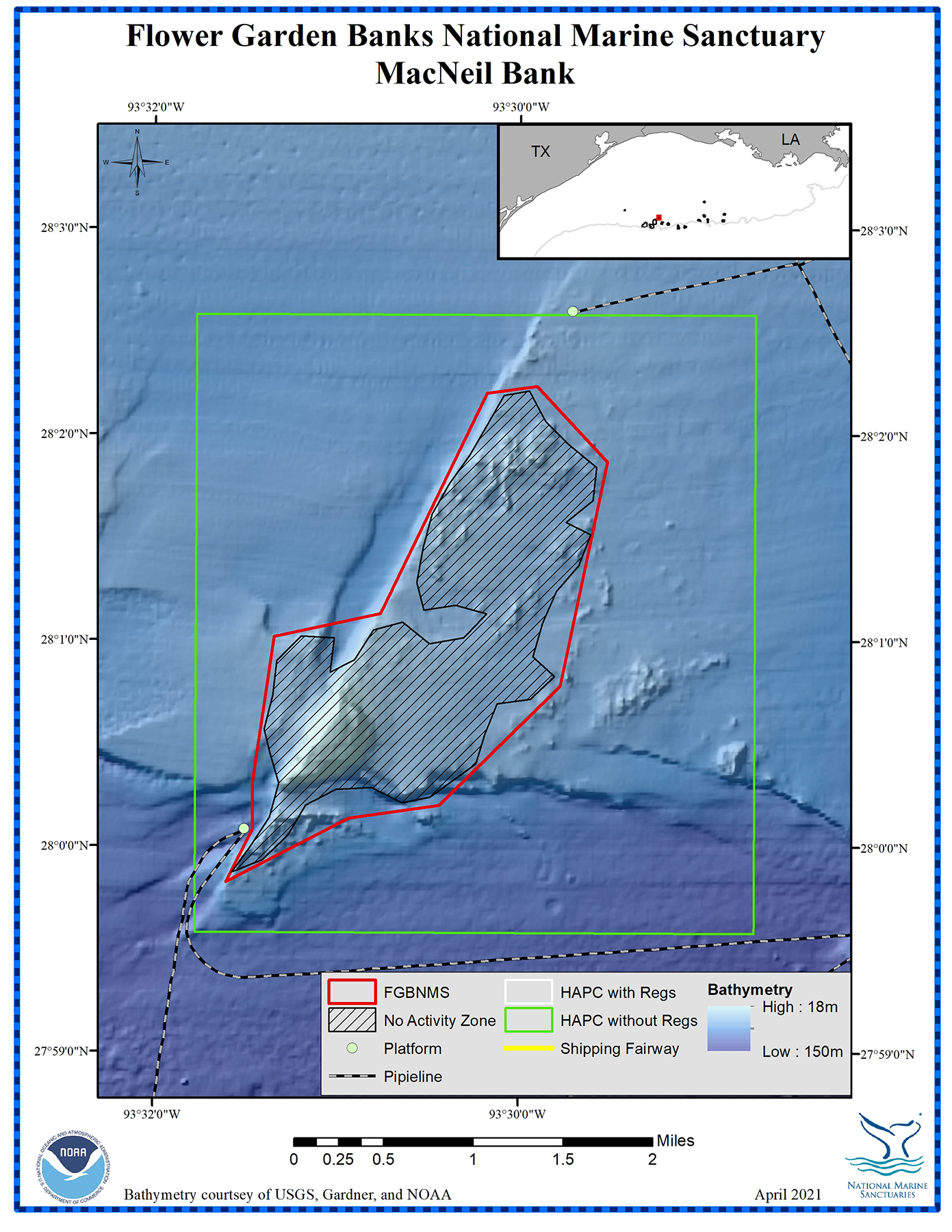
MACNEIL BANK
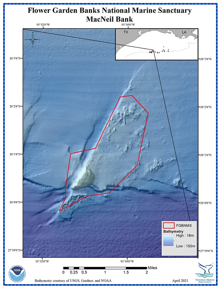
MacNeil Bank

Management zones and infrastructure around MacNeil Bank
For more information about MacNeil Bank, click on this link.
top of page
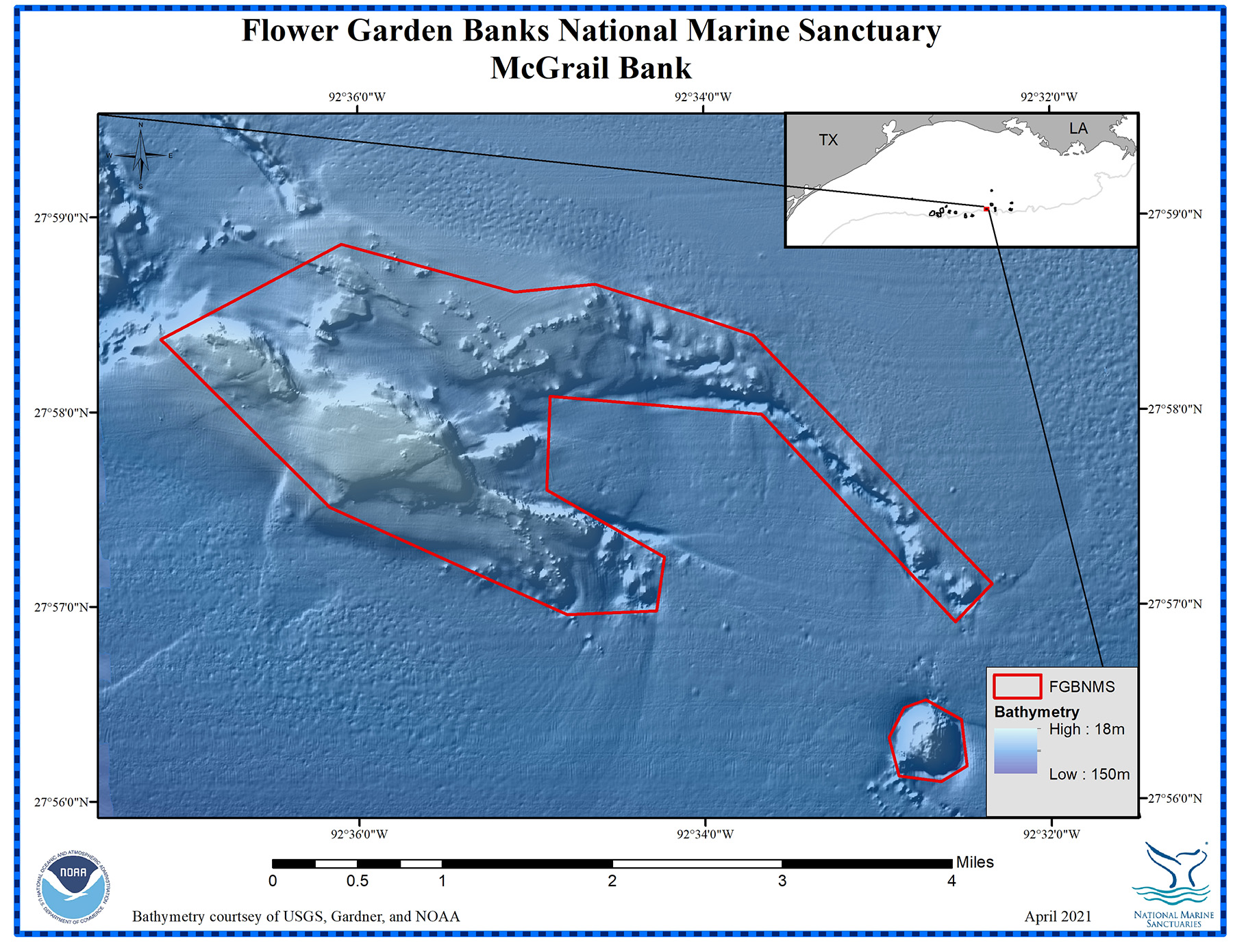
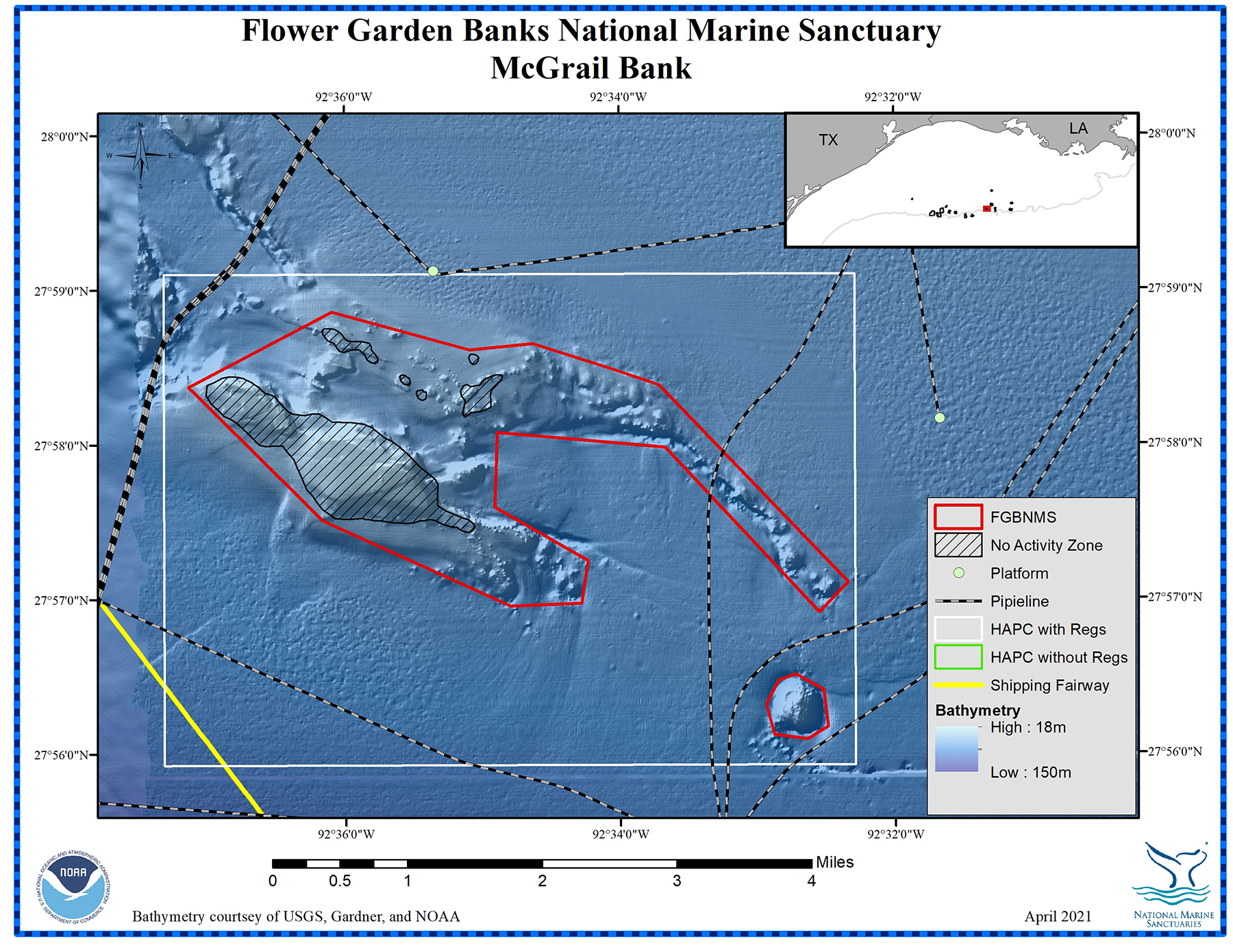
MCGRAIL BANK

McGrail Bank
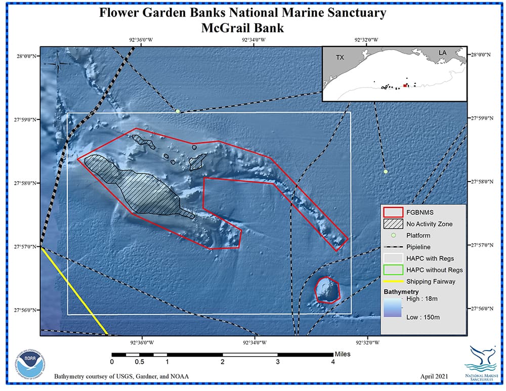
Management zones and infrastructure around McGrail Bank
For more information about McGrail Bank, click on this link.
top of page
PARKER BANK
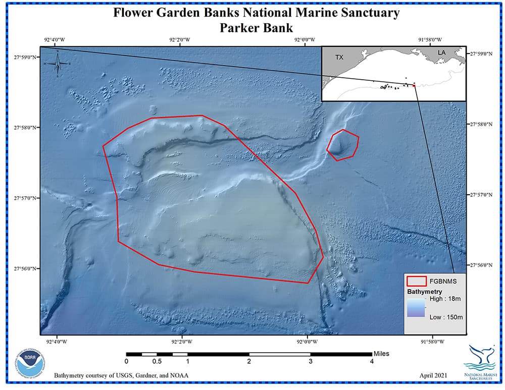
Parker Bank
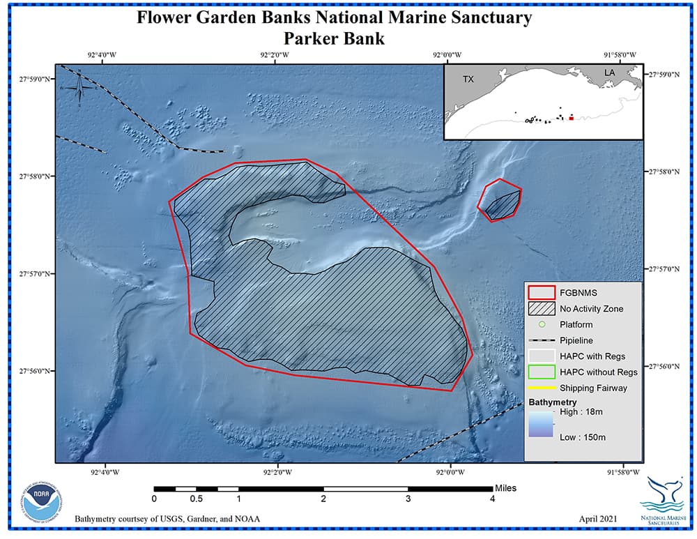
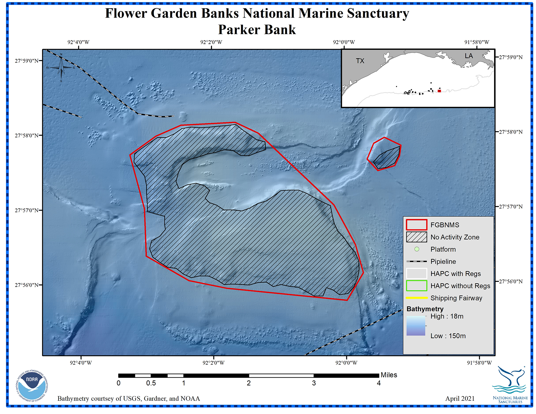
Management zones and infrastructure around Parker Bank
For more information about Parker Bank, click on this link.
top of page
RANKIN/28 FATHOM BANKS

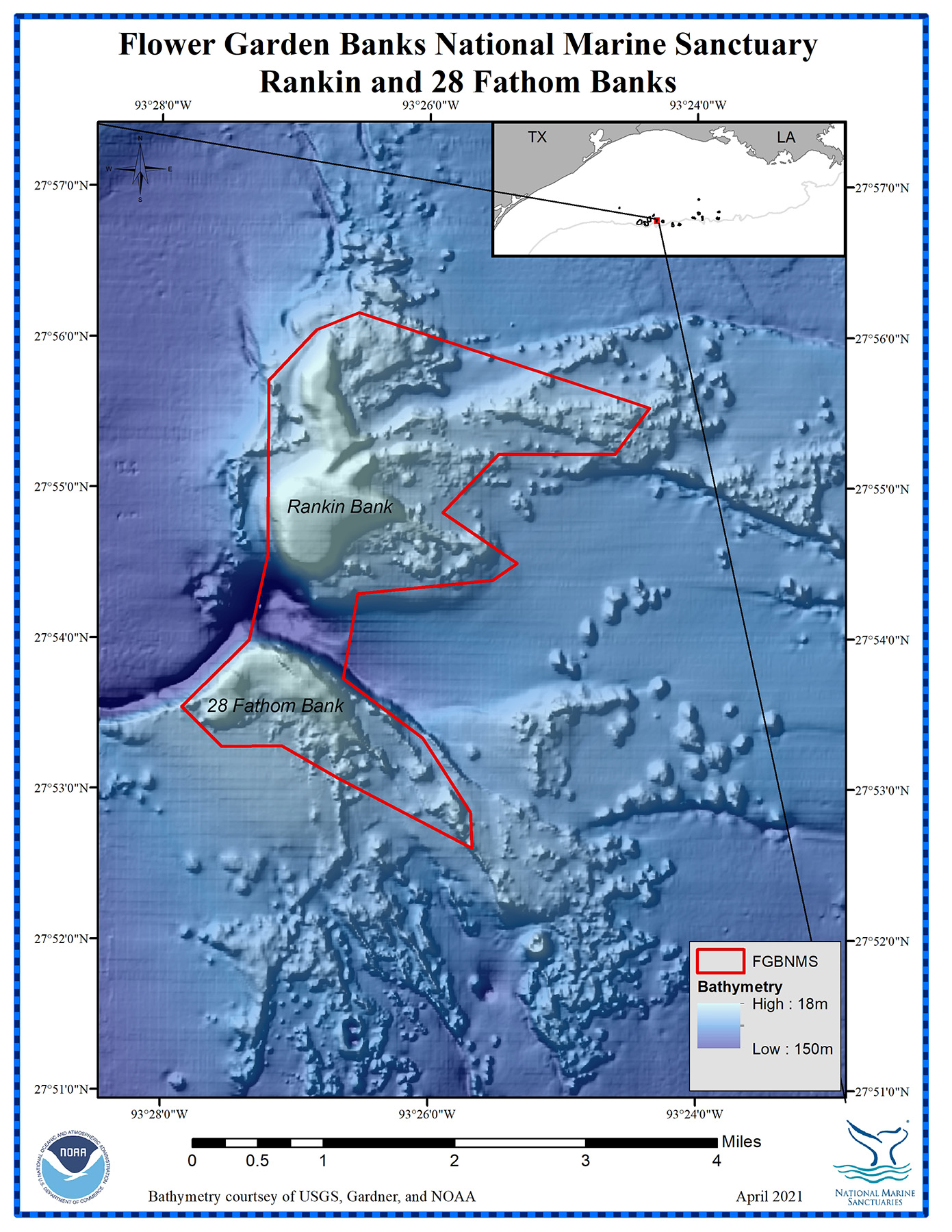
Rankin and 28 Fathom Banks are contained within a single boundary
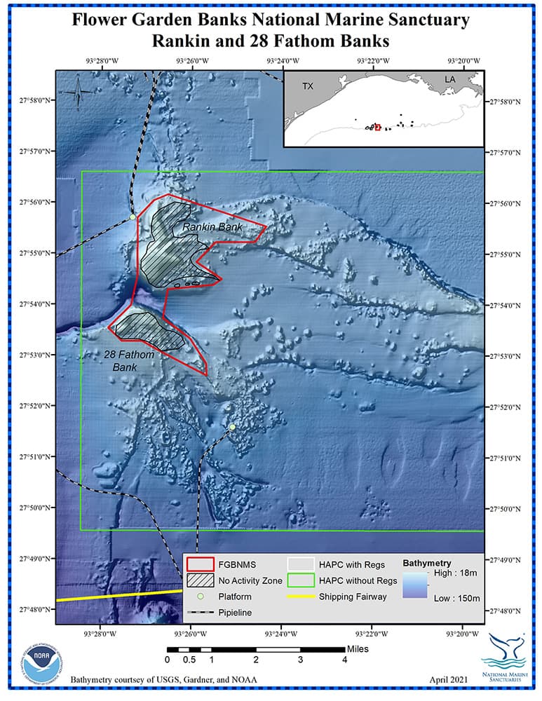
Management zones and infrastructure around Rankin and 28 Fathom Banks
For more information about Rankin and 28 Fathom Banks, click on this link.
top of page
REZAK/SIDNER BANKS

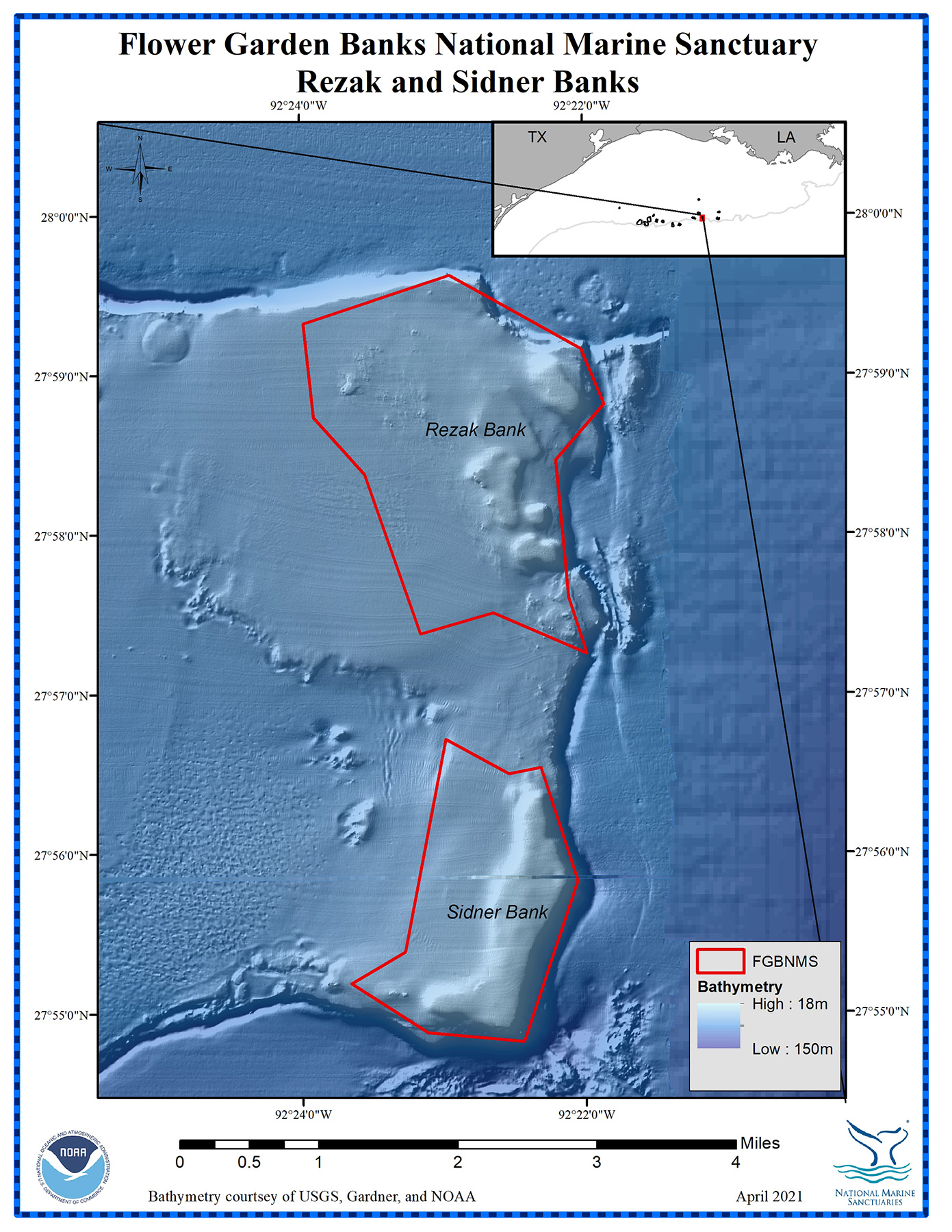
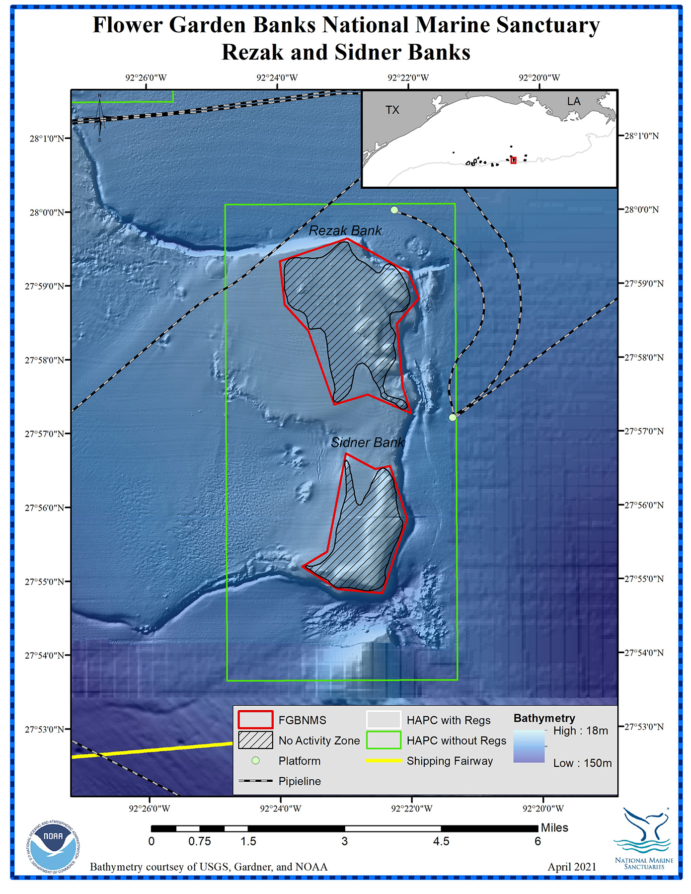
Rezak and Sidner Banks

Management zones and infrastructure around Rezak and Sidner Banks
For more information about Rezak and Sidner Banks, click on this link.
top of page
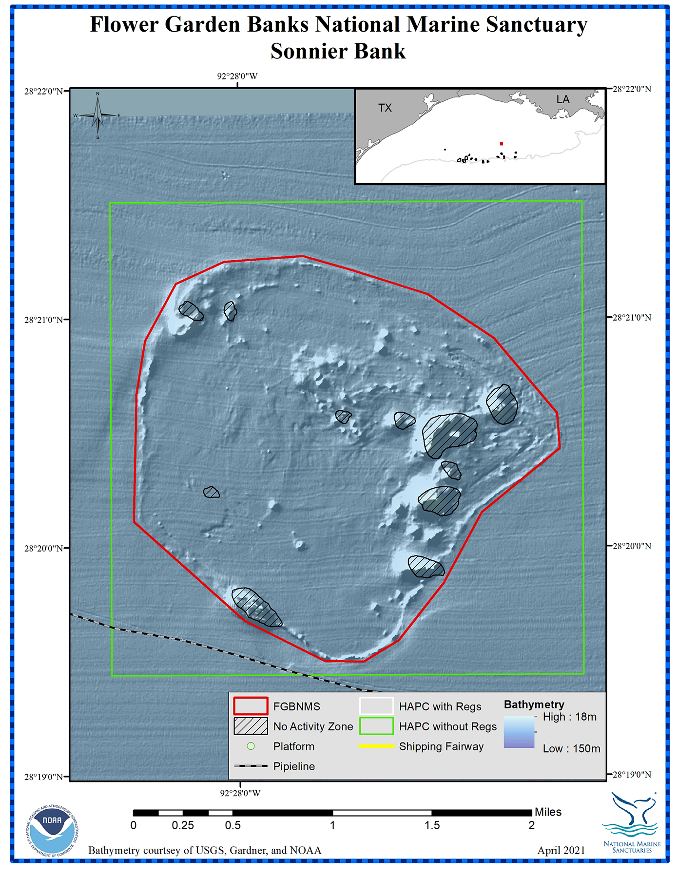
SONNIER BANK
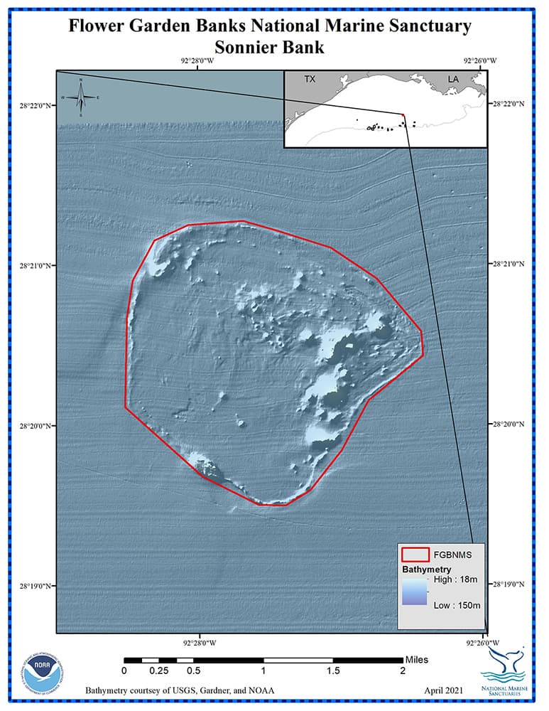
Sonnier Bank
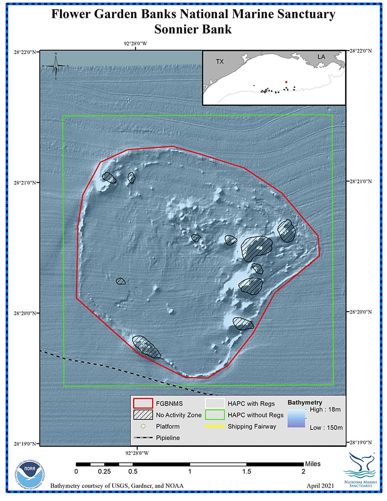
Management zones and infrastructure around Sonnier Bank
For more information about Sonnier Bank, click on this link.
top of page
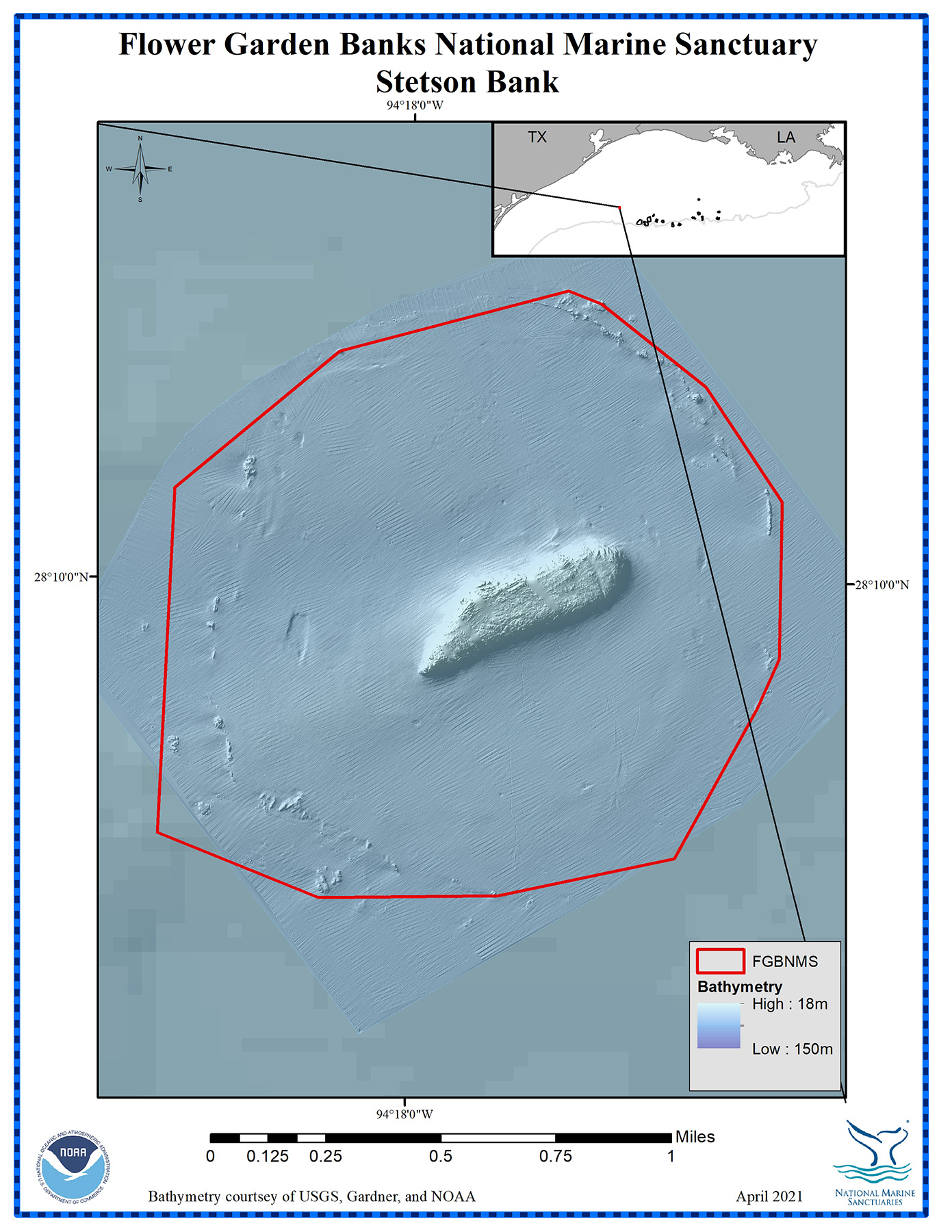
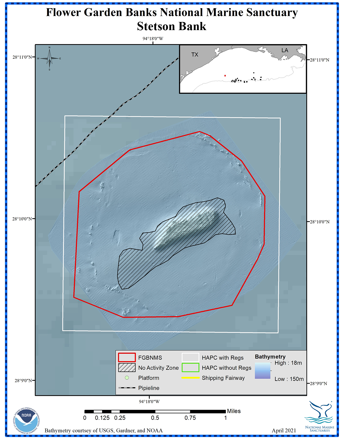
STETSON BANK

Stetson Bank
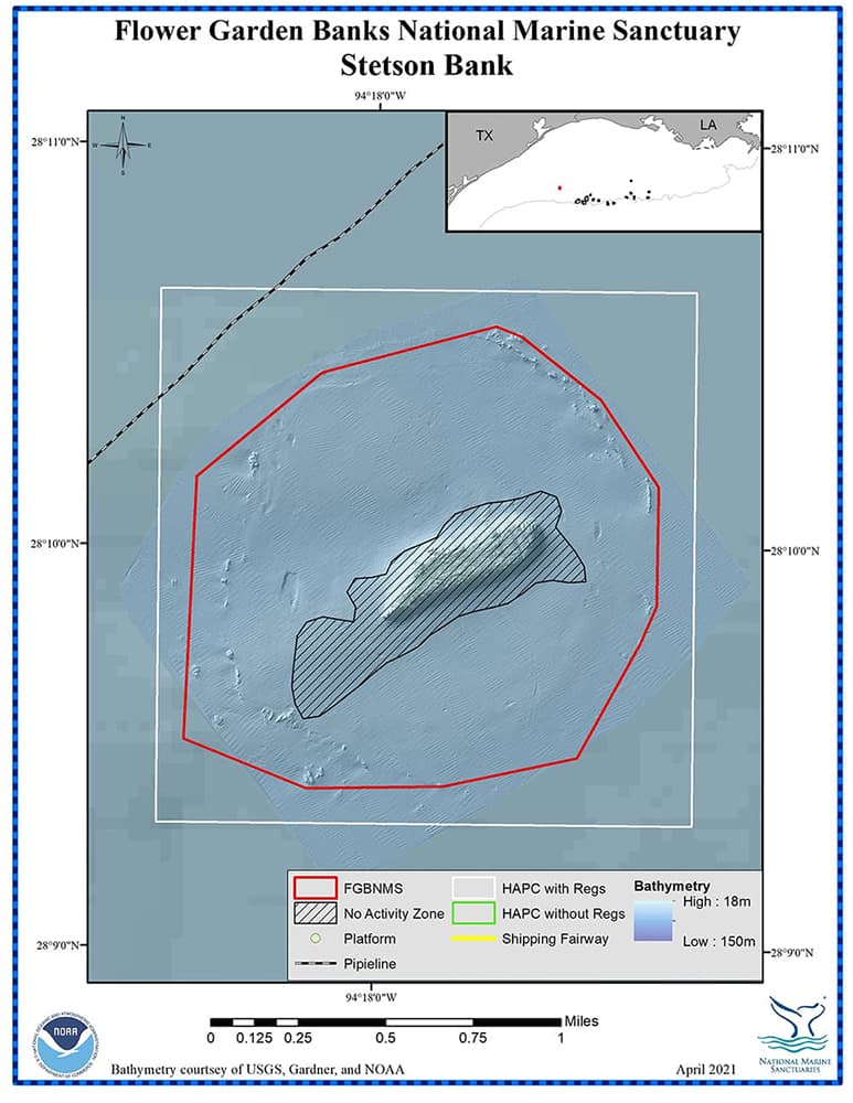
Management zones and infrastructure around Stetson Bank
top of page
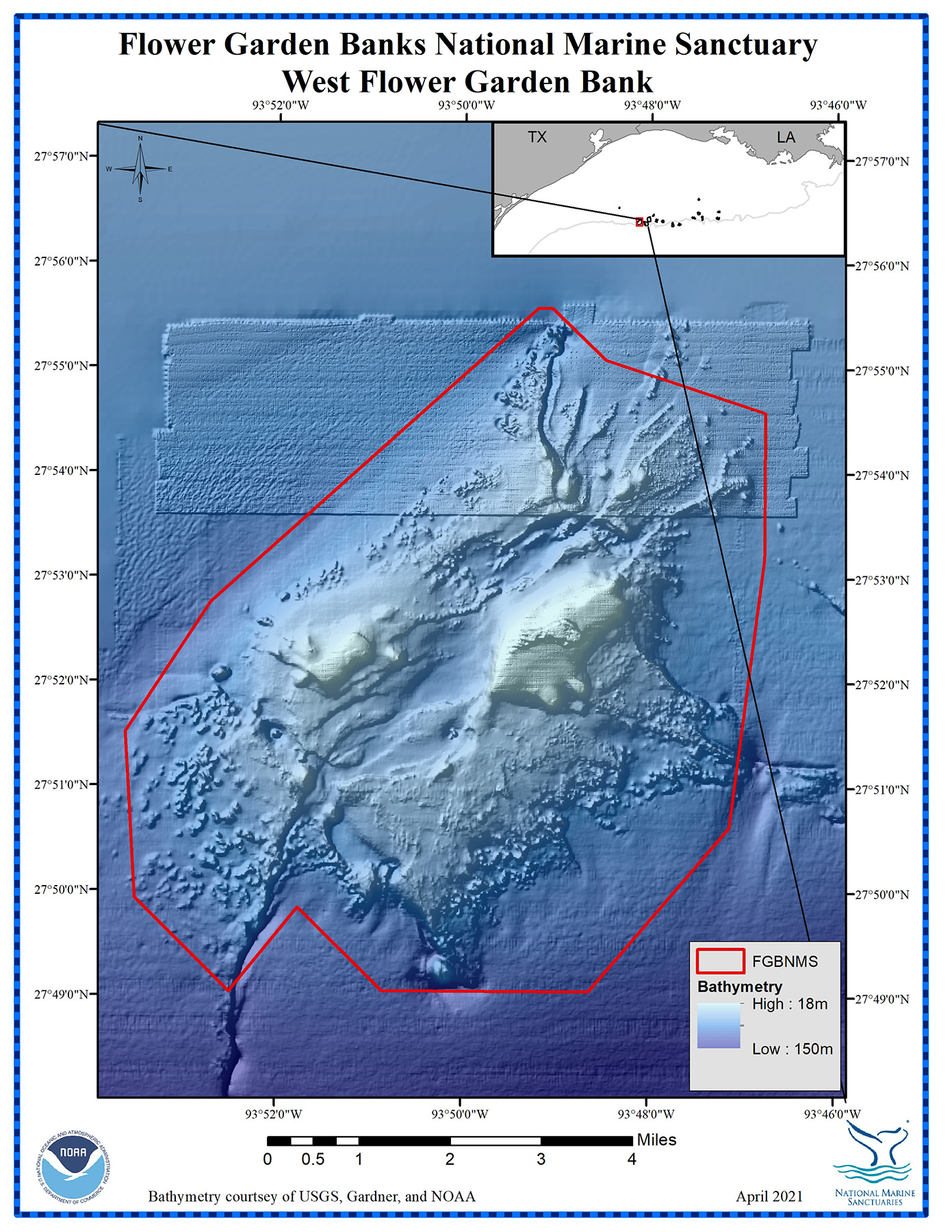
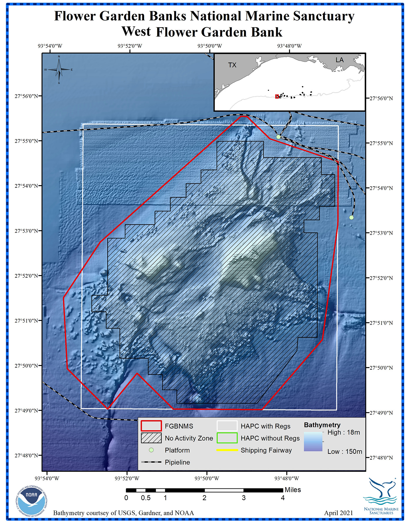
WEST FLOWER GARDEN BANK

West Flower Garden Bank
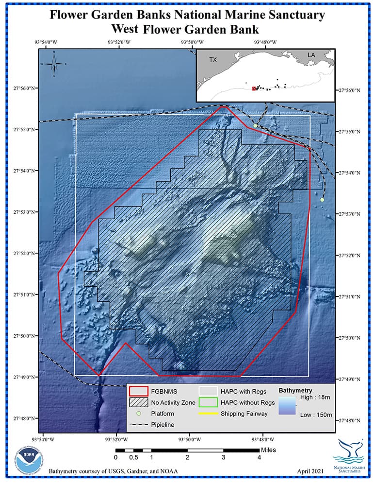
Management zones and infrastructure around West Flower Garden Bank
top of page