MOORING BUOYS & BOUNDARIES

The maps shown on this page were created using high-resolution multi-beam bathymetry data manipulated with GIS (Geographic Information System) software.
In addition to illustrating the relative depths and slope of the banks, the images show the sanctuary boundaries and locations of the mooring buoys.
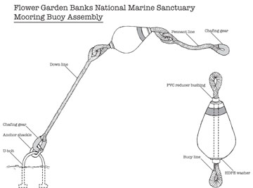
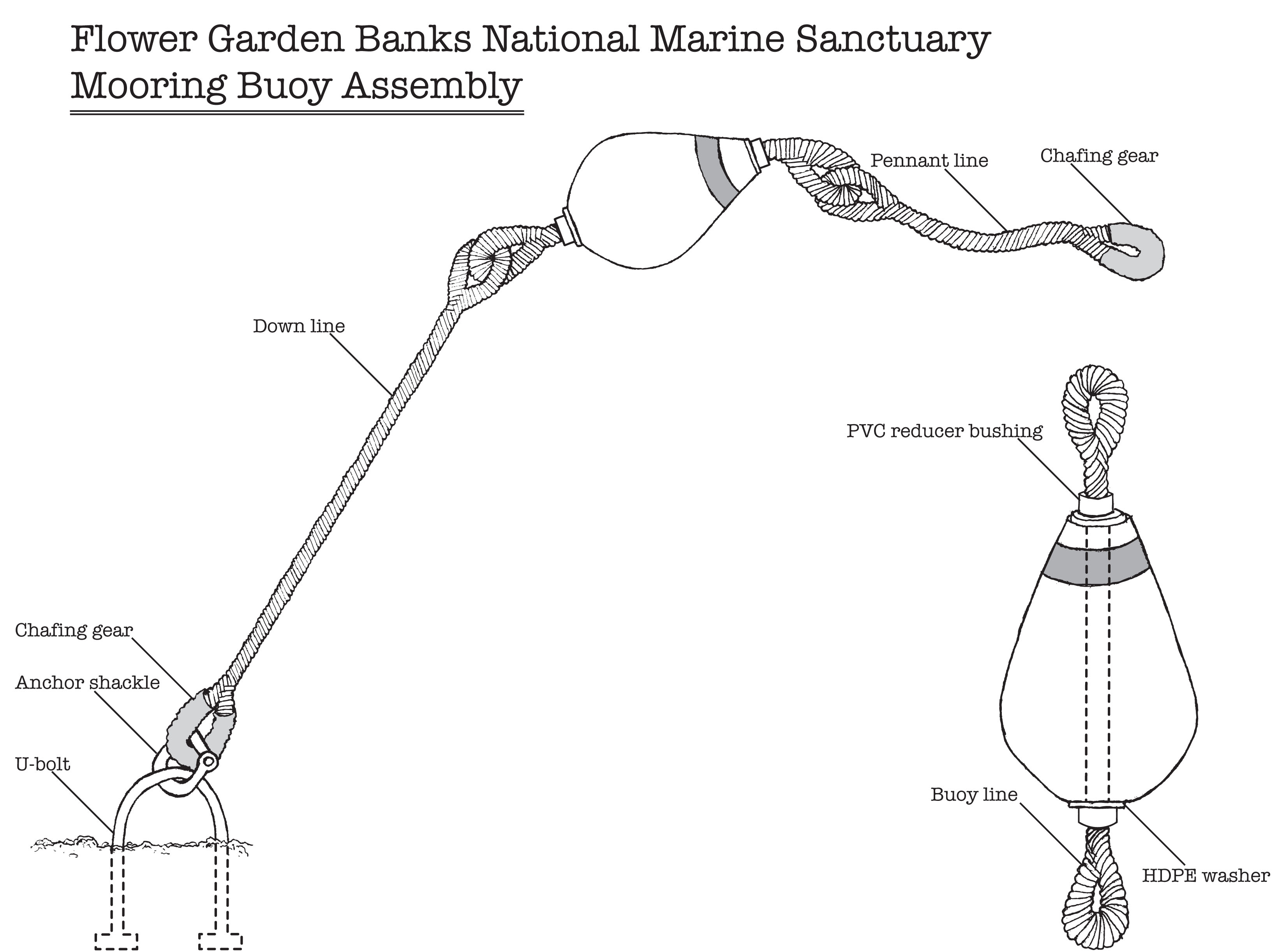
Diagram of mooring buoy assembly used in Flower Garden Banks National Marine Sanctuary. Credit: FGBNMS/Eckert
The bright red portions of the banks are generally within recreational dive limits. These areas are typically referred to as the reef cap or coral cap.
SANCTUARY BOUNDARIES (NAD83)
Flower Garden Banks National Marine Sanctuary actually has three separate boundary areas--one surrounding each of the three banks.
At East and West Flower Garden Banks, sanctuary boundaries closely follow the original No Activity Zone designations set by Minerals Management Service to restrict oil & gas exploration around the coral reefs. This was done in the interest of limiting the impact of sanctuary designation on oil & gas activities in the Gulf of Mexico.
At Stetson Bank, the boundary was set by simply drawing a rectangular area around the bank. We now know that this left important related habitat outside the sanctuary boundary, an issue that we hope to address in our Proposed Sanctuary Expansion.
Boundary Shapefiles (8kb zip file)
top of page
East Flower Garden Bank Boundaries

Click on map to see larger image.
top of page
MOORING BUOY COORDINATES (NAD83)
Mooring buoys are an important part of our efforts to protect sanctuary resources while still enabling visitor access to the coral reefs. Vessels up to 100 feet in length can tie off to surface buoys instead of dropping anchor on the coral reefs below.
PLEASE NOTE: Buoys are periodically removed for maintenance or disappear during severe storms, so they may not all be there when you are.
In addition, use of mooring buoys is on a first come, first served basis. Please review recommendations in Reef Etiquette.
East Flower Garden Bank Buoys

Click on map to see a larger image.
| Buoy |
Latitude (DDM) |
Longitude (DDM) |
Depth |
| 1 |
27° 54.571 N |
-93° 35.845 W |
64ft/19.5m |
| 2 |
27° 54.516 N |
-93° 35.831 W |
63ft/19.2m |
| 3 |
27° 54.444 N |
-93° 35.955 W |
65ft/19.8m |
| 4 |
27° 54.529 N |
-93° 35.99 W |
61ft/18.6m |
| 5 |
27° 54.592 N |
-93° 35.984 W |
70ft/21.3m |
| 6 |
27° 54.645 N |
-93° 35.95 W |
65ft/19.5m |
| 7 |
27° 54.547 N |
-93° 35.918 W |
63ft/19.2m |
top of page
West Flower Garden Bank Buoys

Click on map to see larger image.
| Buoy |
Latitude (DDM) |
Longitude (DDM) |
Depth |
| 1 |
27° 52.578 N |
-93° 48.907 W |
78ft/23.8m |
| 2 |
27° 52.526 N |
-93° 48.836 W |
80ft/24.4m |
| 3 |
27° 52.458 N |
-93° 49.007 W |
80ft/24.4m |
| 4 |
27° 52.506 N |
-93° 49.006 W |
75ft/22.9m |
| 5 |
27° 52.519 N |
-93° 48.889 W |
68ft/20.7m |
top of page
Stetson Bank Buoys

Click on map to see larger image.
| Buoy |
Latitude (DDM) |
Longitude (DDM) |
Depth |
| 1 |
28° 09.931 N |
-94° 17.861 W |
74ft/22.6m |
| 2 |
28° 09.981 N |
-94° 17.834 W |
78ft/23.8m |
| 3 |
28° 09.986 N |
-94° 17.766 W |
73ft/22.3m |
| 4 |
28° 09.888 N |
-94° 17.895 W |
85ft/25.9m |
| 5 |
28° 09.917 N |
-94° 17.770 W |
79ft/24.1m |
top of page