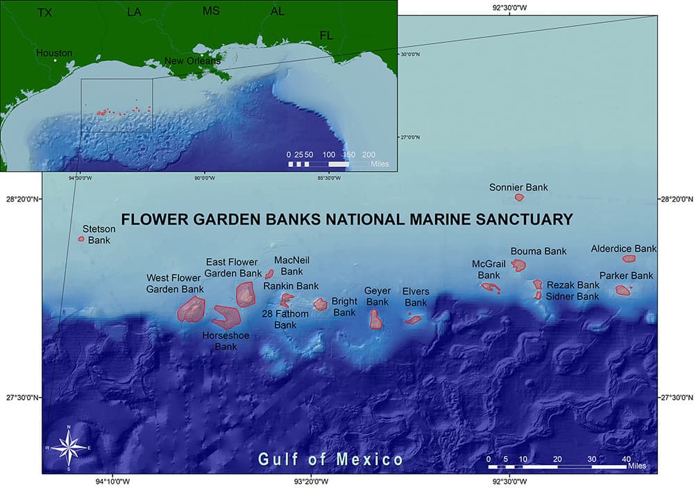
Flower Garden Banks National Marine Sanctuary has 19 separate boundary areas encompassing all or part of 17 different reefs and banks off the coasts of Texas and Louisiana. Twelve of the banks have individual boundaries, two of the banks have a shared boundary, and three of the banks have two separate boundary areas each.
Boundary Determination
Many of the sanctuary boundaries were drawn close to No Activity Zone (NAZ) designations set by the Bureau of Ocean Energy Management (BOEM). This was done to limit the impact of sanctuary designation on the oil & gas and fishing industries in the northwestern Gulf. As a result of this process, Elvers, McGrail, and Parker Banks each have two boundary areas.
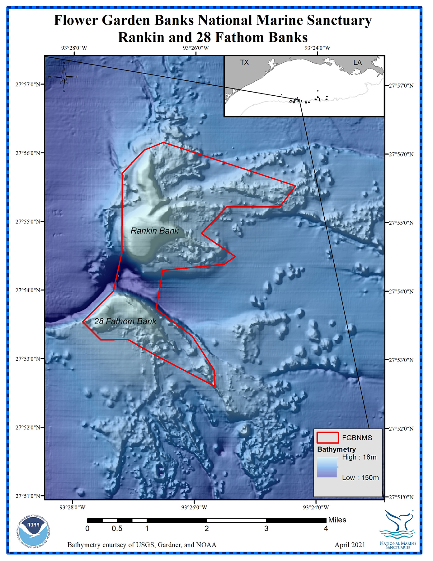
Horseshoe Bank was the only bank without a NAZ so the boundary was drawn relatively close to the mapped features in that area. Rankin and 28 Fathom Banks were combined within one boundary due to their close proximity to one another.
You can view the boundary and NAZ data across the whole sanctuary using the Exploration Tool of the Story Map on our home page .
Boundary Points (NAD83)
Maps and sanctuary boundary points for each of the banks are listed below. These are presented in geographic order from the west end to the east end of the sanctuary, starting with Stetson Bank and ending with Alderdice Bank.
GIS boundary data is available for all national marine sanctuaries here:https://sanctuaries.noaa.gov/library/imast_gis.html
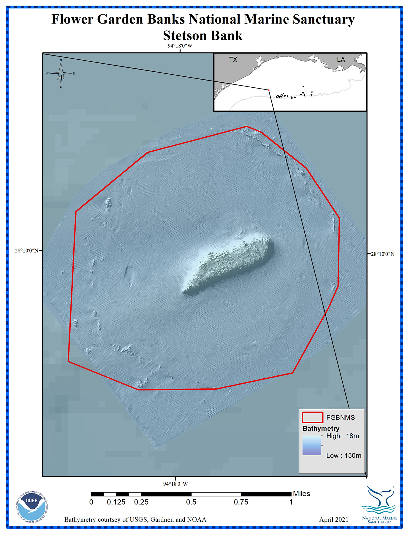
Map of Stetson Bank showing the sanctuary boundary. Credit: FGBNMS
Stetson Bank
Boundary
Point #
Latitude
Longitude
1
28.15673
-94.29673
2
28.15661
-94.30312
3
28.15862
-94.30888
4
28.16950
-94.30839
5
28.17386
-94.30257
6
28.17583
-94.29445
7
28.17543
-94.29327
8
28.17284
-94.28952
9
28.16924
-94.28677
10
28.16428
-94.28681
11
28.16274
-94.28756
12
28.15796
-94.29047
13
28.15673
-94.29673
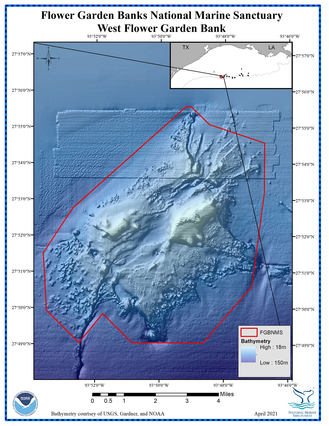
Map of West Flower Garden Bank showing the sanctuary boundary. Credit: FGBNMS
West Flower Garden Bank Boundary
Point #
Latitude
Longitude
1
27.84363
-93.78549
2
27.81750
-93.81056
3
27.81752
-93.84752
4
27.83069
-93.86271
5
27.81735
-93.87490
6
27.83220
-93.89185
7
27.85854
-93.89369
8
27.87925
-93.87853
9
27.92626
-93.82011
10
27.92620
-93.81759
11
27.91801
-93.80801
12
27.90969
-93.77939
13
27.88644
-93.77939
14
27.84363
-93.78549
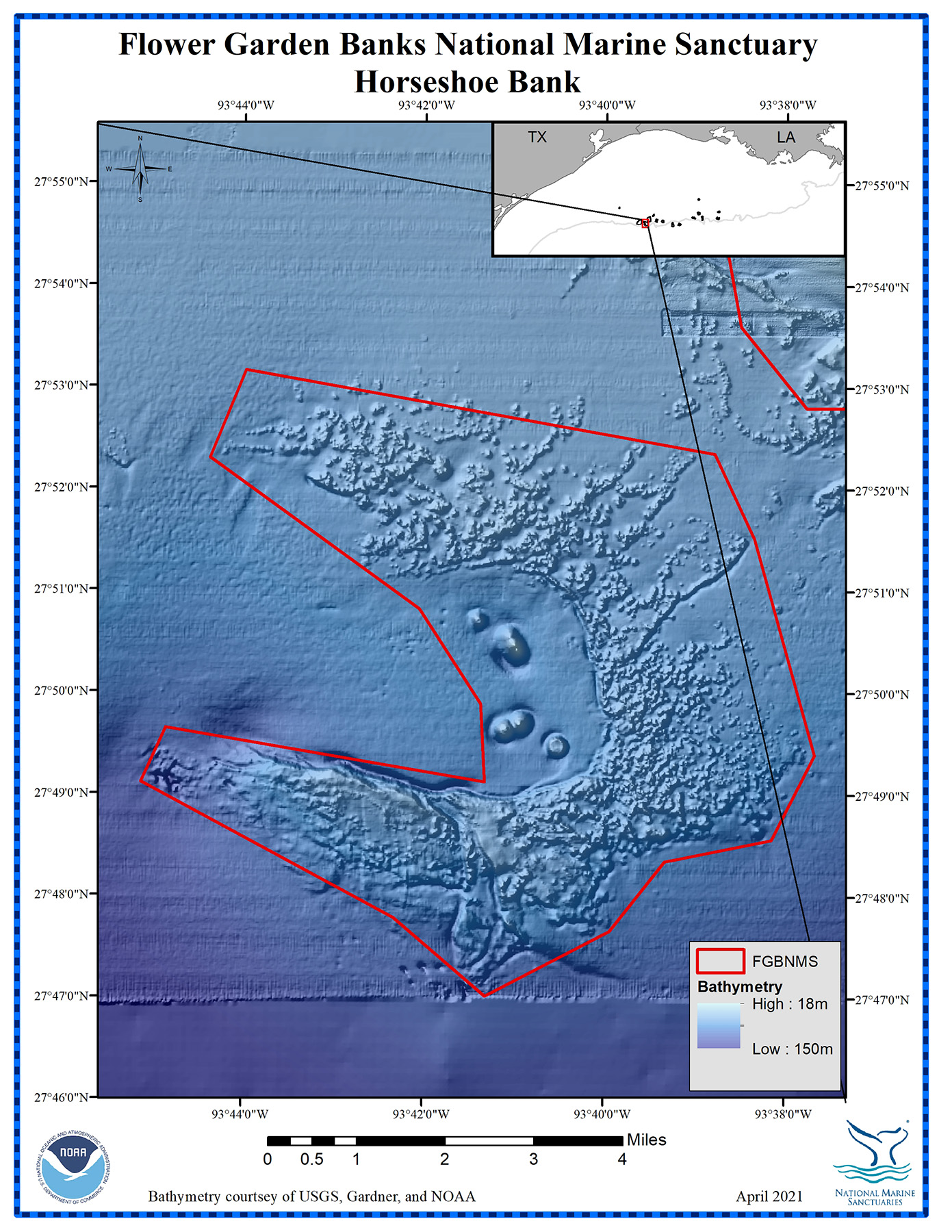
Map of Horseshoe Bank showing the sanctuary boundary. Credit: FGBNMS
Horseshoe Bank Boundary
Point #
Latitude
Longitude
1
27.82317
-93.62789
2
27.80927
-93.63578
3
27.80568
-93.65541
4
27.79429
-93.66555
5
27.78357
-93.68846
6
27.79640
-93.70534
7
27.81855
-93.75198
8
27.82742
-93.74743
9
27.81868
-93.68868
10
27.83143
-93.68941
11
27.84699
-93.70079
12
27.87165
-93.73947
13
27.88602
-93.73294
14
27.87252
-93.64648
15
27.85861
-93.63908
16
27.82317
-93.62789
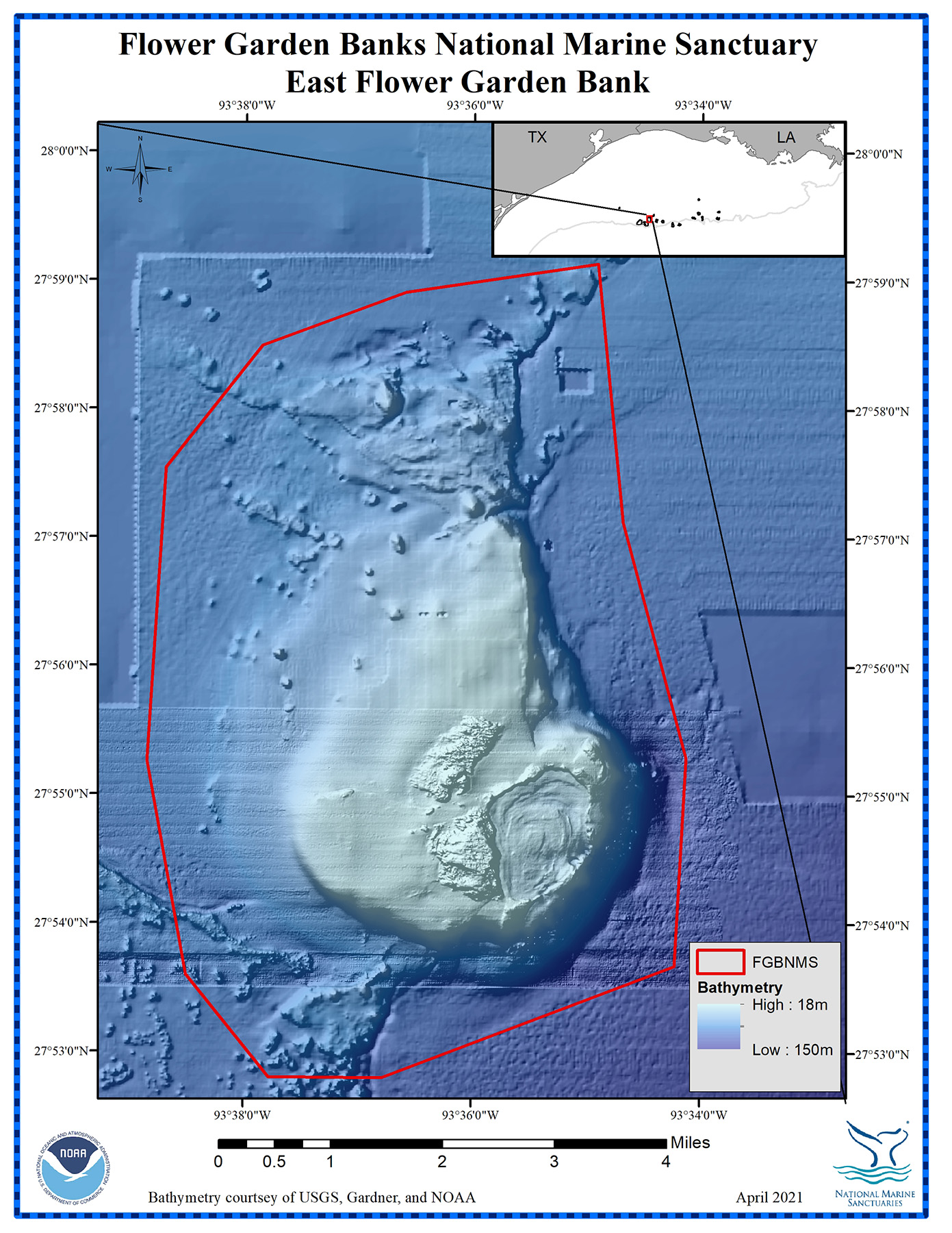
Map of East Flower Garden Bank showing the sanctuary boundary. Credit: FGBNMS
East Flower Garden Bank Boundary
Point #
Latitude
Longitude
1
27.89455
-93.57040
2
27.87999
-93.61309
3
27.88003
-93.62961
4
27.89330
-93.64172
5
27.92101
-93.64747
6
27.95899
-93.64490
7
27.97485
-93.63086
8
27.98177
-93.60996
9
27.98554
-93.58188
10
27.95206
-93.57810
11
27.92151
-93.56880
12
27.89455
-93.57040
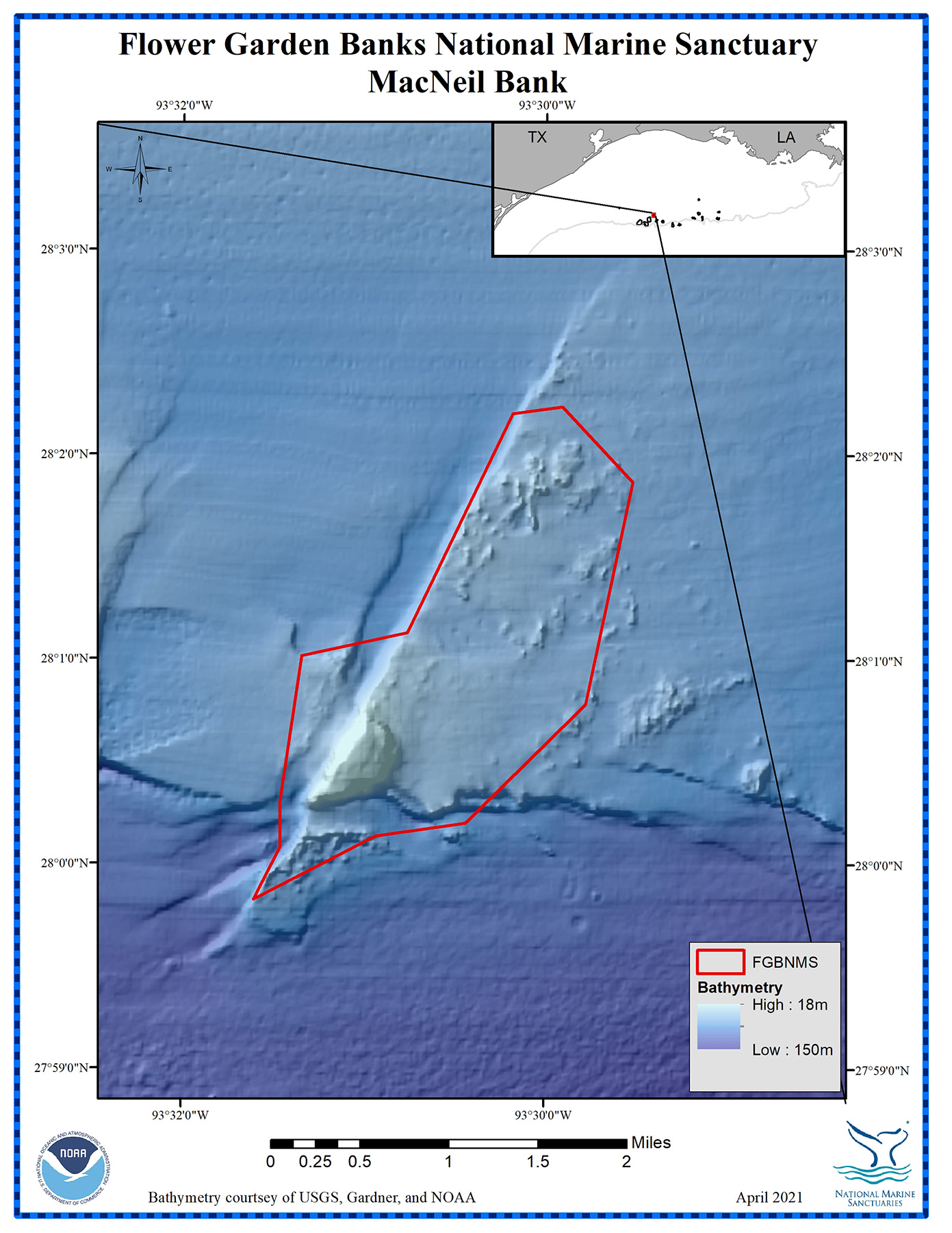
Map of MacNeil Bank showing the sanctuary boundary. Credit: FGBNMS
MacNeil Bank Boundary
Point #
Latitude
Longitude
1
28.00226
-93.51550
2
27.99707
-93.52669
3
28.00136
-93.52423
4
28.00518
-93.52425
5
28.01694
-93.52233
6
28.01883
-93.51264
7
28.03670
-93.50300
8
28.03724
-93.49844
9
28.03113
-93.49199
10
28.01300
-93.49624
11
28.00331
-93.50725
12
28.00226
-93.51550
Map of Rankin & 28 Fathom Banks showing the sanctuary boundary. Credit: FGBNMS
Rankin & 28 Fathom Banks Boundary
Point #
Latitude
Longitude
1
27.92554
-93.40593
2
27.92039
-93.41021
3
27.92035
-93.42474
4
27.91387
-93.43165
5
27.90829
-93.42234
6
27.90641
-93.42535
7
27.90489
-93.44219
8
27.89549
-93.44396
9
27.88892
-93.43403
10
27.88072
-93.42805
11
27.87676
-93.42787
12
27.88449
-93.44458
13
27.88803
-93.45159
14
27.88794
-93.45905
15
27.89234
-93.46410
16
27.89971
-93.45571
17
27.90910
-93.45343
18
27.92847
-93.45335
19
27.93407
-93.44743
20
27.93599
-93.44215
21
27.92554
-93.40593
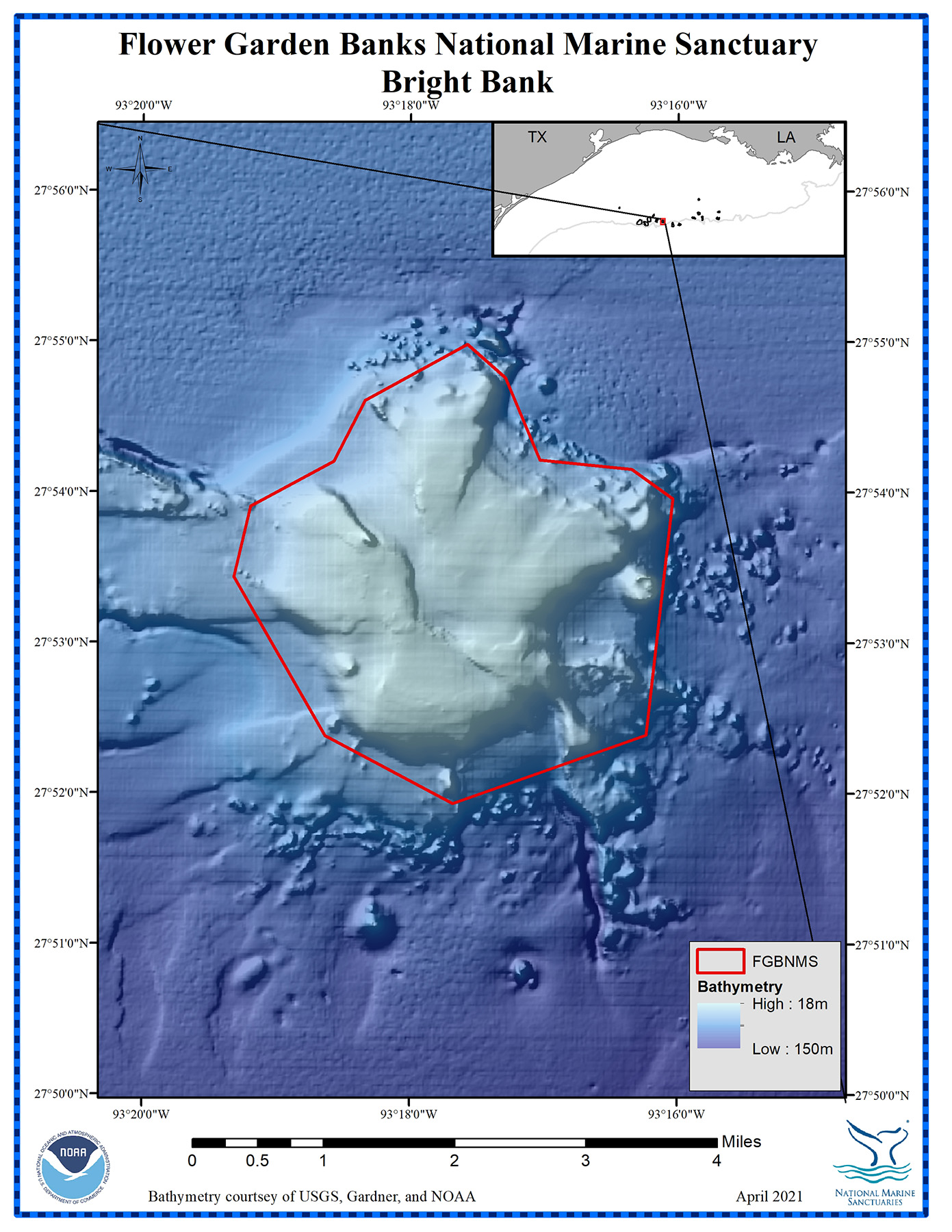
Map of Bright Bank showing the sanctuary boundary. Credit: FGBNMS
Bright Bank Boundary
Point #
Latitude
Longitude
1
27.87310
-93.27056
2
27.86549
-93.29462
3
27.87300
-93.31055
4
27.89058
-93.32193
5
27.89839
-93.31987
6
27.90336
-93.30953
7
27.91010
-93.30562
8
27.91634
-93.29292
9
27.91263
-93.28816
10
27.90354
-93.28386
11
27.90253
-93.27238
12
27.89927
-93.26729
13
27.87310
-93.27056
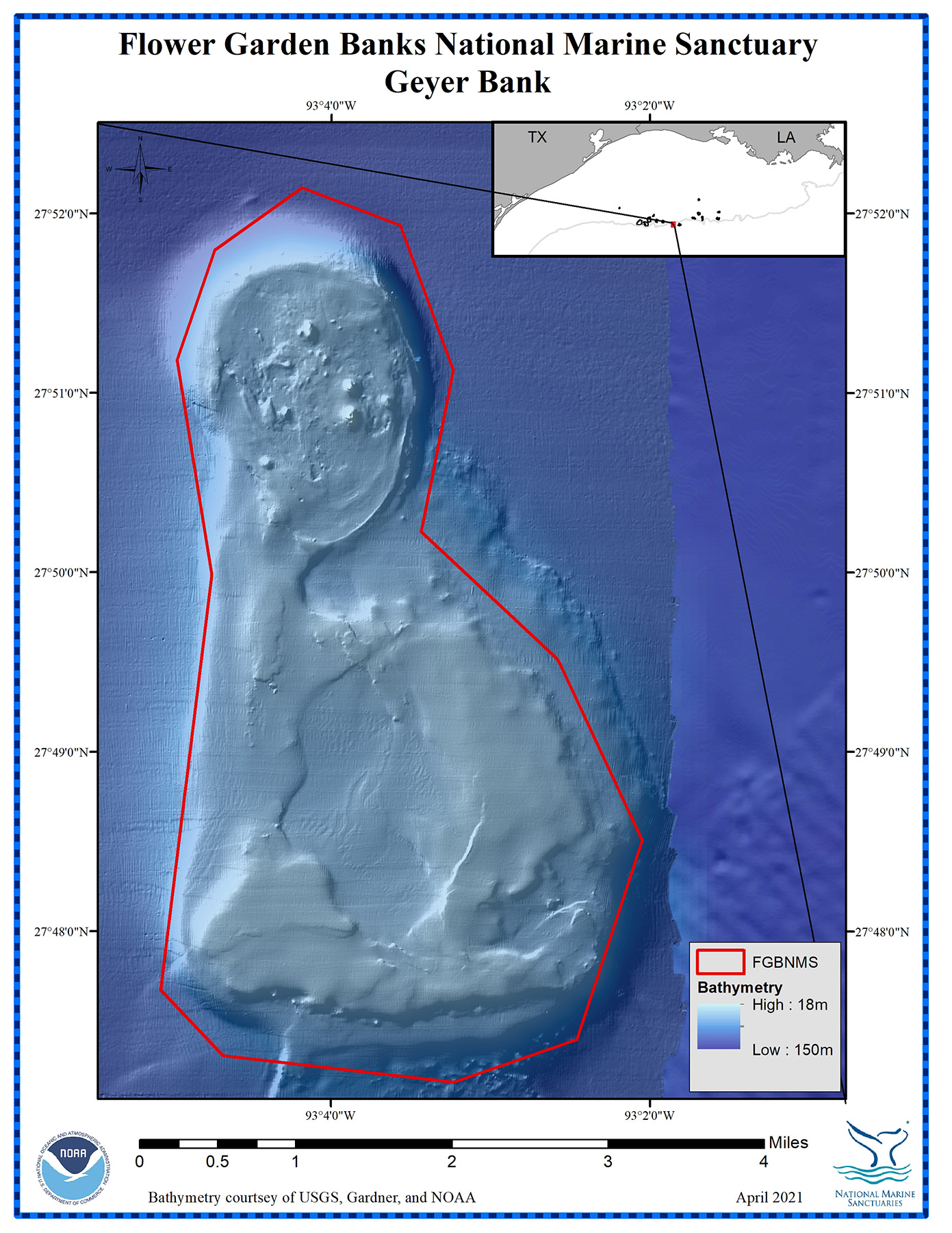
Map of Geyer Bank showing the sanctuary boundary. Credit: FGBNMS
Geyer Bank Boundary
Point #
Latitude
Longitude
1
27.78848
-93.07794
2
27.79458
-93.08448
3
27.83313
-93.07913
4
27.85306
-93.08279
5
27.86328
-93.07885
6
27.86908
-93.06974
7
27.86556
-93.05944
8
27.85211
-93.05391
9
27.83713
-93.05725
10
27.82540
-93.04312
11
27.82490
-93.04276
12
27.80846
-93.03412
13
27.78997
-93.04096
14
27.78602
-93.05384
15
27.78848
-93.07794
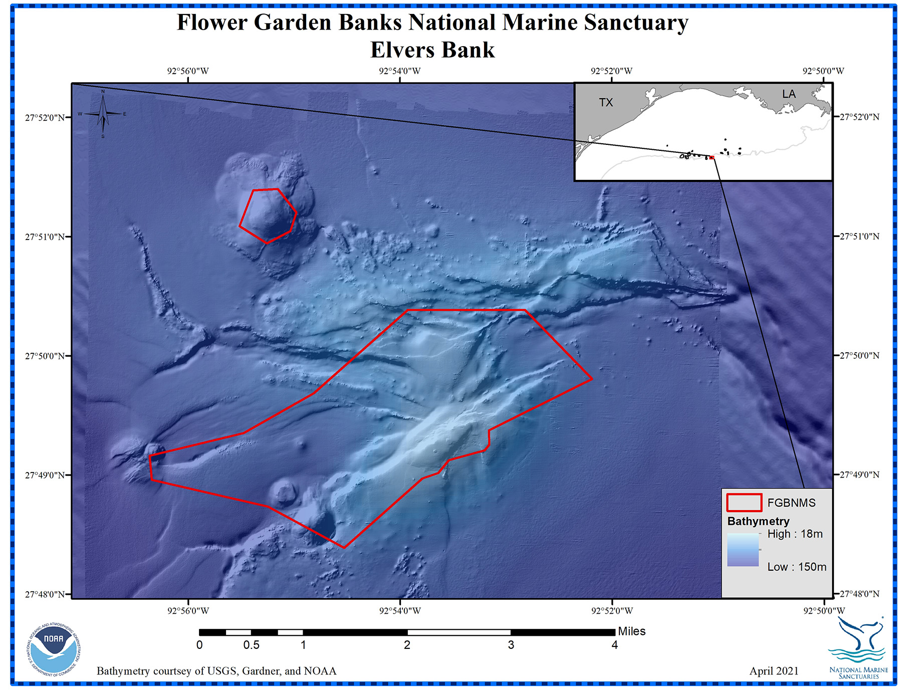
Map of Elvers Bank showing two separate sanctuary boundaries. Credit: FGBNMS
Elvers Bank Boundary A
Point #
Latitude
Longitude
1
27.82285
-92.88605
2
27.82087
-92.88600
3
27.82009
-92.88670
4
27.81869
-92.89235
5
27.81690
-92.89404
6
27.81615
-92.89653
7
27.80645
-92.90884
8
27.81221
-92.92082
9
27.81599
-92.93908
10
27.81934
-92.93940
11
27.82250
-92.92465
12
27.82809
-92.91359
13
27.83973
-92.89876
14
27.83972
-92.88038
15
27.83003
-92.86983
16
27.82285
-92.88605
Elvers Bank Boundary B
Point #
Latitude
Longitude
1
27.85645
-92.92310
2
27.85662
-92.91922
3
27.85334
-92.91631
4
27.85076
-92.91727
5
27.84903
-92.92097
6
27.85145
-92.92524
7
27.85645
-92.92310
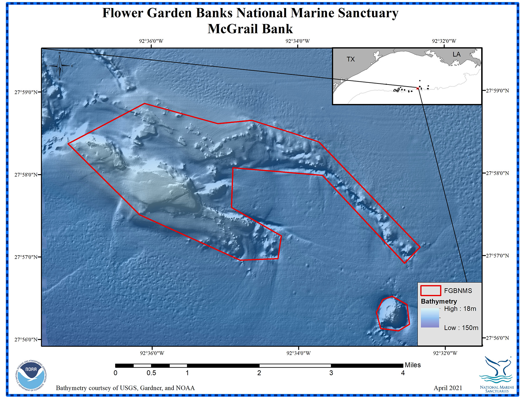
Map of McGrail Bank showing two separate sanctuary boundaries. Credit: FGBNMS
McGrail Bank Boundary A
Point #
Latitude
Longitude
1
27.97684
-92.58489
2
27.97749
-92.57716
3
27.97475
-92.56753
4
27.97304
-92.56191
5
27.95173
-92.53902
6
27.94849
-92.54254
7
27.96632
-92.56116
8
27.96792
-92.58152
9
27.95989
-92.58187
10
27.95409
-92.57057
11
27.94951
-92.57135
12
27.94920
-92.57994
13
27.95846
-92.60274
14
27.97286
-92.61901
15
27.98096
-92.60158
16
27.97684
-92.58489
McGrail Bank Boundary B
Point #
Latitude
Longitude
1
27.94116
-92.54750
2
27.94180
-92.54543
3
27.94010
-92.54202
4
27.93616
-92.54151
5
27.93481
-92.54398
6
27.93529
-92.54803
7
27.93859
-92.54901
8
27.94116
-92.54750
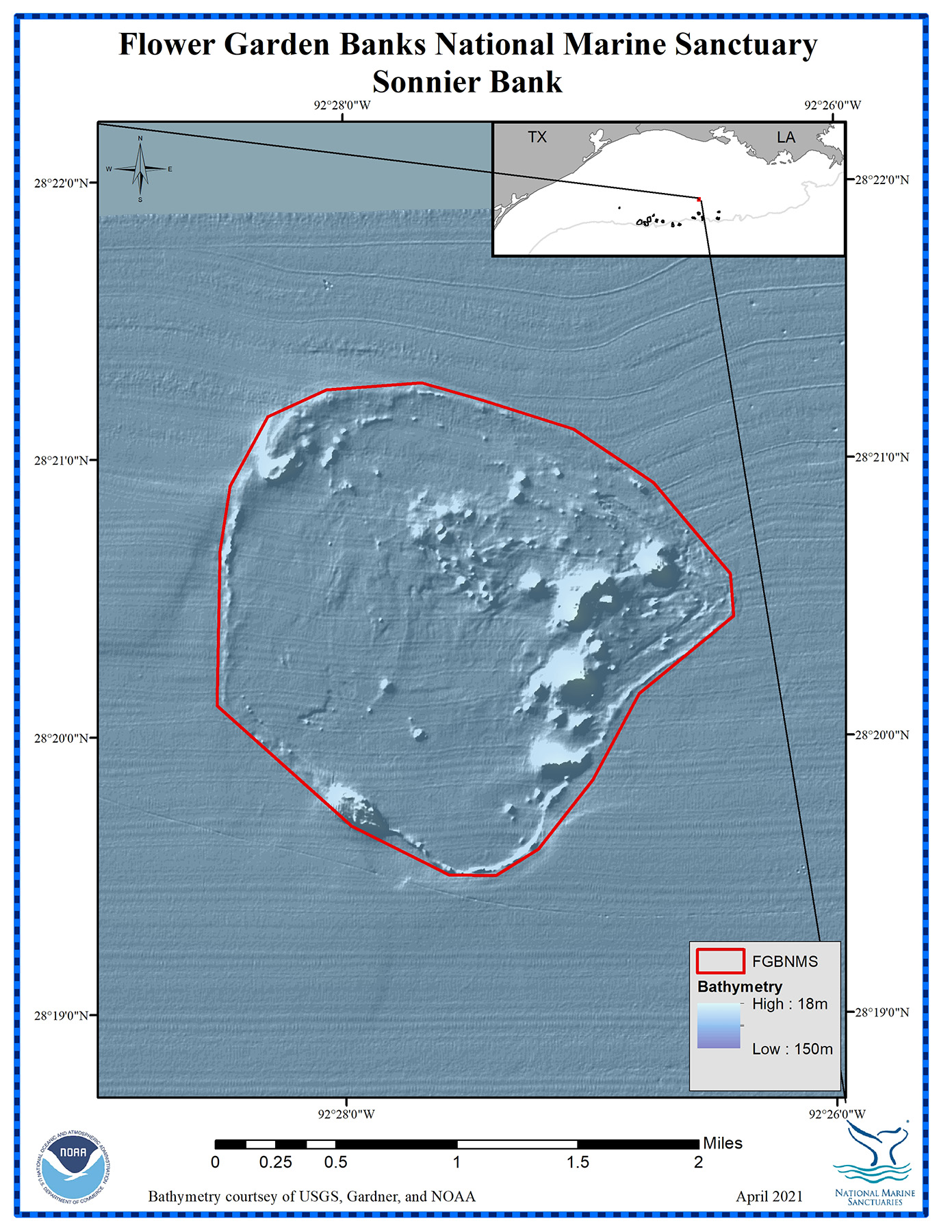
Map of Sonnier Bank showing the sanctuary boundary. Credit: FGBNMS
Sonnier Bank Boundary
Point #
Latitude
Longitude
1
28.32652
-92.45356
2
28.32495
-92.45647
3
28.32501
-92.45965
4
28.32796
-92.46626
5
28.33523
-92.47536
6
28.34453
-92.47511
7
28.34840
-92.47439
8
28.35256
-92.47181
9
28.35416
-92.46784
10
28.35456
-92.46135
11
28.35351
-92.45729
12
28.35174
-92.45107
13
28.34852
-92.44564
14
28.34303
-92.44045
15
28.34048
-92.44024
16
28.33584
-92.44669
17
28.33068
-92.44985
18
28.32652
-92.45356
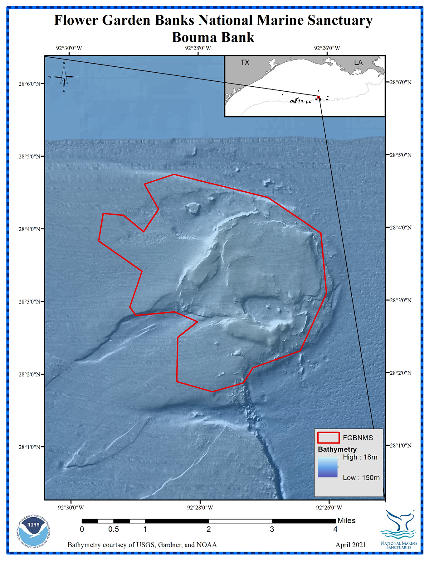
Map of Bouma Bank showing the sanctuary boundary. Credit: FGBNMS
Bouma Bank Boundary
Point #
Latitude
Longitude
1
28.07909
-92.47305
2
28.07370
-92.44900
3
28.07370
-92.44891
4
28.06544
-92.43518
5
28.05162
-92.43380
6
28.03846
-92.44065
7
28.03463
-92.45289
8
28.03114
-92.45537
9
28.02915
-92.46338
10
28.03154
-92.47259
11
28.04166
-92.47229
12
28.04525
-92.46717
13
28.04751
-92.47310
14
28.04676
-92.48308
15
28.04866
-92.48462
16
28.05687
-92.48145
17
28.06388
-92.49262
18
28.07018
-92.49141
19
28.06974
-92.48613
20
28.06594
-92.48098
21
28.07109
-92.47708
22
28.07683
-92.48071
23
28.07909
-92.47305
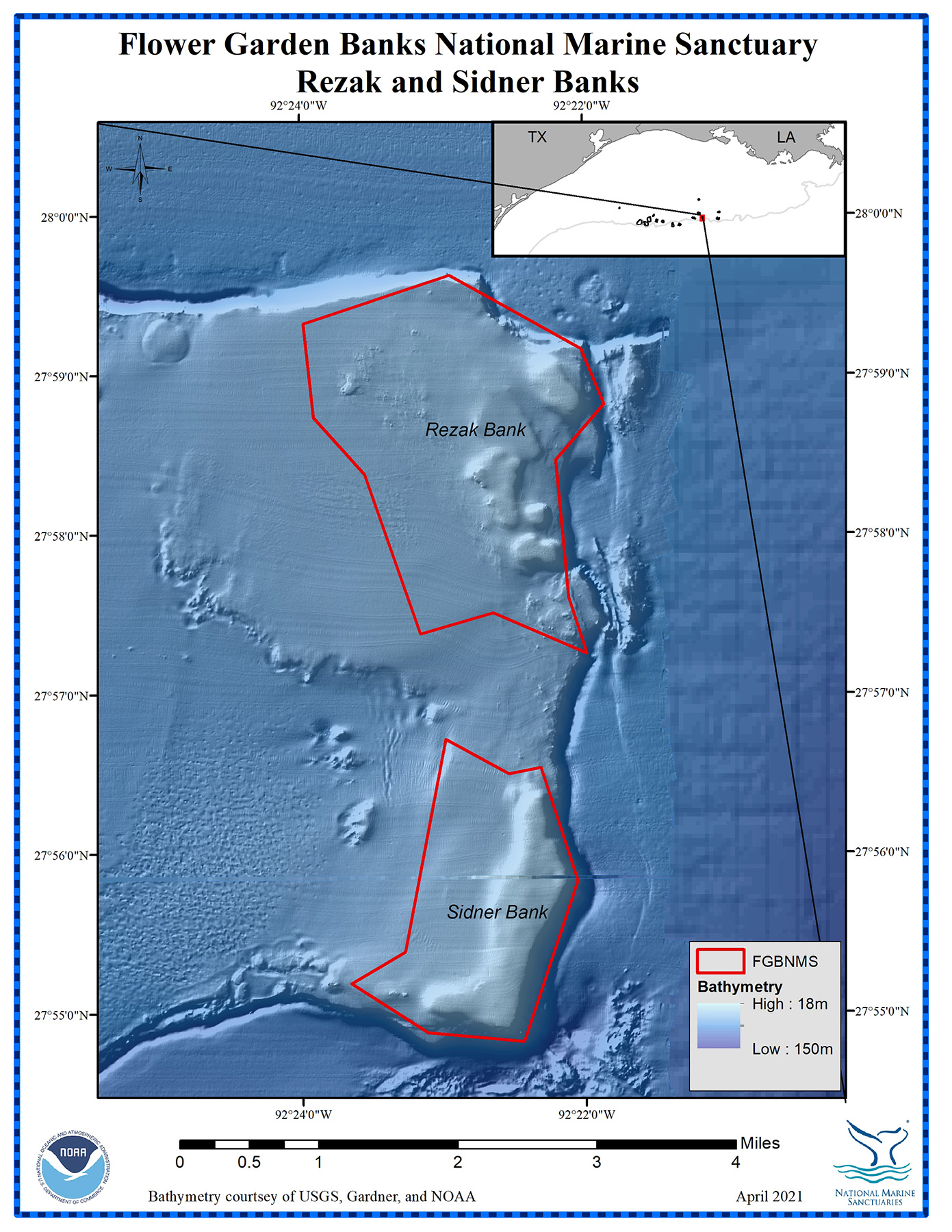
Map of Rezak and Sidner Banks showing the sanctuary boundary for each bank. Credit: FGBNMS
Rezak Bank Boundary
Point #
Latitude
Longitude
1
27.95420
-92.36641
2
27.95847
-92.37739
3
27.95629
-92.38599
4
27.97297
-92.39248
5
27.97892
-92.39845
6
27.98869
-92.39964
7
27.99372
-92.38244
8
27.98603
-92.36697
9
27.98022
-92.36429
10
27.97442
-92.36996
11
27.96006
-92.36854
12
27.95420
-92.36641
Sidner Bank Boundary
Point #
Latitude
Longitude
1
27.93046
-92.36762
2
27.91368
-92.37398
3
27.91462
-92.38530
4
27.91976
-92.39427
5
27.92306
-92.38792
6
27.94525
-92.38305
7
27.94166
-92.37565
8
27.94231
-92.37189
9
27.93046
-92.36762
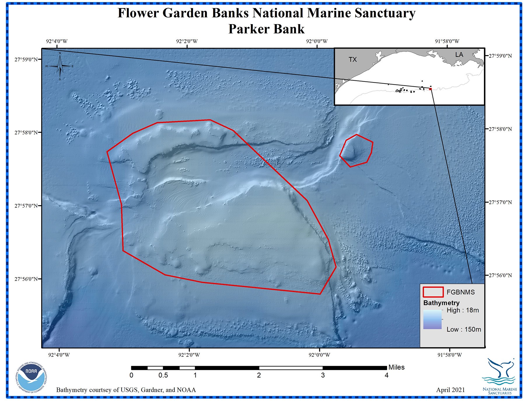
Map of Parker Bank showing two separate sanctuary boundaries. Credit: FGBNMS
Parker Bank Boundary A
Point #
Latitude
Longitude
1
27.95067
-92.00294
2
27.94177
-91.99762
3
27.93547
-91.99568
4
27.92937
-91.99981
5
27.93224
-92.02999
6
27.93401
-92.03946
7
27.93958
-92.05015
8
27.95012
-92.05050
9
27.96214
-92.05407
10
27.96630
-92.04745
11
27.96869
-92.04120
12
27.96925
-92.02758
13
27.96678
-92.02175
14
27.95067
-92.00294
Parker Bank Boundary B
Point #
Latitude
Longitude
1
27.96082
-91.99450
2
27.96432
-91.99285
3
27.96566
-91.99014
4
27.96385
-91.98600
5
27.96149
-91.98639
6
27.95931
-91.98760
7
27.95824
-91.99183
8
27.96082
-91.99450
Map of Alderdice Bank showing the sanctuary boundary. Credit: FGBNMS
Alderdice Bank Boundary
Point #
Latitude
Longitude
1
28.09726
-91.99328
2
28.09474
-91.98619
3
28.09569
-91.97526
4
28.09184
-91.97361
5
28.08410
-91.97273
6
28.07506
-91.97457
7
28.07053
-91.98465
8
28.06959
-91.99347
9
28.06819
-92.00512
10
28.07026
-92.01321
11
28.07562
-92.02032
12
28.08058
-92.02436
13
28.08463
-92.02577
14
28.09024
-92.02296
15
28.09487
-92.01231
16
28.09627
-92.00735
17
28.09507
-92.00008
18
28.09726
-91.99328