TOOLS & TECHNOLOGY

The remote location and depths of Flower Garden Banks National Marine Sanctuary make it necessary for researchers to use a wide variety of tools and technology to research, explore, monitor and manage this ocean treasure.
Tools typically used by the sanctuary team include:
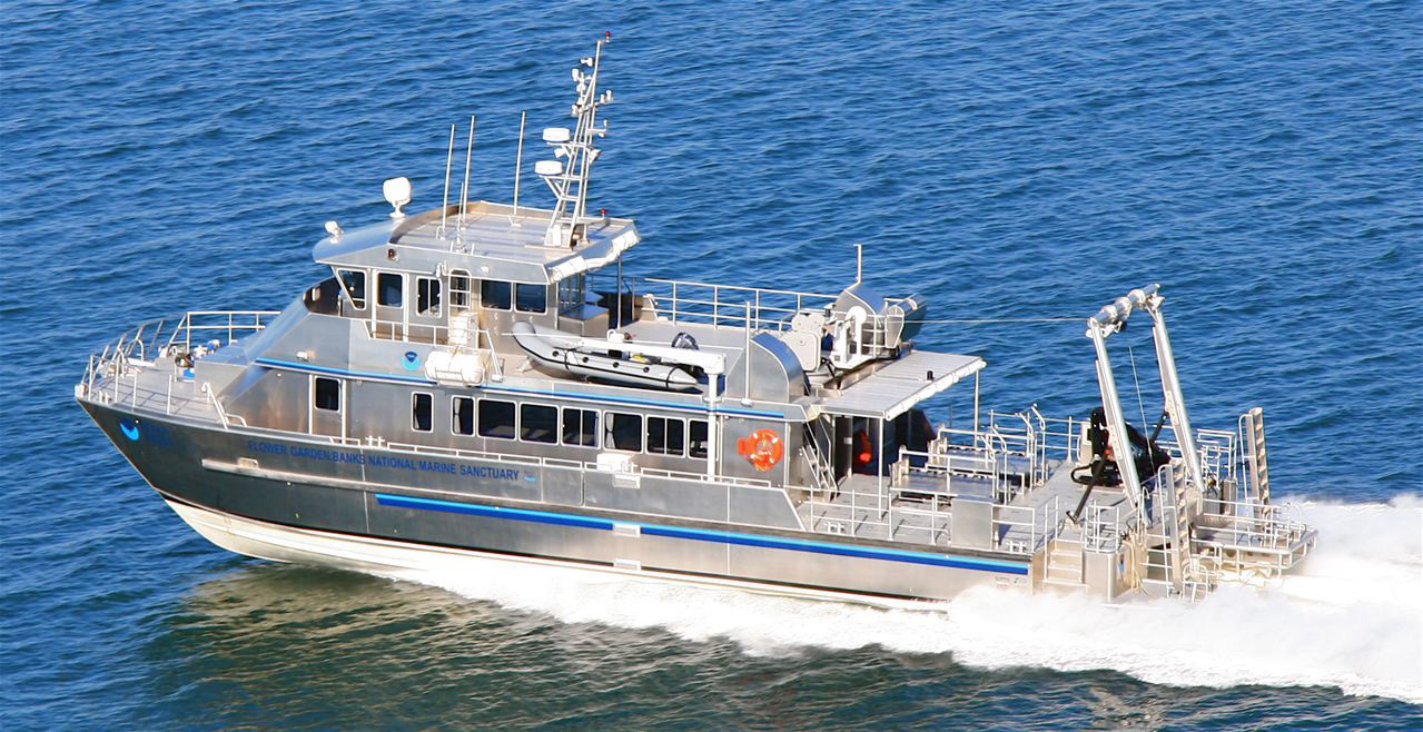
RESEARCH VESSEL
The R/V Manta allows sanctuary staff to visit the sanctuary as needed for research, monitoring, enforcement and emergency response. The special design of the vessel allows for great flexibility in the type of operations that can be conducted.

Check out this great time-lapse video of a trip aboard R/V Manta in 2017.
top of page
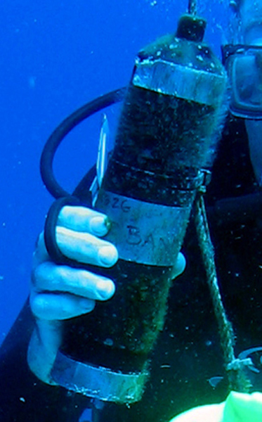
SCUBA GEAR
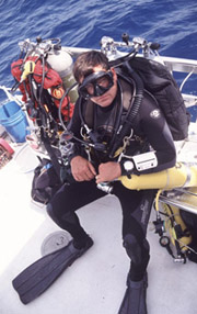 Scuba gear allows divers to make first-hand observations of the reefs. Divers are, however, limited in the amount of time they can safely spend underwater and how deep they can go. The term SCUBA stands for Self-Contained Underwater Breathing Apparatus.
Specially trained technical divers can go much deeper than the average recreational or science diver.
top of page
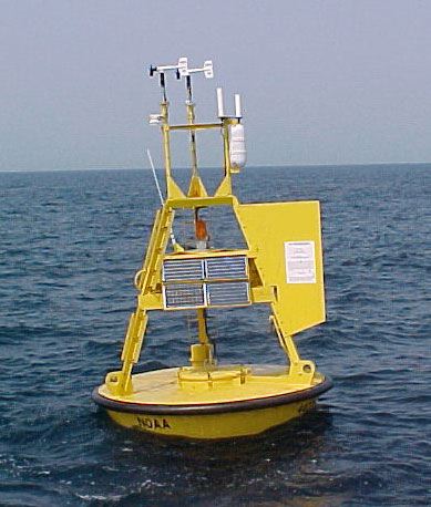
DATA BUOYS
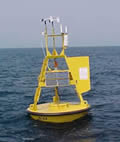 Data buoys record information such as sea surface temperature, wind direction and velocity, wave height, current direction, and water velocity at specified depths. These buoys are not necessarily located within sanctuary boundaries, but still provide valuable information about nearby conditions.
top of page
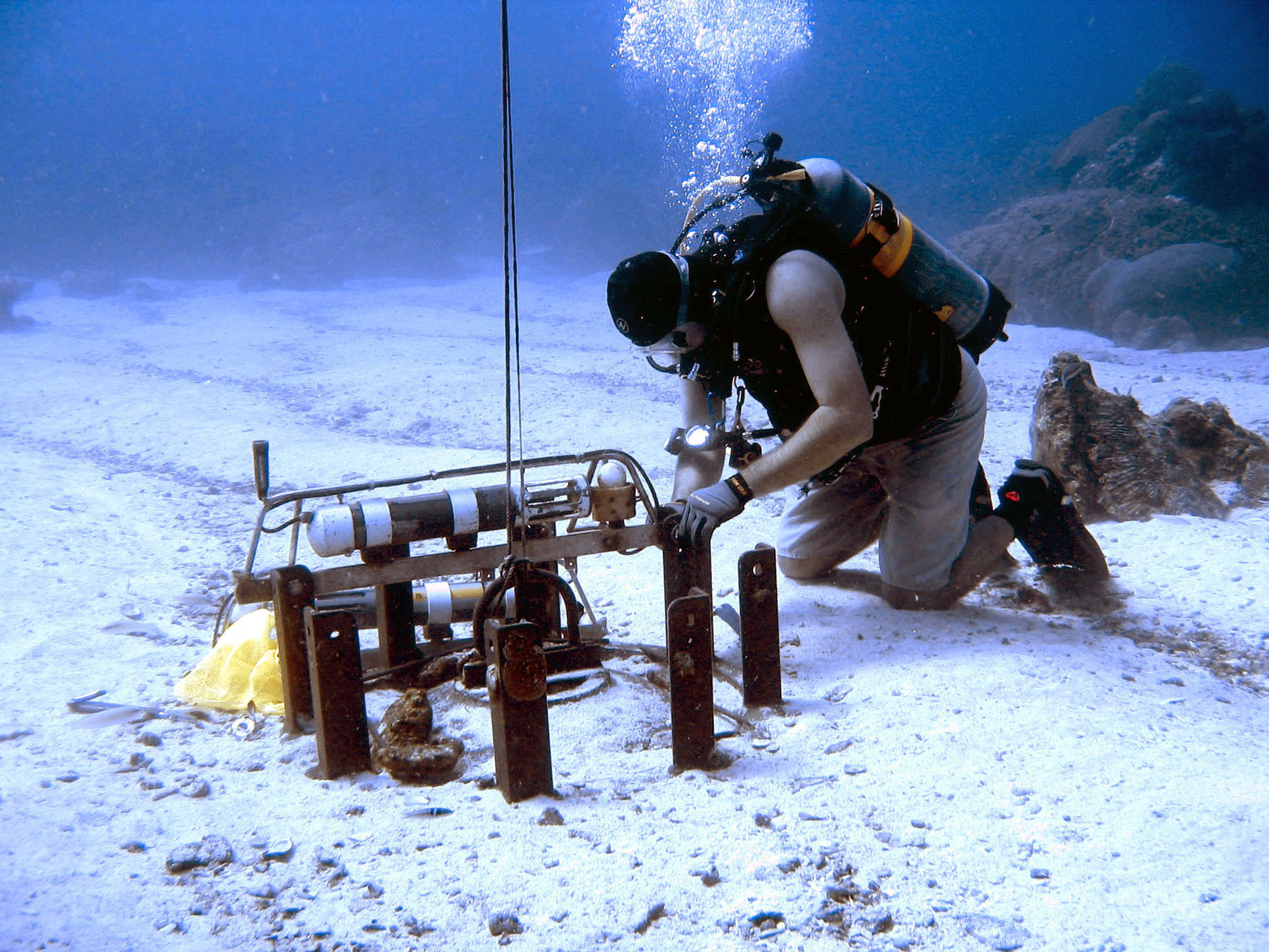
WATER QUALITY INSTRUMENTS
Seabird water quality instruments are installed near the reef at all three banks, about 70-80 feet underwater, attached to old railway wheels for stability. They measure water parameters such as temperature, salinity and water depth (which may actually vary when there are large waves and troughs). Additional sensors may be added to these instruments at a later date.
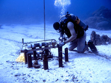
HOBO sensors are installed alongside the Seabird instruments. They also record water temperature, thus providing us with a second set of temperature data for comparison.
Since these instruments only provide us with data from the bottom, we also use a handheld YSI probe to collect temperature and salinity data throughout the water column each time we visit the sanctuary. This gives us an entire depth profile at specific points in time.
top of page
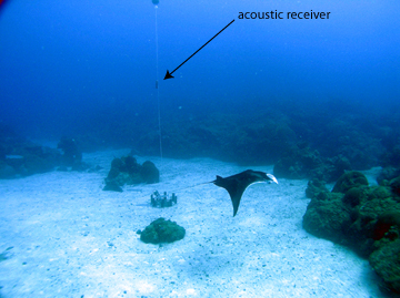
ACOUSTIC RECEIVERS
 Acoustic receivers have been placed at each of the three banks to help us track manta rays and whale sharks that have been tagged with special transmitters. As tagged animals come close to the receivers, their tag numbers as well as the dates and times of their visits are recorded. Although this won't tell us where these animals are all of the time, it will tell us when and how often they visit the banks. Please visit our Manta Research page to learn more.
top of page
UNDERWATER VEHICLES
Remotely Operated Vehicles (ROVs) and manned submersibles can stay down longer and go much deeper than Scuba divers. However, they are generally more expensive to operate and require more specialized training to use.
ROVs have so far proven the most effective means for exploring the deep water areas of the sanctuary.

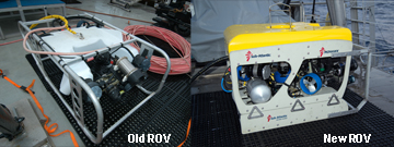
For many years, the sanctuary used the Phantom S2 ROV (below left) operated by the University of North Carolina-Wilmington Undersea Vehicles Program, UNCW-UVP.
However, in 2013, a new Mohawk ROV (below right) was purchased by the National Marine Sanctuary Foundation for use by the sanctuary and other scientists in the region. It too will be operated and maintained by the UNCW-UVP.
top of page
CAMERAS
Still and video cameras are used by divers, as well as Remotely Operated Vehicles (ROVs) or manned submersibles, to record changes in the reef over time. They can also be dropped over the side of a ship on a line (drop cameras). Improvements in underwater videography over the last 10 years have allowed scientists to make more accurate observations at much greater depths than in the past.
top of page
SONAR
High-Resolution Multibeam Bathymetry provides detailed profiles of the seafloor to help guide exploration. These maps help us identify where there are raised features that might indicate specialized habitats such as reefs, mud volcanoes, and brine seeps.
top of page
WAVE GLIDERS
Wave gliders are a new technology that allows us to collect data from the ocean for 60-90 days at a time without actually being there.
They float along the surface of the water using solar energy to power the sensors and other data collection instruments, while wave energy alone makes them move. The collected data is transmitted to shore via satellite as it is collected, providing near real-time information.
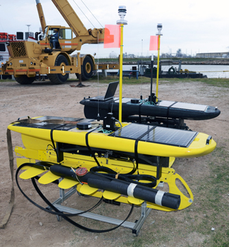
These two wave gliders were launched by Liquid Robotics and BP on December 9, 2011. The black glider was deployed at East Flower Garden Bank to collect data on currents. The yellow glider was deployed in the western Gulf to collect acoustic data on marine mammals.
Photo: FGBNMS/Embesi
In addition to being small, remotely-operated, and energy efficient, wave gliders also cost a lot less to operate than research vessels.
top of page