2011 FISH & BENTHIC
SURVEY
CRUISE (DFH15)

May 15-18, 2011
aboard the R/V Manta
The purpose of this expedition was to assess the fish populations and benthic assemblages in areas of the sanctuary below Scuba diving depths. In addition, quarterly water samples were taken and monitoring equipment was downloaded and maintained.
The expedition was conducted in conjunction with partners from the National Center for Coastal Ocean Science (NCCOS). Harbor Branch Oceanographic Institute (HBOI), the Cooperative Institute for Ocean Exploration, Research and Technology at University of North Carolina-Wilmington (CIOERT/UNCW), and students from Texas A&M University at Galvston (TAMUG).
Participants
R/V Manta Crew:
Captain Darrell Walker
Mate Mike Shetler
Mate Ramie Reed
Cook Kayleigh Stancil
Scientific Crew:
Marissa Nuttall, FGBNMS
John Embesi, FGBNMS
Ryan Eckert, FGBNMS
Lance Horn, CIOERT/UNCW, ROV Technician
Glenn Taylor, CIOERT/UNCW, ROV Pilot
Josh Voss, HBOI
Randy Clark, NCCOS
Eric Ebert, NCCOS
Sam Henry, TAMUG
Mark Ruiz, TAMUG
top of page
Overview
The research team departed aboard the R/V MANTA mid-afternoon Sunday, May 15th, headed for East Flower Garden Bank. The vessel arrived at East Bank early in the evening, allowing some evening SCUBA diving operations and nighttime acoustic surveys to be performed.
The following morning (5/16), ROV operations began at East Flower Garden Bank, and continued through mid afternoon the following day (5/17), when the vessel moved to West Flower Garden Bank. ROV operations continued at West Bank until Wednesday (5/18), when rough seas forced an early return to the dock.
Every evening, following ROV operations, Scuba dives were conducted to change out water quality monitoring instruments and collect water samples. Every night, acoustic fish surveys were conducted.

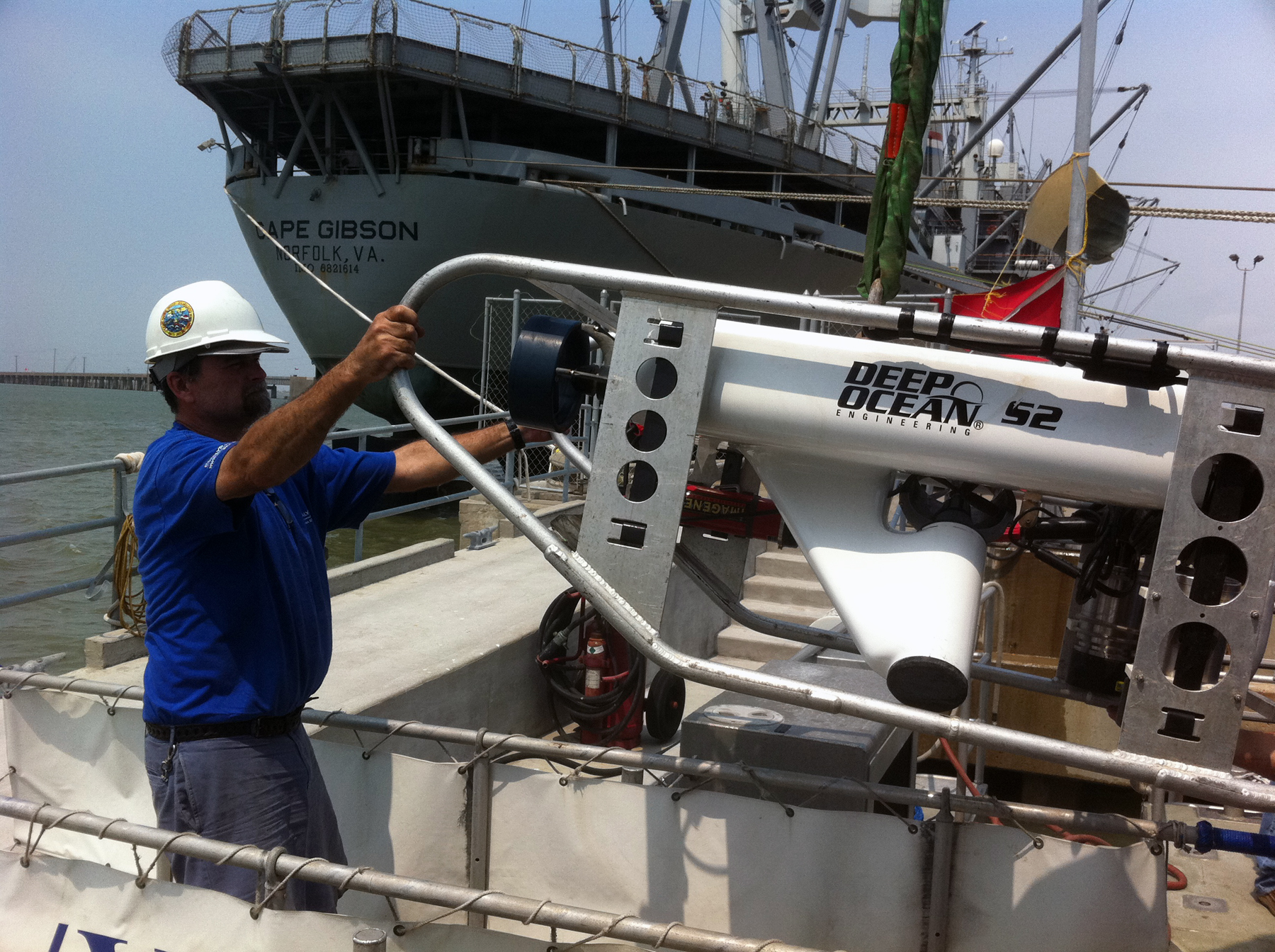
Lance Horn, CIOERT/UNCW, helps load the ROV onto the R/V MANTA at the TAMUG dock. Photo: Embesi/FGBNMS
top of page
Acoustics
Erik Ebert/Randy Clark, NCCOS-SCCFHR
This second year of fisheries acoustic surveys at the Flower Garden Banks was a big success. We covered approximately 190 km ( miles) of survey lines in three nights using a pole-mounted 120 kHz scientific echosounder. The survey covered the coral caps of East and West Flower Garden Banks in addition to a variety of other habitats over the full range of depths.
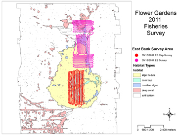
Map of East Flower Garden Bank showing where acoustic
surveys were conducted. Image: Erik Ebert
The fisheries acoustic data is being used to map fish abundance and distribution in relation to habitats in the survey areas. Pairing the acoustic data with the ROV transects will allow for direct comparison of fish community assemblage and abundance and habitat use.
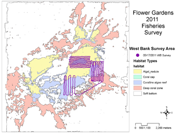
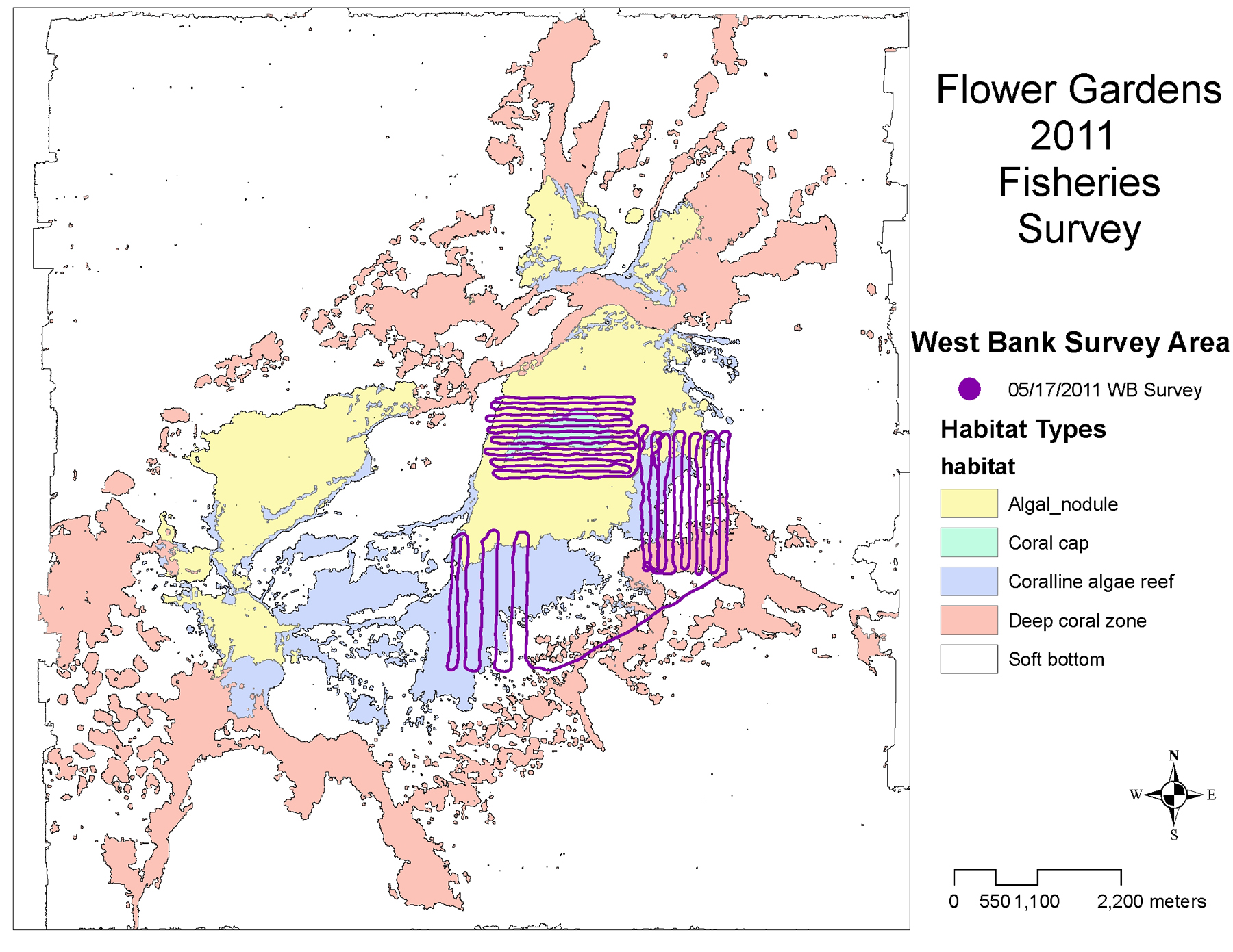
Map of West Flower Garden Bank showing where acoustic
surveys were conducted. Image: Erik Ebert
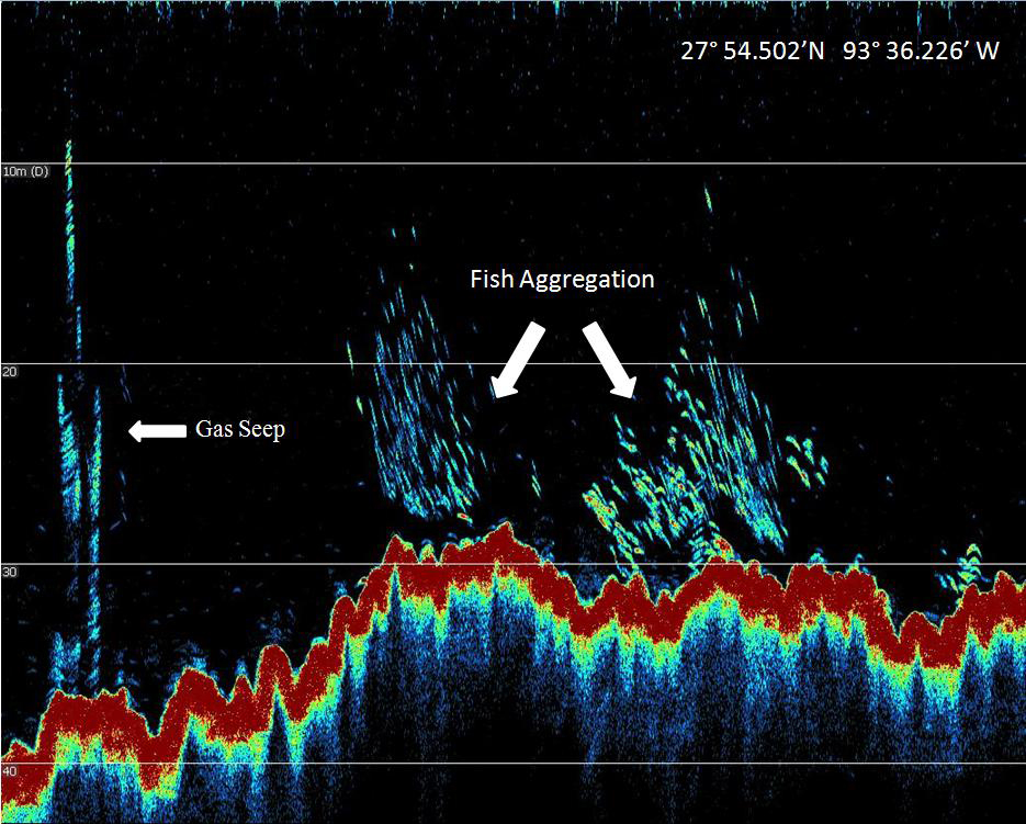
The post-processing of the acoustic data is being conducted at the Center for Coastal Fisheries and Habitat Research in Beaufort, NC. During a preliminary review and processing of the data during the mission, several interesting patterns of fish distribution over the East Bank coral cap were observed in addition to locating several large gas seeps (see below).
Comparing the data from previous year’s surveys is showing interpretable and consistent patterns of fish abundance over the different habitats and depth strata in the Flower Garden Banks sanctuary.
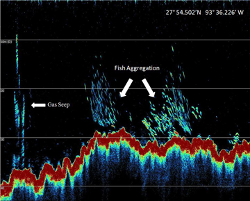 |
| Acoustic representation of fish and a gas seep at East Flower Garden Bank. The thick red line in the bottom portion of the image represents the contour of the coral cap. The clusters of light blue dots above the red show the locations of fish and the light blue vertical streaks show a gas seep. Image: Erik Ebert |
top of page
ROV Transects
Fifteen 100 m (328 ft) transects were randomly generated in each habitat zone for both East and West Flower Garden Banks. These examined the Coralline Algae, Deep Coral and Soft Bottom Community zones within our habitat classification system.

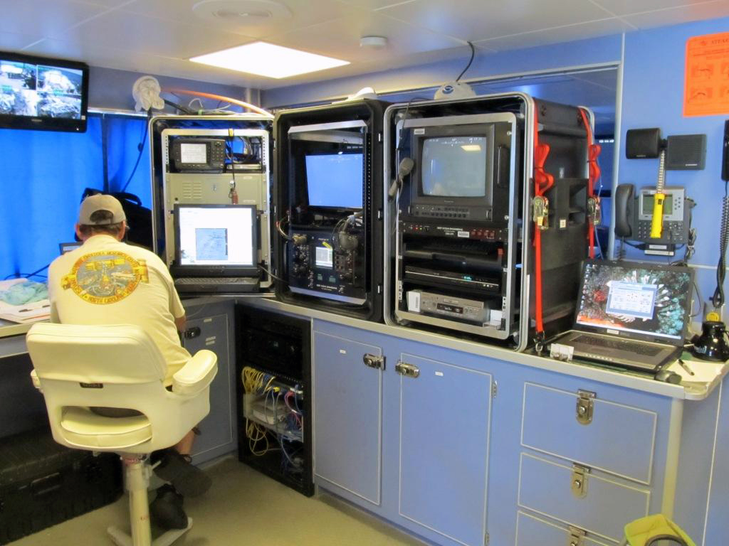
Lance Horn pilots the ROV from the dry lab of the R/V Manta.
Photo: Taylor/UNCW
In the day and a half spent at East Flower Garden Bank, 32 transects were conducted. Of these, 10 transects were in Algal Nodule habitat, 6 in Coralline Algae Reefs, 6 in the Deep Coral zone, and 10 in the Soft Bottom Community. At West Flower Garden Bank 23 transects were completed, with 3 in Algal Nodule habitat, 8 in Coralline Algae Reefs, 7 in the Deep Coral zone, and 5 in the Soft Bottom Community.
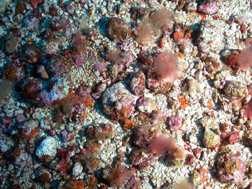
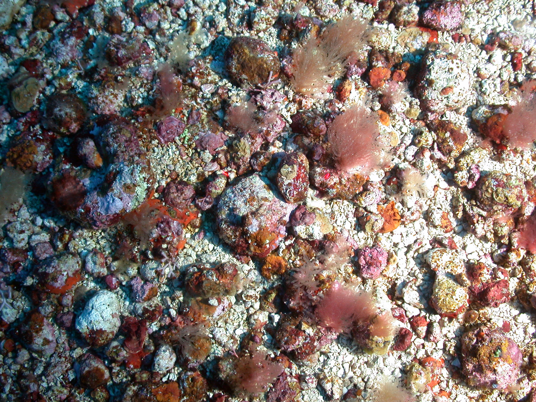
Algal Nodule habitat in the Coralline Algae zone.
Photo: UNCW-CIOERT/FGBNMS

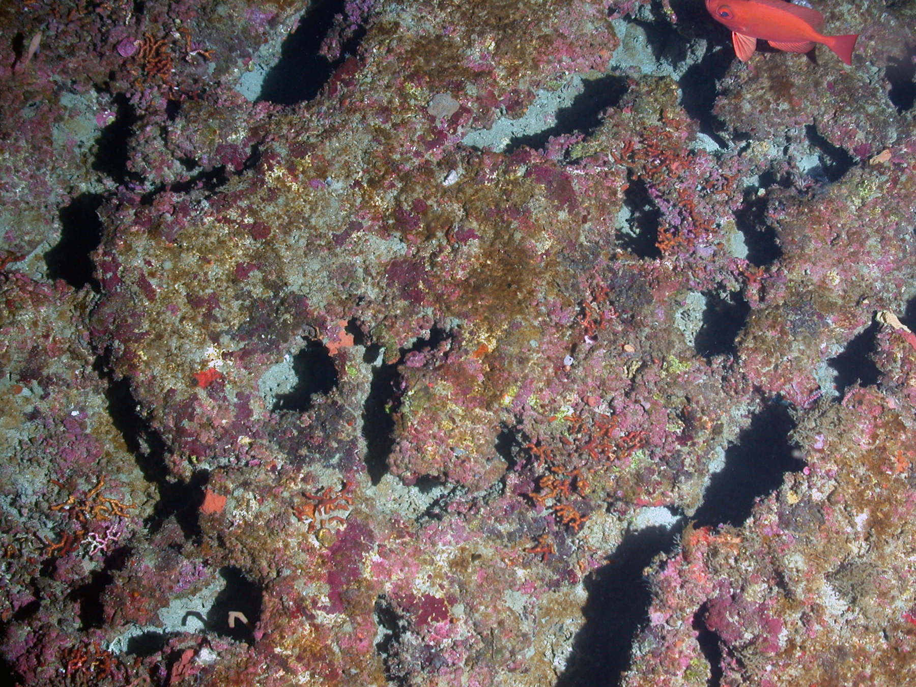
Coralline Algal Reef habitat in the Coralline Algae zone.
Photo: UNCW-CIOERT/FGBNMS
During each transect, forward facing video was collected, as well as downward facing still images. The number of images per transect varied, but averaged 11 images per transect, with a minimum of 5 and a maximum of 17.
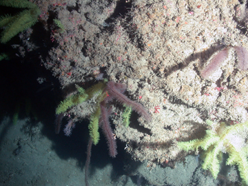
Deep Coral zone. Photo: UNCW-CIOERT/FGBNMS
top of page
Scuba Operations
Following ROV operations, the Flower Garden Banks research team conducted Scuba dives on the reef cap of East Bank, West Bank, and Stetson Bank. At all the banks, water quality instruments on the reef cap were collected, replaced, and downloaded. In addition, divers placed water temperature monitors at 130 ft ( m) at the deep Long-Term Monitoring stations.
While diving, researchers observed several large black grouper at both West Flower Garden and Stetson Banks, and a marbled grouper at Stetson Bank. Creolefish were observed spawning and sharpnose puffers courting at East Flower Garden Bank (5/17). Spotted morays were also seen courting at Stetson Bank (5/19).

Researchers collect a water quality instrument from the reef cap for temperature and salinity data. Photo: Schmahl/FGBNMS
top of page
Water Samples
At East, West, and Stetson Banks, quarterly water samples were collected. These water samples were later shipped to an EPA-certified laboratory for analysis of water quality parameters including ammonia, nitrate, nitrite, phosphorus and chlorophyll.
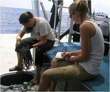
Researchers collect temperature and alinity measuremens using a hand-held YSI meter. Photo: Schmahl/FGBNMS
Download the Benthic Survey 2011 Cruise Report (57kb pdf)
top of page