Exploring and caring for special places in the Gulf that inspire and connect us all.
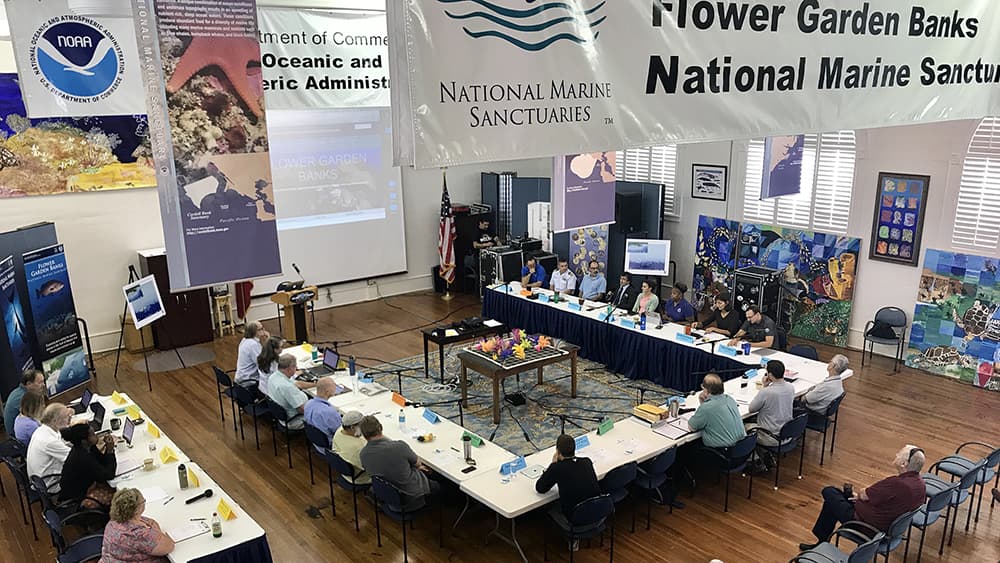
The Sanctuary Advisory Council meets several times a year to discuss topics relevant to sanctuary management. Past minutes and agendas are available on our Meeting Information page.
Next Meeting: Tuesday, May 19, 2026 9 a.m. to 4 p.m.
In-person: FGBNMS Headquarters 4700 Avenue U, Building 216, Galveston, TX 77551
Webinar: Virtual (Registration is not required)
This meeting is open to the public and will include a public comment period.
For more information, contact flowergarden@noaa.gov.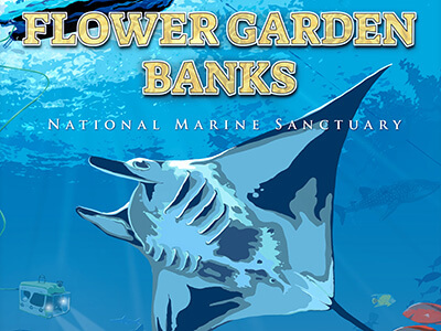
Check out the Flower Garden Banks National Marine Sanctuary poster in the NOAA Office of National Marine Sanctuaries 50th Anniversary Save Spectacular poster series. It's all about us!
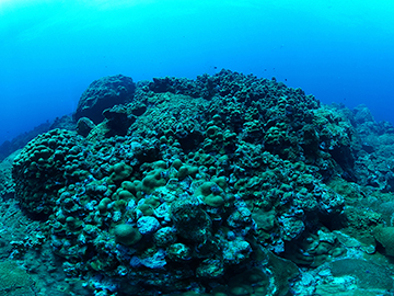
While FGBNMS is best known for its beautiful coral reefs, they only account for a tiny fraction (2%) of the entire sanctuary. The majority of sanctuary habitats lie deeper beneath the waves in an area known as the mesophotic or "twilight" zone. Scuba and remotely operated vehicle (ROV) technologies allow us to explore and learn about all of these areas.
Our commemorative sanctuary poster reflects this in full color graphic art. You'll find coral reef habitat and sea life featured prominently in the foreground, with deep reef features in shadow below them. Scuba divers descend from the surface while an ROV explores the depths, with its umbilical connected to our fantastic research vessel (R/V) MANTA at the surface. And, of course, a graceful manta ray, swims through the whole scene. We love it, and we know you will too!
Download a poster today or visit us at a community event to pick one up in-person.
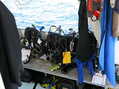
Florida’s coral reefs are currently experiencing a multi-year outbreak of a stony coral tissue loss disease (SCTLD) that has now spread over 200 miles across the Florida reef tract, and several Caribbean locations.
The disease appears to be caused by bacteria, and may be transmitted to other corals through direct contact and water circulation, meaning that divers and their gear may potentially spread this disease between sites.
As a result, we are asking divers to make sure they properly disinfect their dive gear before visiting Flower Garden Banks National Marine Sanctuary, in the hopes of preventing this deadly disease from reaching our otherwise healthy reefs.
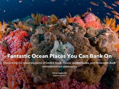
When most of us hear the word ‘bank’ we think of financial institutions and money, but banks in the ocean have a different value.
Discover what makes a bank so special, and how banks feature prominently in three different national marine sanctuaries.
Uncover the ocean treasures of Flower Garden Banks, Cordell Bank, and Stellwagen Bank national marine sanctuaries in our new story map...
Can’t get to your national marine sanctuaries? Thanks to the wonders of 360-degree photography, videography, and virtual reality, these underwater treasures are now just a few mouse clicks away.
NOAA’s Office of National Marine Sanctuaries (ONMS) has launched a virtual dive gallery, complete with immersive 360-degree images of eight national marine sanctuaries including the Flower Garden Banks.
In celebration of World Ocean Day 2020, ONMS has now launched virtual reality voyages using 360-degree videos! Whether you live on a coast or in a community far from the shore, we invite you to experience the power and beauty of America’s underwater treasures.
Along with these videos, lesson plans have been developed for educators to further engage middle school students with the virtual dive experience. These lessons take you deeper into each video and align with leading science standards and ocean literacy principles.

Would you like to receive regular updates about sanctuary news and events? Want to learn more about diving and fishing issues in the Gulf? Or perhaps you'd like to know more about volunteer opportunities or education resources?
We have 5 different email lists designed to keep people informed on these sanctuary-related topics. All you have to do is sign up!
This updated on-line GIS-based mapping tool for Flower Garden Banks National Marine Sanctuary hosts data layers for bathymetry, management zones, oil and gas activities, mooring buoys, and oceanographic data. Data layers can be turned on or off and other external data can be added to the map. Additional FGBNMS dashboards can be found on the Data Resources link.